statcounter

Wednesday 30 December 2015

Final Few Forays of 2015

Ash Gill Force

I haven't been blogging over Christmas, preferring to cuddle up to the several bottles of 40% proof wot various people gave me (and some I got for myself). Nobody was reading the blog anyway either because I hadn't posted anything or due to similar food-and-drink based reasons as mine. Here's what's missing (in brief)
Guidede walkees avoiding a Willington flood

Just before Christmas, 32 peeps turned up at Jubilee Bridge at Willington for an eight and a half mile guided trundle up by the River Wear towards Bishop Auckland and back again on the Bishop-Brandon ex-railway line. Me and Lucky did the reccy a week or so before.
Willingtton war memorial
Lucky running about daft

Rocking strike memorial plaque


Nothing happened. Nobody got lost or drowned It was muddy and the river had been in spate and had flooded the places where it's supposed to flood, but was merely a bit high.  I'll probably do this walk again next Christmas.
LTD on Alston Moor
 
And then, just after Christmas, me and LTD did another reccy for a guided walk from Nenthead to Garrigill and back via Ash Gill. The walk is 9 miles, but we did 10 due to duff directions in a guide-book, a complete inability on the part of the Pieman to walk in the correct direction or, indeed, understand even roughly where he was half the time and a severe time/space continuum lapse which nobody else seemed to notice. It's a good walk, though and I just hope that the weather is as nice as when me and the Pup did the reccy.


View from behind the waterfall

Readers considering attending should note that the highlight will (ought to be) be walking behind Ash Gill Force and looking through the roaring curtain of cream-coloured water at the gorge below. Wearing waterproofs for this bit is recommended. Lucky wasn't keen - too noisy and wet..  The walk is a Wednesday Walking Group Which Sometimes Walks on Saturdays organised by email by the redoubtable Lancastrian Eric.

View from the top of Warden Hill


Finally, yesterday, me and LTD went to bag Warden Hill, just over the hill in Northumberland. We'd attempted this lump (Tump, actually) last summer but found it well-defended by suckler cattle that had only just calved and were in no mood to let anybody, specially anybody with a dog, in the same field.  A lass from the cottage up the hill did offer me a lift, but that would have merely left me stranded up a hill surrounded by manic cattle with a dog that barks at cattle. (Not good!) It's a lovely hill, though and has an iron-age fort or settlement on the top and some big views of Tynedale.

LTD at the top of Moot Law

After this, we went on to bag Moot Law from the hamlet of Ryal, a few miles East. This one is a nice, green little hill with an ancient beacon site on the top. All cowfields were mercifully void of cows and, indeed, there was nobody about at all, apart from a couple of local children walking their dogs and some girly horseriders who chatted briefly about what a nice day it was. And it wa sa nice day too.

I abandoned the plan to also bag Shaftoe Crags in favour of going home to sit in front of the telly drinking hot tea and scoffing chocolate digestives. Shaftoe Crags is next to a main road, so I'll likely bag it some other time.
Lucky enjoys a brief rest from the snoozing


And that was that for 2015. I'm not going out again other than to take LTD for his constitutionals and, in the face of today's attack by Frank The Storm, he's not too bothered about that either and, at this very moment is sighing, snoozing, snoring and having the occasional running-about-barking dream on a beanbag on the landing. It's a hard life, but somebody has to do it.

Everybody here at Pietowers wishes everybody out there a Happy New Year, specially if they're pieblog readers. And even if they're not.

Tuesday 22 December 2015

Solstice Camp-Out Weardale

There's a dog in there that won't come out

Well it seemed like a good idea when I thought of it, just after the summer solstice.

So, me and Lucky used my bus-pass to get the 14:15 bus to Frosterley and wandered up by Bridge End in a lively breeze.

As we clumped ever higher towards the moors, it became increasingly obvious that the lively breeze in Frosterley was a bit of a gale up here, and this could only be even windier at my planned campsite. So, instead, we sought shelter and we found an ideal flat spot just next to Fine Burn, in the lee of some forestry and the fact we were in a deep cleft in the hill.
Fine Burn in a fine spate


So, we settled in for a long and dark night. I had some scotch and a couple of books loaded onto my phone and a warm dog nearby.  It soon became clear that the night wasn;t going to be so dark after all. There was a big and bright moon and a clear sky although the wind blustered around and the beck was roaring away from previous rainfall.

Meanwhile, Lucky enjoyed himself by snoring, stretching, having running-about-barking dreams and producing sulphurous gasses  from deep under his tail.

And I brewed up, read, snoozed and sipped cheap whisky until finally, I found myself waking up to the sound of drizzle sizzling on the tent.
Lucky The Dog


Later, it was dark and the tent was lurching around in a gale whilst the rain hammered down and the beck roared even louder. It was at this point that Lucky's bowels went into biological warfare mode. I swear there was a green glow in the gasses emanating from the dog. Such a small dog, such a large effect. And, not quite worse than this was that the tent had shrugged off a peg at each end resulting in partial collapse. I teetered out into the storm to fix the problem, finding a flat stone to weight one peg, and double-pegging the other. I offered Lucky a short walk for the relief of the bladder and/or whatever was cooking under the tail, and he refused to move from his cosy pit.

Even later, during another snooze, another bit of the tent collapsed and there was wetness in the tent, so I had to duck out once again.

I missed the solstice happening due to the rain still bouncing down at 9:00 am, and yet still at 10:00. The forecast said it would rain heavily till four o'clock, after which it would just be wet. Obviously, we couldn't stay much longer. So we left.
River Wear at Frosterley


The rain did slack off a bit, but the bridge at Bridge End was closed due to it being "Hit by a big tree trunk flertin doon tha rivah" (I use the actual vernacular here). So we diverted to a footbridge half a mile or so downstream. This turned out to be closed too, but I only discovered this when approaching the North end of the bridge where there was fencing and a notice. So I climbed over. Going back would have meant recrossing the bridge, of course, and this did look a bit scary, with the buttress being attacked by a huge and violent wave and being undermined.

I'm now looking forward to the summer solstice where we have a bit of a beach bivi planned.

Happy Yule to all pieblog readers.  The year has turned.  The King is dead(probably drowned I should think) long live the King

Sunday 20 December 2015

Down a Hole on Cateran Hill Northumberland

Cheviots from near Blawearie

Not many sandstone-based moors have caves - but Cateran Hill - looming in a not-very-looming-kind-of-way above the Northumberland village of Eglingham does have a cave. Actually, it's more of a rift or gap between sandstone blocks but goes deep underground and is a bit hard to find if you don't know that there's actually a bit of a path to it.

Moody skies...
Cateran Hill summit cairn
So, I collected Dawn from where she lives and we hurtled off up the A1 to Alnwick and then to Eglingham where we parked specially prettily outside the old school.
Dawn and Lucky march purposefully off towards Cateran Hill


From here, we wandered up a gently tilted road, then a track, then a thin trod through the heather to the magnificent summit of Cateran Hill 267m  which has TWO cairns and some heather.  Locating the hole from the top is a matter of some compass and detective work and the entrance is quite obscure, but places in a shallow sinkhole with the only bit of green grass around.
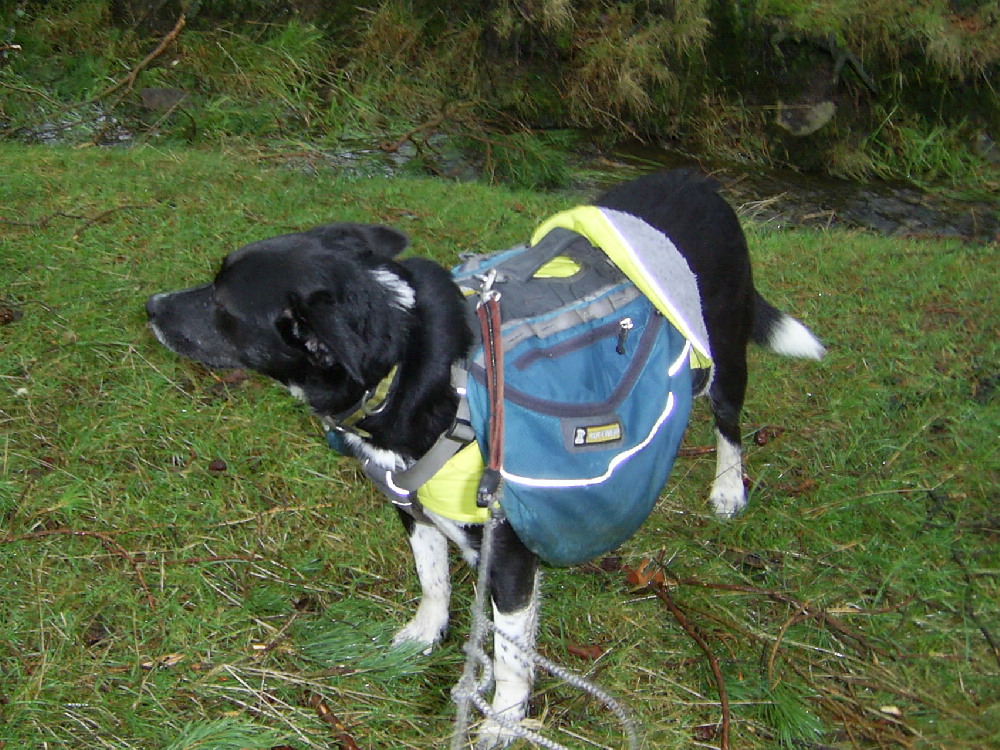
Lucky attempts an escape from Cateran Hole
 
A few steep steps lead down into a passage which bears some chip-marks on the walls reminiscent of similar marks inside the coffin level in the mines at Scope End. Such chipping seems to have been abandoned as the passage widens a bit and once daylight was left, me and Lucky, who wanted to escape at this point, were faced with a duck under a lodged stone for further progress, which, without a hard hat and not willing to get covered in cave-shite, we abandoned further exploration to rejoin Dawn at the entrance.
Eermerging (hurriedly in the case of LTD)


 Dawn had, more sensibly, decided to wait on the outside. Lucky didn't like it at al and was keen to re-establish contact with the warm wind outside and the distinct sniff of heather
and moors and life in general. One of the things I really enjoy about underground stuff is the smell and buzz of life when you emerge from the dark and damp stuff.  It's a bit like being born, I should imagine, and coming out of Cateran Hole does have some similar aspects, I think (see the photo )
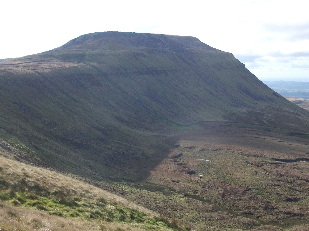
Blawearie and distant Cheviot Hills


After snuggling down in some friendly and deep heather for a relaxed lunch, we progressed along soggy bridleways to Blawearie - a ruined terrace of buildings which may well have been a farm. Blawearie, it seems to me, is a magical spot, ideal for a summer camp-out. There's more to the place than meets the eye, including, apparently, a garden, which we had no hint of. There's some nice green grass for a tent, though.
Corbie Crag hillfort and LTD sniffing the wind for suspicious pasties


Just on a bit further was a hill-fort - maybe a fortified settlement, quite typical of similar places up in the Cheviots, but with a double ditch. Quite an effort to defend a small settlement, I think. Again - a nice and breezy spot for a tent in summer. And just below, we explored the little beck and gorge containing Corbie Crag and "Grey Mare's Tail" waterfall, which turned out to be quite small.
Dawn and Corbie Crag


A boggy path took us back to Harehope Farm - which seems to be several cottages, and some roadwalking back to the car which was exactly where we'd left it.

This area will likely bear a bit more exploration. It's quite gentle if you stick to the paths and there's the expectation of more interest to be had. And worra crackin place is Blawearie fpr a summer overnight.

I made it 8 miles. Dawn thought it was 9. Lucky's idea was more like 7 and suggested that next time I might take a bonio or something, at least....

Tuesday 15 December 2015

Beer Trekking: News


I've been considering my proposed Beer Trek for May 2016, based on a list of the twelve highest pubs in England.

There's a few problems:

Firstly, just one of the pubs is on Dartmoor. This would seriously skew the walk and loead to miles and miles of teetollalation wandering through Birmingham and Crewe and other places where they don't have pubs at all.


Secondly - some of the pubs on the list are closed. Clearly, the wait for new landlords to come  to re-open along would also skew the timing of the walk somewhat.


Thirdly: Some of the pubs on the list don't open every day. This could also end up in some substantial waits I suppose.

Soo.....  I'm just going to do Northern pubs. This resolves the issue concerning Dartmoor.


And I'm left with a list of twelve pubs, some of which are permanently closed, some have been gentrified and probably won't let my little dog in and some have been converted into other things. But it strikes me that linking these places up, whether they're open or not and whether they'll let me in or not, probably says something about the state of English pubs in the early 21st century, so I'm going to do it. I'm going to visit each one and take a picture and reflect of whatever welcome I might receive.


I'll likely visit several significant hillwalking pubs in between and I have a short list (not a shortlist) of some of these, but am open to suggestions as to any other drinking establishments might be included

Many of the pubs seem to come in little swarms or groups - particularly around  Flash and specially around the A53.


This is the list of pubs, open or not:

1. Tan Hill Inn
2. Cat and Fiddle
3. Travellers Rest Flash (possibly aka The Knight's Table??)
4. Kirkstone Pass Inn
5. New Inn  Flash
6. Royal Cottage A53
7. The Mermaid A53
8. The Winking Man A53
9. Miners Arms Nenthead (hooray!)
10. Deerplay Inn  Bacup
11. Sportsman's Arms Bridestones
12 Allenheads Inn.

Other pubs to be visited might well include

Stags Head Edale
Snake Pass Inn
New Delight
Red Lion Earby (and maybe the White Lion too)
Buck Inn Malham
Crown Hotel Horton in Ribblesdale
Hill Inn Chapel le Dale
Station Inn Ribblehead
Moorcock Garsdale
Nateby Inn
The George Orton
Crown Inn Shap
Golden Rule Ambleside.

There may be others. Never say never, innit?


Friday 11 December 2015

Northumberland - Darden Rigg

Key Heugh from Darden Rigg

Blogger and Livewriter are playing silly buggers again, so this post is written in Blogger, which isn't as pretty as livewriter. I suspect its got something to do with my new phone which accesses google and has various extra security levels which defeat livewriter. Its annoying anyway. I may have to migrate the blog to wordpress or something....

Anyway.. here goes
LTD and Dawn on the way up


Walkers wandering along the beautiful and interesting Simonside ridge overlooking Rothbury have the option of continuing through the heather, bogs and tussocks to Darden Rigg and beyond. They’d have to be fairly tough, though whilst at the same time having an affinity for some quite hard work.

There’s an easier way to get to Darden Rigg, though, from a little layby on the road between Eldon and Hebble from where a sign announces that a circular walk of some four-and-a-half miles to Darden Lough is available with the opportunity to carry on to Simonside. What it doesn’t say is that carrying on to Simonside would be hard work and you’d have to get back again.
Darden Pike

Our plan (Me and Dawn’s and ratified by Lucky The Dog) was to go up the left wing of the circular walk to Darden Lough and either follow the forest boundary fence to the 407m Darden Rigg summit or to find a way through the forest should the fenceline prove too rough or the fence too high to get the dog over.


The ridge towards Simonside


Both Darden Loughs

So, with the low winter sun in our eyes and a wutheringly biting wind in our faces, and to the sound of heavy artillery fire from the ranges just over there ---> we slithered off through the post-Desmond mud on a clear but narrow path through the deep heather to Darden Pike where we had a break in the shelter of the summit hillock and snuggled down in the deep heather.  Meanwhile LTD did some shivering. Darden Pike has a fine cairn and a trig pillar, is close to Darden Lough, a wind-blown and beautifully bleak little tarn, and is, perhaps a bit more interesting than Darden Rigg itself.

Little Darden Lough in late afternoon light

Some rough-stuff followed as far as the forest fence, which was found to be low, devoid of barbed wire and easily crossed, and a bit of a track alongside.
We passed Little Darden Lough – just a  smaller but equally bleak version of “Big” Darden Lough and fairly easily  along the ridge to the high point – a piece of heather higher than the other pieces of heather – and back to an ancient cairn fashioned into a square shelter for lunch.
Darden Lough

After retracing to Little Darden Lough, where Dawn disappeared briefly into a hole doing minor, but probably, painful damage to an ankle,  we took the other wing of the circular walk back to the start. This was sloppy and slippery at the same time.

On the way down
 The other, probably easier option for the bagging of Darden Rigg, would be to use the bridleway from Hepple Whitefield farm to the  forest edge and then the forest road which passes close to the summit on it’s South side. This gives all kinds of problems for a return route, though, unless you want to return the same way. So our route was better, see?


Wednesday 9 December 2015

Wandering About Winster

undermillbeck 007

A week or so ago,me and The Bro arranged to have a walk somewhere in the South Lakes, and, in view of the general lack of daylight, I identified four likely and unbagged Tumps not too far from Kendal as targets. In the meantime there was a visit from Desmond so a walk seemed unlikely for a while… but I set off anyway.

undermillbeck 001undermillbeck 003

As it happened, the road to Windermere and then South-East from Windermere was open and so, we parked in the little car park opposite Winster Holy Trinity Church (don’t try this on Sundays, folks) and wandered off along soggy paths and lanes towards Hubbersty Head and then Northwards to the foothills of one Scott How, the 169 metre summit being achieved only after mounting some barbed wire, followed by violent and unfriendly brambles and clinging, but dead bracken. Once on the top, we noticed that there was a higher top on the other side of the wall, which we duly bagged after an awkward scramble over an impending rusty gate. (Had we checked the hill bagging website we would have already known that this other top was 2 metres higher)

undermillbeck 004

Onwards to Cat Crag.

This involved a short but friendly trespass, a derelict gate and some rough and, in places, soggy moorland. Cat Crag 186m is a rocky tor with a nice view and some friendly walls behind which to shelter whilst seriously damaging a turkey dinner pasty wot I got in Durham covered market the day before. Lucky dozed off. It started raining, quite heavily, so we wandered down the hill and through the trees to Knipe Tarn where we gazed at some ducks for a while. Then it stopped raining. Yes folks, there is a Knipe Tarn.

undermillbeck 008

Top #4 was to be Undermillbeck Common 187m. This was to be a bit awkward.  We gained access to the fell from a track to the South and followed a wall with a high mesh fence on the top. The summit was on the other side and, there being no gates or stiles, we had to teeter over this whilst not collapsing the delicate dry stone wall.

This was OK, but, after summiting , we had to recross this obstacle once again, just next to a floating bog defended by more barbed wire.

Capple Barrow which achieves the dizzy altitude of 196m was much easier and defended only by a gate with a “No Footpath” sign on it. We knew that already, obviously, so this information was excess to our requirements and whilst we made a mental note, we did nothing about it.  We did note that the grass around Capplebarrow was very lush and green and would make fine spring grazing for lambing time. The top also has a fine view of Windermere golf course.

undermillbeck 010undermillbeck 011

Returning to the gate, we progressed over rough and soggy  patchy woodland/ moorland (quite beautiful, actually). Lucky celebrated by putting up a new route on a rocky slab and we emerged on the main road not too much later. It’s sad to note that he’s a much better climber than I am now. (Although I was never much good)

And that was that. 8 miles and four tops Tumped. Note that none of the summits gained were very high at all and those hill-goers who are even more decrepit than those who seek to collect Wainwright’s Outlying Fells may well wish to consider Cumbrian Hills like these as they sink into the final stages of decrepitude. In fact, senility could well be a useful excuse if discovered doing all that trespassing,  whilst being rescued from impalement on a barbed wire fence or being winched out of one of the sucking bogs.

We avoided any serious flooded, apart from the drive back through the Lyth Valley which was underwater, except for the main road, which wasn’t.

winster

Thursday 3 December 2015

Another Advent Adventure

advent adventure 004

Pic shows walkers climbing heart-attack hill; so-named since it was the first hill to be graded by the number of heart-attacks expected whilst climbing it.

“Advent Adventure” is the title of this 8 (ish) mile circuit of Crook which we’ve now done as a Durham County Council guided walk some four times. So, it’s “another” Advent Adventure, innit? Traditionally, walkers have access to hot coffee and cakes, buns, mince pies and ginger wine at the end of the walk at St Catherine’s Community Centre, served by Mrs Pieman. This year, Lucky The Dog (LTD) was in attendance on the reccy and in St Caths, but couldn’t come on the walk cos I’m not allowed a doggy whilst leading a guided walk. It’s a distraction, see? 29 People turned up including Richard the steward.

advent reccy 001

LTD near Mown Meadows – heading towards Kitty’s Wood

advent reccy 003

Bridleway at Roddymoor

advent adventure 002

Lunch on Billy Row green

The reccy and the walk both went without any excitements – nobody got hit by a golf ball, nobody got knocked down on one of the road crossings and nobody fell off a footbridge into a ditch (which is what happened on a previous occasion)

This year there was no frost and the clarts weren’t nearly as clarty as on previous Adventures, and more coffee and cakes were sold than before.

advent adventure 007

Dowfold Hill

Its an unexpectedly nice little trundle around the very far Western edge of the Durham coalfield and has a long and coaly industrial history, including some of the first steam railway lines in the entire world, some huge, but now all-but disappeared industrial installations involving tramways, coalmines, brick works, benzine factories, railway sidings and coal tips – mostly now replaced by woodland and over-smoothed fields.

And nobody ever starved to death waiting for a bus in Crook (lots of cafe’s tea rooms, pubs and cake shops)

advent adventure 008

Pie Towers is down there somewhere

advent reccy 005

Same place, no people… on the reccy. Big view of the North Pennines and North Yorks Moors from here.

There, that’s a plug for walking around Crook.

Here’s a map.

advent adventure route