statcounter

Monday 28 October 2019

Long Walks - Mardale Skyline

 I suppose I should really have posted about our hollibobs in the Preselli Hills - very nice hills by the way and the nearby coast is crackin'. But the moment is passed. So instead, on the theme of our little group wot does a long walk every month, this is October's effort.
 Lets just state from the start that, as a 20-mile walk, this one was short, by the tune of one mile. I felt that this was something of a shame. Clearly, something went wrong in the planning stage. (Maybe if there'd been an actual planning stage, the magic 20 miles would have been achieved.) There were lots of contours, though and Diane's GPS said we'd climbed 4900 feet and this number was used as an excuse for trying to make me feel better about the abject failure of the 20th mile. Actually, there wasn't a 20th mile.

 The conditions were quite good and much better than anything I'd experienced in Preselli (Did I mention we'd been to Preselli?. It's in Pembrokeshire y'know. Quite a long way from Durham as it happens. My longest walk there was 10 miles. But I'm not blogging about Preselli)

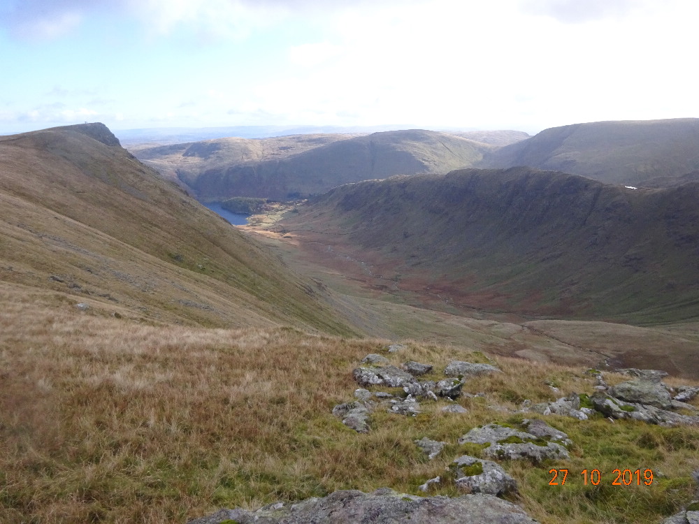
 So, the idea for the walk was to circumnavigate Mardale. That's the Dale that is mainly beneath Haweswater. So we began at Burnbanks at just after 8 o'clock, having remembered to put the clocks back. Our team was me, LTD, Bailey the other dog, Li Yang, Diane and David. Unfortunately I'd utterly failed to contact Ruth who'd said she wanted to come on some of these walks but I only remembered as the sun went down... dhuhh.... A mile short AND I've probably upset Ruth. I'll tell her about the future dates and she can decide whether or not to tie my bootlaces together at first lunch (long walks have two lunch stops)

 It was spectacularly cold for October and there was snow on the Helvellyn range as we plodded up the hill from Burnbanks to join the ridge at Keasgill Head. Navigation from there is pretty straightforward and the ridge is followed over High Raise, Rampsgill Head and High Street. It occurs to me that if we'd included Kidsty Pike and Thiornthwaite Crag that shortage of miles by one wouldn't have happened and not much extra effort would have been involved. (dhuhhhhhhh)

 From High Street, we dropped down to Nan Bield Pass, heaved our tired legs over |Harter Fell (a big climb),  down to Gatescarth Pass to consider the apparently huge but grassy climb up Branstree. This proved both huge and grassy, quite a lot like many of the Preselli hills, except that some of those have tors on top which need to be scrambled for the bagging tick. This proved tricky for Lucky on one or two occasions.  


 Having rested on Branstree in the shelter of the cairn, we plodded over Selside, completely missing Branstree's North East Top which, had we wandered over there, would surely have taken us a bit closer to the 20 mile target. I'm not bothered about this by the way. I'm not sure why I even mention it, really. It's not as if it was important or anything

 
The picture above is me and LTD on Pen y Fan, which is the highest bit of Dinas Head. It's a Tump. The picture was taken by a member of a friendly  family out on a walk from Swansea. It's on the Pembroke Coast, see?  This is where we went on our holibobs. It's not on the Mardale Skyline. The Mardale Skyline doesn't have sea quite as close as this, although you can see Morecambe Bay at times.


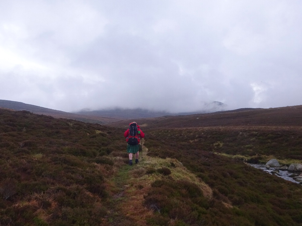
 So, we descended to the old corpse road, upon which there appeared to be no old corpses, at least not yet and wandered into a lovely wild bit which required a bit of navigating for a kilometre or two, specially as the sun was winding up the clock on the mantelpiece, was warming it's cocoa milk and had already put the cat out.
 We made for a "ford" on a track crossing High Goat Gill and followed this to the concrete water board road which leads to Burnbanks. Headlights were only needed to protect the group from wild-eyed drivers returning from their pathetic little walks at the top end of Mardale or, indeed, an afternoon of carousing at the hotel up the road. I bet none of these had done twenty miles anyway ....er......

Thursday 3 October 2019

Knipe and Knipes' 2019 TGO Challenge. Roadwalking to the end

 The last bits of a TGO challenge usually involve quite a bit of roadwalking. However, we had cleverly planned a route over some heathery moors to take us to Fettercairn, a plan which went wrong in it's early stages. We rolled up at a cottage up a side road where a friendly old chap described the two deer fences we'd have to cross with our big packs on (that is to say , we'd have to climb over a 12 foot high wobbly fence) - and gave us an alternative route avoiding the trouble. So we set off on the new route and promptly decided to go a different way missed the turning and ended up walking along the road all the way to Fettercairn. This wasn't as bad as it sounds and we found a nice place in some woods for lunch and a woman stopped her car for a chat. This kind of thing often happens on a TGO Challenge by the way.


 We got to Fettercairn in good time and got a lift with a woman and her dog into Johnshaven where she allowed us to use her shower, took us to the pub, let me walk the dog and gave us comfy beds for the night. In the morning she returned us to Fettercairn. Her name was Mrs Knipe, which was an outrageous coincidence as my wife has the same name. And, oddly enough, she had a collie/staffie cross mongrel which answered to the name of "Lucky", just like my dog. Remarkable. Worra small world.


 Back at Fettercairn the next morning, we marched off to Laurencekirk where we broke the cardinal TGO Chally rule by not stopping at the tea room nor doing any shopping at the supermarket. We managed to get off the road for a bit but returned to it to cross the hill to sea the see, or even to see the sea...


 This is dangerous country in a morning, folks. This is riskier than the wind up your tartan in the Cairngorms. The roads are quiet and empty. This encourages the local drivers to consider that as they've been driving the lanes for the past thirty years without spotting any pedestrians, that there won't be any around those blind bends.  We made it to Benholm which was closed. The only thing moving was a fluffy kitten. We navigated to the "beach" (it's a lot of rocks)

 I found some rhubarb growing wild on the shore and picked some to take to Johnshaven.  We were invited into a bungalow for a cuppa, which we accepted. They were the Mum and Dad of a TGO challenger who had finished the previous day but had not  apparently yet visited challenge control..  We wandered along the coast path to Johnshaven where a Mrs Knipe agreed to give is a lift into Montrose to check in. So that's what happened.

 And that was the end of that. We went to the Friday dinner at the Park Hotel. I took Mrs Knipe's little dog for a walk or two. We dined at the Anchor in Johnshaven. Mrs Knipe let me sleep with her and took me and The Lad home to County Durham. We'd done 192 miles. It was James's 4th TGO Challenge and my 15th. I ought to try for 20 now, I suppose.


Wednesday 2 October 2019

Knipe and Knipe's 2019 TGO Challenge - Fleshpots: Mar Lodge, Braemar and Tarfside

 As I was saying: the superb  warm and sunny weather would now probably last all of the next few days and see us to the finish. This morning's raindrops would probably be just a temporary hiccup in The Big Drought of 2019 which had clearly started last Saturday. So, we fished out the waterproofs and marched off down Glen Derry to Mar Lodge where there was a strong rumour of tea and biccies.

 I'm not allowed biccies, obviously, but I did have a cuppa at Mar Lodge and we enjoyed a brief but entertaining bit of socialising before joining the procession into Braemar. Braemar provides almost everything a TGO challenger could possibly want: beds, music, drinks, meat, pies, more drinks, sweeties (I'm not allowed these) phone signal, campsite. And drinks.


 And , in the morning, having acquired a rather disappointing weather forecast which would surely see us taking a foul weather alternative from Callater, we decided to alter the route and head for Gelder Shiel and then the tiny, cold and draughty Shielin of Mark bothy from where we could access our original route, as recommended by Mr Grumpy,  our vetter and thus enter Tarfside from the correct direction without getting all wet on Lochnagar. We would in fact, walk around Lochnagar. We told control.

 And after a substantial Full Scottish breakfast in Braemar, we wandered through the forests of Balmoral and ended up, early afternoonish at Gelder Shiel Bothy which was occupied by challengers. We camped outside alongside several more challengers, one of whom played a penny whistle briefly. . I had a plink on the bothy guitar and the radio decided to play Jimmy Shand music which was, in fact Just The Thing for a relaxing evening's camping with a lovely view. I had replaced my depleted in-tent entertainment supply of cheap whisky with some more cheap whisky and my dinner was a lovely pie from the bijoux beef boutique (butcher shop)  in Braemar.


And in the morning, the glaur was back and clouds covered the hills, with the occasional severe wetting. We bashed on over the hill to Loch Muick where the visitor centre provided some brief shelter and some fairly unpleasant machine-produced "soup" (the inverted commas are important here).

Onwards to Shielin of Mark, where it brightened up a bit and, it still being early and us now well ahead of our schedule, we decided to rub it in and press on with part of Mr Grumpy's route. This involved crossing the moors to  the Water of Unich - a substantial river which we might cross and then camp. As we passed over Easter Balloch, and started to descend to the river, we disturbed  a White-Tailed Eagle which sailed out over the glen and flapped off into the distance. It was here that we felt the first few drops of a new rainstorm, so , having achieved the riverbank, we took the first reasonable camping spot just by a bend and on a little rise and settled in for a wet night.

At around midnight, The Lad expressed some concern that the river was getting a bit lively and that we might be in a vulnerable position. I had a look. He was right. At 2:00 am I had another look and it was worse. We packed up  for a quick getaway and sat in the tents till it started to come light. At 4:00 am (ish),  headlights on, we left, the river by this time  being in a very bad mood indeed and the rain continuing to do what rain does best. There was no way to cross the stream to continue with Mr Grumpy's route, and any attempt would probably entail a very quick  and bumpy journey towards the beach at Kinnaber Links,  so we followed the North bank down by the Falls of Unich (impressive!), passing Bernie's tent and turning up at Tarfside at 9:00 am, just in time for breakfast and lots of tea.


Tarfside has several attractions: the field, where it's possible to camp fer nowt, St Drostans, which is taken over by TGO challenge peeps and which provides some beds, tea, breakfast, evening meals and beer and the Mason's Arms which provides more beer and chats and is managed by locals. So we had a relaxed day's camping after breakfast, dinner at St Drostans and a Bit of a Do at the Masons, during which time it chucked it down outside. We were now just a day and a half's walking from the finish at Benholm Haughs.