statcounter

Sunday 31 March 2019

Backpacking Ayrshire Tussock Territory


It's not a huge distance between Lochwhinnoch and Largs, but the bit of random wilderness in-between is as rough as a badger's bum, not to put too fine a point on it. Three of us (Me, JJ and Margaret) plus LTD made the journey, probably possible in a day for a fit local who knows the way, in just three , or was it four, days. Let's call it three overnights and two small parts of two other days.


We began well with a sunshiny walk from the station into the fleshpots of Lochwhinnoch, the first and only of which presented to us as "The Corner Bar". We investigated. It was occupied by some quiet locals and a friendly landlord who let in the dog and served us with jinkies. But there was no time Toulouse. We had to press on. So we did. For about four miles into the tussocks and found, on a small but dry ridge, a nice little camping spot, quite close to some nice water. The night was quiet.....

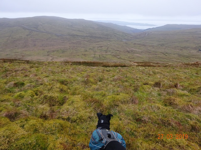
 ......   but the day had dawned drizzly. We braved the wind and mist and bashed on up the track, bagging Misty Law a bit later and then, into bigger, better and badder tussocks for East Girt Hill, Stake Law and West Girt Hill. We couldn't help but notice the use of the Yorkshire dialect in the hill-naming system; "Yongerthill" of course, being the name of almost any biggish hill in the Yorkshire Dales....


We bashed on bravely becoming wet. LTD expressed his disgust at being dragged out in such conditions by sheltering himself in any patches of juncus available at all opportunities available. He began to look quite fed-up. As rufty-tufties, though, we complained not  but soaked up some more contours. Hills fell beneath our soggy boots - High Corby Knowe, Long Hill and Box Hill. It became three o'clockish. We sought out  the Gogo and found a flat and green spot next to Gogo Lodge, a disappointing circle or two of stones, but adjacent to nice water and the only really untussocky spot for miles and miles and mi....

The morning was better. It was now dry but perishing cold. The real pre-TGO training experience kicked in. We had to bash on into the mosses bogs and general rough-stuff before us. We bravely breakfasted not considering the efforts ahead. These were: Feuside Hill, and, after a chat with a man in wellies with a small dog, Paton Hill, Rigging Hill the A760 and the local crematorium which we first identified as a visitor centre, probably selling bacon barms and cups of steaming hot tea. I expect that there were indeed hot spots within, but nothing for us. We joined wind-farm city and bagged, with aching legs, Brown Hill and Blaeloch Hill, identifying a pitch or two for the tents beside a very small and unnamed beck. Me and Margaret climbed Kaims Hill after a brew whilst JJ attended to whatever he attended to within his akto. We had a misty view of the Isle of Arran. The weather improved and LTD managed to luxuriate in the warmth of the sun-lit tent whilst I attended to reducing tomorrow's pack weight by finishing off the scotch.


In the morning sunshine, we descended to Fairlie and wandered along the Ayrshire Coast Path to Largs where we met the brother of my first NHS boss from between 1970 and 1975 (ish). How we came to this information seems unlikely, but it was , in fact, the result of JJ's habit of talking to strangers. We repaired to the Douthy Neebours pub where LTD had a sleep by a radiator and I had a steak and sweet-potato fries. And some liquid carbohydrates.


We eventually parted at Glasgow Central Station after catching the train from Largs, with a promise to do it all again soon... my plans for which are going a bit awry at the moment...  Cracking company, though, thanks to JJ and Margaret,  and personally, I had a whale of a time, although LTD experienced some periods of abject misery in the driving drizzle. He never remembers these for long, though. I can recommend these hills for a taste of wilderness, though and there appeared to be lots more hills to be bagged and routes to be done. I can't think why these lumps don't appear in more walking mags...

Tuesday 19 March 2019

Rambling Up Slitt Wood

 
Warning: Readers are cautioned that they may find that the following post generates some feelings of deja-vu. And I'm not talking Crosby Still Nash or Young, here.
 

 The reason for a bit of deja-vu, and who doesn't enjoy some deja-vu from time to time. I said who doesn't enjoy a bit of deja-vu from time to time,  is that there was a Wolsingham Wayfarers walk a few weeks back, lead by LTD who was dragging me up the hill out of Slitt Wood. (Now is it two T's or just the one. In all the excitement, I clean forgot to count the number of T's on the OS map...)


However - all was not lost because no sooner had the twenty peeps and a small black dog emerged from Slit(t) Wood and heaved their mortals up the moor to the top of the hill, than Dave, the Leader, left the Wayfarer's route and descended to the Red Road, a rather lovely moorland trod which heads in the general direction of Rookhope. This is much less soggy than the "other" route, has fewer tussocks, and nobody has to be extracted from deep peat, so it's not quite as Good for the Soul as the other one. 0-1 to Wolsingham.


The pics above demonstrate what a nice day it was too, but what they fail to show is the desperately nithering wind blowing from the front door of Santa's Grotto, somewhere up the North Pole. It was truly chilly and much colder than when the Wolsingham peeps did it, and, therefore, Very Good for the soul. So far, it was a 1-1 draw.
There are no further pictures because , just as we embarked on the Weardale Way back towards Westgate, it began to snow and/or sleet and/or rain. And this was combined with the nithering gale mentioned above. Any pics taken had far too much shake on them from the desperate shivering.
This was, of course, Extremely Good for the Soul and, therefore, it was a win for Crook and Weardale Ramblers. 3 - 1 is what I made it. Lucky said I was being over-generous.

Wednesday 13 March 2019

At The TGO Challenge Gathering - Snake Pass Inn


Me and LTD went to the Snake Pass Inn to enjoy the annual TGO Challenge Gathering, organised every year (because it's annual, innit?) by Alan Hardy.

I have only one picture taken in the actual gathering, mainly because I was busy in my quest to rid the world of the evils of strong liquor (mainly whisky) one glass at a time. I'm afraid my quest was futile on this occasion, but this hasn't curbed my enthusiasm for this venture and, despite failure this time, I am determined to have some kind of re-match.


We went on Friday, and on Saturday, me and LTD went off to bag Crook Hill and Bridge End Pasture, two Tumps lurking on an isthmus of Ladybower Reservoir. We did about 7 miles, curtailing the walk quite a bit due to rubbish weather.


It was, in fact, blowing a bit of a hoolie and, embedded in the hooliness ( hmmm.. sounds like a Scottish Pope...) were very frequent and heavy showers of rain, sleet, hail and snow with bits of sunshine in-between. A gale of a breeze made it imperative to shelter in the squalls and, luckily, Crook Hill has summit rocks on both it's summits behind which to hide.


When the sun did shine, and shelter from the nither was sought, it was actually very warm.

Nevertheless, we sought out a hot cuppa at the café, on the way, coming across Sue from TGO/Newtonmore and, at the café, with a cuppa in hand, Alan the Gathering organiser (pic below.

Overnight, Saturday night, the snow returned properly and I thought it best to head for the lowlands of Sheffield, Barnsley and the M1 rather than stick around getting stuck.


The TGO Challenge has a bunch of unsung heroes who organise things, vet things, help out  at Control and so-on, and so-on; jobs which are essential to the event. Alan's done the organising for the English Gathering for quite some time (not sure how long) - it must be like herding kittens.

A few more pics below.... 


Saturday 2 March 2019

Foggy Sneakiness on James Hill

The empty road to Swinhope
A hasty decision, made the night before and with pack packed and owd fowks bus pass located, me and LTD travelled to Daddry Shield to start on the road up to Swinhope. This was something of an error since the road up to Swinhope doesn't go from Daddry Shield at all, but from Westgate, a place I'd just passed on the bus. Never mind, I needed the miles (Some kind of happiness is measured out in miles)


Swinhope (Pig valley) has a gated road that goes to Newbiggin in Teesdale. Just one car passed in the couple of miles from Westgate to the pass at the top of the road and there was a chap fixing a stone wall, and he had a car, so that was two. And, as I snacked by the cattle grid at the top, an Asda home delivery van went past. Probably lost. I hope the fish fingers weren't thawing out.


Swinhope's main attraction, though is the Weardale Ski Club's tow and, as there was no snow at all, there was nobody there. So the dale was quiet and empty save for Curlews calling. There was no wind and the mist was laying on the hill tops and well down the fellsides beneath. This was Very Good News.


Sometimes it pays to be discreet and on these occasions, a thick blanket of fog is Just The Thing. Me and LTD plodded the squishy bogs to the summit of James Hill, at just over 2200 feet above sea level.

And we handrailed the fence over Outberry Plain, turning North to try to find Ewestone Currick, an obscure and small feature about a mile and a half across the moors, which, in these conditions were almost featureless. Navigation by map and compass would probably have meant handrailing the fence most of the way and trying to find the spot from a corner about 400 metres away. This would have proved quite hard, I think so I used GPS all the way, and, even then, the place was hard to spot.


Ewestone Currick above. A currick is usually a cairn and it often includes a small shelter to allow a shepherd to get out of the weather for a while. Ewestone Currick has seen better days. The next target was the trig point on Snowhope Hill and even this wasn't quite where the GPS thought it was - in fact , it was a good 90 metres away and, since visibility was about 50 metres.....


We had a short break on Snowhope Hill, at The Carrs, a bijoux clump of boulders with a cairn. Lucky decided that this was an ideal spot for a snooze and he went straight off to dreamy sleepy snory land whilst I dealt firmly but  fairly with a banana.


A bit later, with some more GPS'ing,  we hit the Stanhope - Egglestone Road which is shadowed a bit by a so-called Roman Road. This was actually built in 1832, apparently, so the Romans must have been hanging around.
It does lead towards Stanhope, but the road is not much fun and soon, we turned off by some teetering buildings and descended to Stanhope through rabbit pastures and some quiet lanes.


We'd done 15 miles altogether and Lucky had bagged 3 tops - a Nuttall/Hewitt and two deleted Nuttalls, which don't really count, I suppose. This wasn;t bad since the walk had no plan to it at all and was, in fact, more or less made-up on the hoof.  Don't try this at home, folks, it's probably nopt a safe thing to do, but I'm 67, with a dicky ticker and Type 2 diabetes in remission and I have passed on my genes, and some of my genes have passed on their genes, so safety is not my principal concern. I think this is only right. Youngsters are the ones who are gung-ho, and owd fowks like me are cautious in  the extreme. This is the wrong way around, surely. The world would be a lot safer if it was the pensioners wot did the fighting. We'd never hit anything for a start....