statcounter

Saturday 26 January 2019

Fruitless Forest Foray From Hadrian's Wall


LTD on the wall
 Me and LTD walked all the way from Housteads roman fort and up the Pennine Way to bag Bell Crag – a diminutive Tump in the trees. When we got there, it was surrounded by a large and spiky security fence sporting a warning notice concerning non-ionising radiation, whatever that is… so we couldn’t reach the top which, according to my GPS thingy was just 60 metres away from the gate.
On the upside , it was a really nice frosty winter’s day with just a smidge of snow here and there, otherwise I would have been in a right old sulk.
We won’t be going back for another go, though.
It was 10 miles there and back and included a flying visit to Haughton Green bothy, which was quite lovely even though it contained some abandoned socks and some doggybix in a plastic box. LTD enjoyed a few doggybix.
Dhuhh……

And another thing! I had to use "blogger" to write this since Open Live Writer refuses to connect to the blog for publishing the post. Not sure what's going on there....

sunset
Haughton green bothy
sparkly tree
Add caption

Monday 14 January 2019

Long Walks–Durham’s Deweys

durham deweys 001

Attentive walkers may remember that I’m trying to do a 20+ mile walk each month in the ru8n-up to this year’s TGO challenge (I might well continue afterwards as it happens)  This also suits various other peeps who seem to enjoy joining in.

Sooooo   January’s 20-miler was a traverse of the four hills in County Durham categorised as “Deweys”. These are hills between 500 and 610 metres with 30 metres of re-ascent on all sides. And they’re fairly close together, ranged, as they are, on the Northern side of Weardale’s watershed. The list is as follows: Dry Rigg (an ironic, or, possibly sarcastic name) – just above Rookhope; Bolt’s Law, Horseshoe Hill and Collier Law.

Linking these together from a start at the Dales Centre in Stanhope involves a walk of around 22 of the Queen’s miles.

durham deweys 004

So, five of us turned up at 08:00 in the dark at Stanhope – plus doggies Bailey and Lucky The Dog – and we stumbled off into a lively headwind up by the River Wear to Eastgate and then , by Bolt’s Burn to Rookhope for lunch#1 in the bus shelter there.

durham deweys 007durham deweys 008durham deweys 010

The crux. or at least, the first crux of the walk is the ascent to the wathershed ridge by following the line of the lead-smelter’s flue (aka “chimney” which runs for a mile and a half up the hillside above Lintzgarth. The summit is a short splosh away over bogs and tussocks.

The traverse to Bolt’s Law is fairly straightforward by following paths beside the fence or from the road to the summit where the wind was specially fierce for some reason. We found a sheltered and sunny spot beside a shelter a little way down the hill for lunch#2. It was here that Bailey and LTD decided to have a fight. I suspect it was Lucky’s idea cos he’s Just That Sort of Dog.

durham deweys 011durham deweys 013

The old railway line which rinhs to Parkhead will be familiar to Coast-to-Coast cyclists and this gave us an easy but long (and a bit dull) trundle to Parkhead and then down the hill a bit towards Stanhope, with an intervening short but brutal up-and-down climb for the bagging of Horseshoe Hill where the weather seemed to be brightening but cooling quite a bit.

durham deweys 014

Finally, quarry tracks took us to the top of Collier Law and, in fading light, we descended to Stanhope on steep grouse-shooters tracks.

The next Long Walk is on 3 February, probably from Wolsingham Station. It has become traditional (quite quickly) to do these long walks on the second Sunday in the month, but me and Dawn are in Wales on the 10th; there’s a ceilidh in Nottingham on the 16th, which precludes a walk in the North-East on the 17th and I’m leading a Wolsingham Wayfarers walk on the 24th (fab walk by the way – Coldberry Gutter from Bowlees – be there or be square, innit…   and it’s free…)

I must say that I’m quite enjoying these long walks, apart from the stupidly early getting-up. I’m not finding them too taxing although LTD was limping quite a bit on Sunday night. He seems to be OK now and he’s had a very lazy day today. I’ll keep an eye on him. Maybe 20 miles is his limit, but there was a fair amount of hard tracks on Sunday. We’ll see…….

Friday 11 January 2019

Old Photos #1 2009

There’s a small hiatus, so I thought that intimes of hiatuses  (or whatever the word is) I would show some old pictures. Nostalgia is not just a pain in the nose, y’know. These are from 2009.  No comments are available. I may do 2010 the next time there’s a gap. Big walk due in a few days…. (click on the small pics for a bigger pic)|

P5090038P5110055anna arrivingarf arfbaal hill 001brian emerges from crawlbruno spies sheepconsidering a dog biscuit cnicht summitculvert entrancedanger to lifedoubtfrom sail to outersidegarrigill stand offdont try this at home folksin a hole 4kept his specs on somehowkinder edgemeatballs with smash and peasmike and netty leave lingy hutmudpie ghost 2my brain hurtsP4070014P7080011P8220044P9100017PA110048PA130064PA240018PA240020pieman with tgo half chally tshirtsnow morningsolstice 003

Wednesday 9 January 2019

Eight Years of A Shivery Walk To The Border–(Brrrrr)

shivery walk 004

Years and years and years ago, in the company of Rothman’s Walking Club (think cigarettes here…) – we did a walk across Burtree Fell on a lovely, sunny day in mid-winter with deep, hard snow. I suppose you might call it “neve”.

middlehope moor 001 

Now Burtree Fell’s walking is pretty rough in places – typical Pennine stuff with heather, sphagnum bogs, peat hags and tussock grass and progress can be quite slow. However, on this particular day, the walking was spectacularly easy on the hard snow, and it was veen deep enough to cover the walls and fences which might have impeded progress. The downside was that we completed the walk a couple of hours earlier than we should have done.

middlehope 006

Rothman’s Walking club eventually fell apart and time moved on to a period when I was volunteering for Durham Voluntary Countryside Ranger Service – mainly stewarding guided walks and, later, leading guided walks.

And I revisited Burtree Fell and encountered exactly the same condiions as on the Rothman’s walk. I decided at that point that should these conditions be repeated, that it would make a fine guided walk for Durham County Council, and so it came on to the programme, each early January, for a few years at least.

DSCN1041

Later, in a strop, and because I was a bit bored, I stopped leading DCC guided walks but the walk appeared on the Wednesday and Saturday Walking Group programme (aka the Wednesday Walkers Walking on Saturdays)

So far, on both groups, we’ve now done this walk 8 times since 2012 with a total of 137 participants and several doggies.  We’ve never had the conditions for which it was designed, although there’s been snow 4 times – mainly thin and icy, cold and frosty twice and mild and drizzly the other two times.

shivery walk 005shivery walk 006shivery walk 008

Last Saturday was the latest and it was cold, with a few icy bits, but no snow.

Ho hum. 

I’ve changed the route a bit and, instead of sticking strictly to the rights of way and staying in County Durham, it now crosses the border into Northumberland (adventurous or what?) and visits the summit of Middlehope Moor at 2007 feet. This is marked by a small cairn and, as a high point is a remarkable anti-climax.

midlehope wswg 003

And I’m fed up of low-level mud and barky farm dogs, so I varied it a bit out of Blackdene.

It’s 8.5 (ish) miles and 1400 feet of ascent.

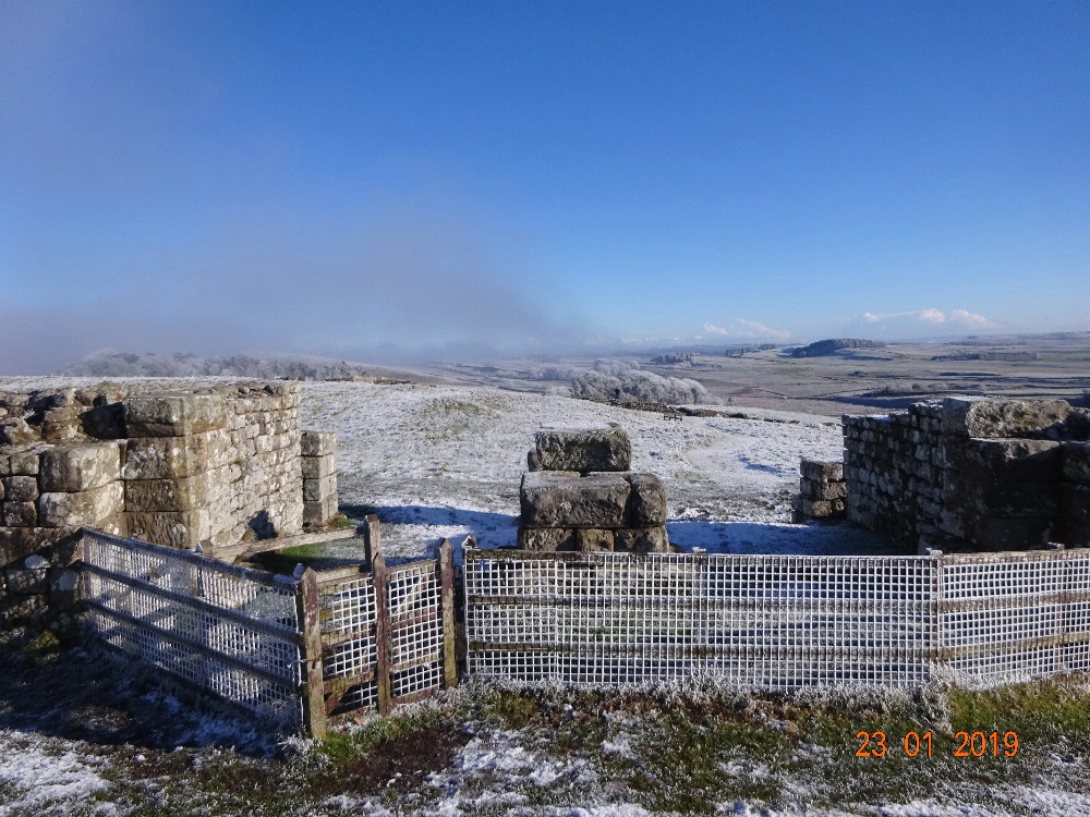
Pics are from some previous visits to the route and to Middlehope Moor.

DSCN2423DSCN2425