statcounter

Wednesday, 19 June 2013

Finishing Wainwright’s Outlying Fells Part 1 – Staveley

bruno bags hugill fell

As many people will attest, I’m a bit of a sad act when it comes to bagging hills. In 2013, my main bagging objectives are to finish visiting the tops listed in Wainwright’s Outlying Fells book and and try to complete the Hewitts.

And so, with a duff back, which many people keep telling me is sciatica , but I prefer the more Northern , working class condition known as “lumbago” – I turned up in Kendal yesterday morning to collect the bro for a brief foray into the hills just a bit North of Staveley for the bagging of three of these tops, and another one that Alf (Where exactly is my pipe?) Wainwright seemed to have overlooked.

reston scar view of ings

We started on the old road out of Staveley and immediately headed uphill through densely packed contours to the little cairn on the top of Reston Scar – a hill with a fine view of the road accidents and other near-misses on the A591 at Ings, just below. The day was sparklingly sunny and warm and, in fact, ideal for this type of thing. And this route provides some unusual views of the Kentmere valley and the Coniston and Wasdale hills to the West.

It seemed that there was a perfectly good path leading from Reston to the next top – Hugill Fell, just over there a bit. Hugill Fell has several tops, all of which we visited, just in case. The last one, which may also be called “Black Crag” is the best, a narrow little ridge with a well defined top, just like a proper hill has.

hay meadow

We descended to Scroggs Bridge and climbed up to Hall Lane via Low Elfhowe. The meadows around here are remarkable at this very moment. If you want a look, you’d best be quick before they’re all cut for hay.

cotton sedge nr millrigg knott

We followed Hall lane uphill for a bit and by various shenanigans, achieved the top of Millrig Knott where it was declared Time For Lunch. Millrig Knott was missed out of all Wainwright publications, but is, in fact, a very nice top with a remote-ish feel and, despite being fairly rough pasture, is outwith any open access land and, so, a visit there is a trespass, so don’t do it. The fact that the top is a trespass is unlikely to be the reason why Alf didn’t include this top, since the next top is a trespass too…

kentmere valley

that stile

We descended to Ulthwaite bridge, passed through Browfoot and climbed to the lane just below Williamson’s Monument. Visiting Williamson’s monument, is also a trespass, despite being in the guidebook. Alf says that there’s a stile which gives access to the final pasture. there isn’t. What there is, is an old gateway, blocked up , except for a thin stile-like gap and defended at head-height by fencing wire. In view of the awkwardness of the wall crossing, and the occupation of the pasture on the other side by a herd of cows, we took turns at visiting Williamson’s Monument, with the other keeping Bruno company on the “safe” side of the wall. He didn’t seem to mind. He doesn’t like cows anyway.

And so, by lanes and pastures and cut meadows, we returned to the A591 and Staveley.

About 9 miles – there’s a map below.

reston etc

It seems that walking about with a pack on, specially up a lot of contours, is the ideal treatment for lumbago (or whatever it is). This deals with any back pain in short order and any twinges etc only return after a long drive home up the M6 and across the A66.

I now have just five Wainwright Outliers to do – and four of these are in a bunch in the South of the Lakes, the other one is near Windermere and is a bit of a billy-no-mates.

Sunday, 16 June 2013

Ouch

weardale wander reccy 008

I seem to have buggerred up my back somehow and…. I can’t walk very far. Which really is a right bugger as I’m supposed to be leading a guided walk on Wednesday.(And a walk with me brother on Tuesday)(and a walk with DCC rangers tomorrow…)

The wife says it’s sciatica (she’s a fully qualified arcane neo-medicalist general nurse with magical fingers) and has prescribed ibrupofen gel, massage and lots of cheap whisky, all, or at least most of which I’m very willing to try.

There could be a bit of a gap here…..

What I’d really like to know is what happens to a walking idiot who can’t bloody walk…?

Aaargh somebody give me a rub down…

Nurse…?!

Monday, 10 June 2013

Just Me and the Dawg in Ettrick

superedawg conks out on ettrick pen

Plans for a Howgills holiday went nips-up last week – the trip is postponed, rather than cancelled – and so, Plan B was implemented, or, at least, some of Plan B.

Plan B consisted mainly of the bagging of two hills in the Borders – Fanna Hill and Black Knowe, neither of which, I strongly suspect, will mean anything much to blogreaders except those owning a pair of well- worn boots and living in Hawick. The plan also consisted of camping in relative but fairly noisy luxury on an actual campsite in a bigger tent than usual and with a much wider selection than normal of food and booze. And with Bruno the superdawg.

fanna hill (almost anyway...)

And so, Thursday morning, following some serious shopping at Sainsbury’s in Durham, and a long drive through Kielder, me and the canine found ourselves embarking from the knipemobile at an obscure cattle grid on the B6357 somewhere between Newcastleton and Hawick. It was immediately apparent that our proposed “easy bag” was to be tougher than expected because, since my map had been drawn, somebody had planted a new forest on my route, with all the consequent digging of drains and exclusion of anything likely to scoff the abundant vegetation. It was also pretty sweaty, summer having finally decided to arrive. So we blundered and tripped and  dripped our way upwards through the ditches and tussocks until finally in-line with our first target – just over the fence and a bit further through tough conditions to somewhere in the region of the spot height on Lamblair Hill – 498metres and categorised as “Probably Not a TuMP, Although Vaguely Possible”  You have to be really desperate to tick one of these.

We progressed  over easier ground to a minor top at around 500 metres and then easily North to the bagging of Fanna Hill, 514 metres and  HuMP – That is to say, a proper tick, like.

One thing about forestry is that they’ve built huge roads everywhere, capable of taking lorries loaded up with enormous piles of sticks and so it was, that shortly after I’d given Bruno the job of retracing our steps back to the cattle grid – a job which he could perform in any weather, day or night and step-for-step without hesitation, I pulled him off-course to join one such road. This didn’t appear on my map, so it was a bit of a gamble, but it did lead , as I suspected, to the house at Saughtree Grain and thus to the B6357 not all that far from  where I’d parked.

ettrick valley

Later, much later, and still lathered from the exercise and the unusual heat, we checked in at the Honey Cottage campsite near Tushielaw in Ettrick. Thursday night was cold and quiet. I used the cheapo tent I’d been given for review a couple of years ago and which I’d broken one of the poles at Tarfside whilst trying to stick it up in a hurricane. The pole is still broken. It doesn’t seem to matter. Hopefully, whenever I use this tent, it won’t get windy…. It’s very spacious , though and me and the dawg could spread out. Bruno is specially fond of spreading out.

near phawhope

On Friday, we took a short drive up the Ettrick valley to Nether Phawhope where shepherds were training their dogs to do sheepdog trialling. Very interesting to watch, but the sun was beating down and we had Things To Do, so, instead of marvelling at the skills on show, we heaved our ancient carcases up the steep hill to bag our first tick of the day – Lochy Law. Lochy Law is a fine and grassy mound categorised as “Probably Not Quite a Donald Dewey” at just 518 metres and yes, I can sense your eyes glazing over already. Onwards, we marched – up onto the equally fine and grassy HuMP Black Knowe at 549 metres. A cracking viewpoint for long stretches of the outrageously beautiful Ettrick valley. Its outrageously beautiful at the moment anyway, and , like most other places in Scotland, it would seem that The Authorities are intent on buggering this outrageous beauty up by bulldozing roads everywhere and planting commercial forestry – miles and miles of the stuff. Get rid of the sheep and lets have some Christmas trees which we can shred up later and set fire to just outside Doncaster for electricity (presumably)

We sat by a cairn for a bit and I allowed Bruno to watch me eating a choccy bar and a banana.

Just down the hill a bit was another round and grassy in the same category as Lochy Law – one Phawhope Hill 508 metres and this was a quick and easy, if ever-so-pointless bag.
phawhope kipps

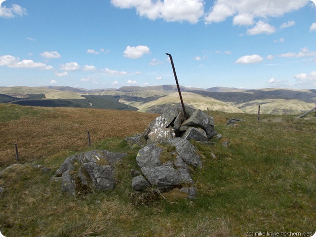
Things got a bit rough for a bit as we traversed the forest edge and then down through a steep and soggy ride and back up the similarly steep and rough bit through clear-felled brash to the opposing ridge. Things were getting hot. I noticed that Bruno’s puppy-ish enthusiasm had worn off at this point and he was dragging behind quite a bit. We struggled on up to the ridge and followed it over ground which was now much easier to the top of Phawhope Kipps, at 590 metres and in the same hill-category as the previous Phawhope. This one, though has a nicely defined top and a glorious view. Bruno conked out at this point and fell asleep, sighing  with a little growl, that the walk was now over and, he could relax and the Pieman would be along soon with a tin of doggybeefychunks and some kibble. And that this would be followed by hours and hours of dreamysnoozytimes on a comfy cushion with pictures of bones on it…. to the sound of the Pieman opening yet another tin of warm beer….  But this was just a dream. A Kip on the Kipps…?   All too soon, and in the time it takes to scoff a cheese butty and an eccles cake, the lead was being pulled and we were on our way again.

ettrick pen

The going was yet easier than before, but the heat was starting to become uncomfortable. The contours were still arranged in an uphill fashion and we plodded and dragged our way up to 654 metres where the fence changes direction and then to the cairn on top of Ettrick Pen at 692 metres. I’d been up here once before –according to my log, it was on 12 June 1991. It was raining and there was no view. Today, resting on soft turf in hot sunshine with just a hint of a warm breeze, the view was just fine. We lazed for a bit more than half an hour. Bruno fell into a deep sleep, complete with doggy dream involving twitching and little barks.  The last couple of miles had seemed hard for the dog. I felt myself changing the plans for tomorrow, specially if it was going to be hot again.

over phawhope bothy

We returned via Over Phawhope bothy and along the Southern Upland Way, which is a long and hot road-walk back to Nether Phawhope (is it me, or are they a bit short of place names around here…?). Bruno trotted along behind all the way back. At least he was keeping up

Another cold, but noisier night followed. The campsite now had a few more tents , but it wasn’t crowded. It seems that this was the weekend for Dads and their kids to go camping. Some of the Dads seemed over-protective and were keen to prevent any damage being done to their boys – who would have preferred, I think, to go a bit wild and gain a few scabs and bruises. This was where my grandkids had fallen into the beck several times within twenty minutes a coupe of years ago. Bruno snoozed his way through the mayhem. I anaesthetised myself quite a bit and decided on an easy walk for the next day.

ettrick rewilded woodland

Saturday was blue and clear and shimmering with heat. Me and the Dawg, on advice from a resident caravanist with a Jack Russel, followed the easy path through the huge re-wilded forest area which runs along the East side of the Ettrick marshes nature reserve for two or three miles to Deephope. This is lush and green and well-shaded. Its also very beautiful and free from stock, Bruno could be free to run about at will –which he did. The return was on the quiet  public road through the Dale back to the start – I think we were passed by no more than three cars. Bruno was flagging a bit on this too and so, we spent the afternoon snoozing in whatever shade I could arrange, having a cooling paddle in the river and drinking tea until it was time to move on to more interesting beverages.

ettrick marshes glimpsed through the trees

I’ll have to try to make some  new assessment of Bruno’s hillwalking abilities. He is twelve, so, maybe you’d expect some resilience to start to go, and, he’s had a long gap between proper walks whilst I’ve been doing the TGO and so on. And it was quite hot…  So, we’ll see…. I doubt if he’d want to retire from the hillwalking at this point. I have a little plan, though…. (things are always better when you have a plan)

Wednesday, 5 June 2013

Interlude Plan B - Ode to Joy/ Off to Ettrick


Always have a Plan B. that's what my Uncle Stan used to say. Mind you, he was as mad as a box of raspberry jelly on a double decker bus going out of control down Alston main street (it's cobbled, y'see...)

The Plan A trip, which involved non-lightweight camping in the Howgills, that is to say, luxury, food-based camping involving bits of dead cow, onions and potatoes and all kinds of lovely delicacies like that, has had to be postponed.

Ans so, me and the Dawg are off to Ettrick to do some bagging of minor hills, explorations of the lovely Ettrick ridges, paddling in the beck and consuming the fine selection of nutritious food wot I've just got from Sainsbury's

Probably back sometime Monday, unless it rains a lot in the meantime, which seems unlikely.

Talking of meantimes, here is the very talented "beaker" playing "Ode to Joy" This is the short version. Note that people with other people's livers shouldn't be watching this kind of thing before the hole heals up.  Rock on, Tommy....

Splinterers Bag High Cup Nick

high cup nick 021

Maybe it’s me. Maybe I’m on a roll of medical emergencies or something, but this walk ended with yet another of my walking partners being shuffled off to hospital in the company of paramedics. (Todays paramedic was much better looking than Dawn’s paramedic on the TGO, though, I have to say…)

Anyway, more of this later. (Not much more, we wouldn’t want to break patient confidentiality here…)

bridge over grain beck

Today’s walk was arranged some time ago and was a result of a conversation with Nurse Kathy during which it was revealed that a certain individual was charging £25 to guide people to High Cup Nick from Cow Green and I said I’d do it for nowt. And so, a  following further discussions amongst leading lights of this informal group , a  new walking group, it appears, has been formed. And more of this later, too.

superdawg walks with the vanguard

nearly there

Fifteen of us met in outrageously bright blue early summer conditions in the car park at Cow Green. The party included two dogs – Dot, a  small , furry, fun-filled Jackadoodle and Superdawg who made the mistake of trying to run around after Dot and had to be put back on a lead before he did himself a mischief. (he’s an ageing dog and too heavy to carry over the moors should he run out of steam, showing off after this little floozy). The son-in law came just as far as Moss Shop Mine, so we were down to fourteen.

high cup nick

..back a bit...

nichol chair

We hurtled over the Pennine Way to High Cup Nick, which appeared, as it does on this walk, suddenly as a huge chasm below your feet. We lunched. There were souvenir photos (don’t step back!) A small breakaway/splinter (what’s a splinter of a splinter?) group returned the way we’d come and the remainder did the small loop that includes the old Pennine Way flood route via the limestone gorge. And, so, now down to ten, we plodded back the way we’d come. This is quite high wastage, I have to say, although the split of the splitters was tactical rather than the result of a spat.

maizeback scar gorge

Soon, cars were gathering around the Langdon beck Hotel, where a meeting had been declared. I arrived to find one of the party in a state of semi-collapse and in the process of having a medical emergency. Nurse Kathy stepped in a ministered – making the sensible decision to call an ambulance. And so, Pieman’s second medical emergency in three weeks ended with our patient being driven off towards Darlington.

not taking the prescence of emergency services all that seriously...

But the new walking group formed and it’s policy is to walk once a month on Wednesdays whenever the Durham County Council walks programme has a suitable gap – suitable being either no walk at all, or just a shortish one. These splinterers need mileage. They need to feel stiff legs and achy knees on Thursday mornings. they need a good excuse for a post-walk pint (or whatever). And the walks won’t necessarily be constrained by County boundaries. “Splinterers” isn’t the name of the group by the way, but I’ve forgotten what it is… I have a notoriously poor memory for…..er……

Today’s was 13.5 miles and 1250 feet of ascent.

Superdawg may be in lurve…

Despite the warm conditions (what did we do right…?) there was still a small patch of snow in a gully above High Cup Nick.

spring gentian

And the Cow Green area is bursting with patches of Spring Gentians. This is the best display for years. Some things obviously enjoy a long and cold winter that lasts till the end of April.

high cup nick