
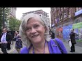
Bruno enjoys the summit of Saughy Hill
Each November (ish), when the nights are dark and the days are short and grey (a bit like me grandad, in fact), I do my planning of walks and new hills to bag for the next year. This is because November always seems like the end of the year to me. OK, I know it isn’t the end of the year, but it seems like it. And many of the hills on the list are those which I didn’t manage to bag the year before. So, if I don;t have a good year, the list might well look the same.
So, in order to make room for new hills, I sometimes find myself wandering up obscure tops in October – just so I can make room on the list for more , more and better hills the next year.
And so it was, that after a day of considering some lake District tops, I was persuaded, by the variable nature of each BBC weather forecast (it will rain, it will be dry, it might rain, it’ll probably be dry, expect rain, wet, dry dry wet, fckn dry…) I decided to nick off to the Cheviots to climb and tick Saughy Hill.

Clennel Street
Readers will be forgiven for not having heard of Saughy Hill before. Its fairly high, at 494 metres and looms steeply (with a rounded top) over the deep side-valley of the Usway Burn and can be included in a walk along Clennel Street, which is what I did.
I arrived in the deserted national Park car park at Alwinton to the sound of enormous explosions, machine-gun fire and helicopters. I stayed not in the Car park, but parked on the free picnic area with everybody else as I didn;t have two pound coins for the machine (it only takes £2 and £1 coins) I otherwise had the money, but not in the correct denominations. I don;t expect anybody from the Northumberland National park reads this blog, but if they do, they might well have found the reason why they’re not taking any money in the pay and display machine…. (just a thought…)
Clennel Street is the ancient road towards Kelso that me and Dawn had a chilly adventure on back in the winter. It was a bit warmer today, only just nithering, in fact… brrrrrrrrr

The white bit is smoke from the target. Bang, boom , whallop
Me and the dawg progressed reasonably easily along Clennel Street, chatting to a couple of cyclists pushing their bikes and bemoaning that they’d been given a bum steer about how good the was the road surface (boggy). Meanwhile, the army’s efforts to defeat some heather on a nearby hill were reaching manic proportions. I noticed, in the distance, that they seem to have managed to set a bit of the hill on fire.

Bruno decides how to navigate to Usway Burn below…
However, we soon found ourselves on the tussocky top of Saughy Hill. The tick duly ticked. A very steep descent brought us to Battailshiel Haugh where my Curd Tart received fatal wounds and my Egg and Tomato Butty was ravished along some nice, hot filter coffee (in a flask, there’s nowhere to plug in a coffee machine up here.

Nothing to see here….
I decide to have a look at the site of a mediaeval village on the way back. This meant walking back to Alwinton along the road. there was no traffic, though, and there’s a short bit of permissive path which took me to the village. This was a bit of a disappointment since there’s not much to see from ground level. It’s much better from the Pass Peth path just over the river. In fact, perambulating primarily on the Pass Peth path produces a perfect peek at the place.

Army warning notices including flag retrieved from the 1964 Labour Party Conference in Brighton
My apologies for the previous sentence. (the one with all the peas…..)

We did ten miles. Some bugger has been messing with the clocks as it almost went dark on me today….


.jpg)
.jpg)


9 comments:
Damn these clocks, they play tricks on you when you least expect them to.
That's the thing with clocks....never trust 'em.
JJ
Nice route Mike. Never been that way myself. Looks really interesting with the settlements and such like. I like Coquet Dale, what a great name. I suppose Flirting Dale was what its called locally. Or worse.
It looks different from the last visit Mike.Some lovely walking though.
Lovely walk Mike and great to see that you feel the same about the dark nights. I look forward to reading more :)
Hmmm... Clennel Street is on my list of must cycle places. Maybe I'll leave it until summer or at least after a dry spell or maybe when the ground is frozen - so many choices. It does like a look well good ride in your pic!
Thanks for doing the recce ;)
Alan, when I lived (for a few short months in a drafty, cold rental) just outside Rothbury, we simply called it Nookiedale. Much easier, really. The hamlet we were based in was called Tosson - maybe a mis-spelling. Who knows?
John J + Dibble - Clocks were never made to be altered. Only a timelord should play with time. Brrrr dark nights...
Dawn - I think it was a bit whiter last time. Saughy is the hill next to the one we descended to the first camp.
Tony - lOts of the route is a nice. green track as per the photie. There's a very boggy section just after this where you'd probably have to get off and push, then it's a forest-style track. At the border, its boggy again but there's a good surface on the Scottish side.
Iain -is Coquetdale the same as Nookiedale?
Bruno looks like he’ll enjoy any place at any time. He has been taken with the hill I take it? I don’t blame him. It looks like a grand adventure to explore on your own.
Bruno goes with me most, but not all of the time. He misses out on guided walks, cos I'm not allowed to take a dog, and he doesn't go backpacking cos he howls at the moon and two of us howling disturbs the sheep.
Post a Comment