statcounter

Wednesday, 29 April 2009

Adopt-a-path stuff in North Durham


May (Yes, yes, I know its still April) is the other time that I do my twice-a-year walk around the moors, pastures and moors of the very North bit of County Durham – so far North, in fact that the walk starts in Northumberland. Its only 20 miles from chez Knipe, so its no big deal.
Superdawg is banned from this trip, partly because of the fact that its lambing time and the foelds are full of new lambs and/or very fat sheep – and there’s the little matter of three big fields full of suckler cattle. These girls seriously mugged me once when I had Bruno with me. I’m not letting that happen again. So I diverted the dog with his ball thingy that you put doggy bics in and he chases around trying to get them out again – and sneaked out of the house. There may have been some howling.
Anyway, two walks. Number one started at Blanchland and went through some woods, down a track (where I fell over and put a hole in my leg – lucky I had a spare…) up to a hamlet, up onto the moors, a bit more woodland and back to Blanchland. About 5 miles.
I should explain that the reason for this patrol is to monitor the footpaths and bridleways for the County Council. I report any problems on line. There was just one report to be made where a steep path is shored up by timber, and its starting to collapse.
I also clipped a few bits of overgrowth and ate a banana. I also came across a little blind rabbit. I believe this is a symptom of myxamatosis – a disease deliberately spread in the 1950’s to reduce a rampant wabbit population. This particular wabbit appeared to have just a few days left. It knew I was there, but couldn’t see me, and couldn’t run away. Not a good position to be in…
After a short lunch, I went off to the next village, Edmundbyers and had a good old thrash up a long bridleway onto the moors and back again on a footpath through those pesky cows. Fab weather – sunny and breezy and warm – and a really good old bash through the heather. No footpath problems to report. And I get expenses for this…..
I’ll be back in October.
The bluebells are just coming out and this year there seems to be a lot more lapwings – and curlew, oyster catchers and a large bunch of golden plover. So the moors were fair buzzing today.
A total of 14 miles and 1800 feet of uphilliness. Some readers may recognise the footbridge in the pic. A few may recognise the rabbit.

Incidentally “Blanchland” was so named because it had an abbey which was run by white monks – that is monks in white robes. Unfortunately between the Scots and Henry VIII, the place was ruined – the only bits surviving in tact being the Church and the pub - and, maybe the gatehouse. The rest was rebuilt by Lord Crewe, a Bishop of Durham, using stone from the abbey, and forming a square. All of the land to the South belongs to the Blanchland estate – originally Lord Crewe’s land, in fact.Edmundbyers, on the other hand is named after it’s one time owner, King Edmund. So there you are….

Monday, 27 April 2009

They nicked my text


I was browsing my blog stats (very quiet weekend as it happens) when I came across a link to this tp://waterproofboots.start4all.com/2009/04/23/northern-pies-cheviots-border-ridge-and-colledge-valley-in-modish-boots/
Well, the cheeky buggers (lets not be coy about this) have nicked the text from my post , added a few out-of-context bits of text of their own and published the resulting garbage on the internet.
I used the "contact" facilities at start4all's blogging website and it doesnt do anything.
The cheeky cheeky buggers. Nil points for these arseholes.
Lets hope they auto-copy this bit of text without checking it because the people who run start4all blogging software are a set of ignorant front bottoms and you'd have to be mad to use their services. That should do it.


Pic of me up Scafell pike (cheers me up anyway)

Sunday, 26 April 2009

Read the Beano!


Here in Crook, we’ve been having some problem with these little green pests ransacking the place and eating the maidens, setting fire to waste bins and stuff. So we’ve called in the local County militia to sort them out. Pic above is George from the Bishop of Durham’s men despatching one of the feral dragons
.
We try to keep these blokes well away from the Border with our Northern neighbours as we are running our of space for all the cattle they keep bringing back…

Prolly go for a walk tommorrow….. in the meantime the house is noisy with kids and dogs and people telling the kids and dogs to behave, stop whatever it is they’re doing or do something they don’t want to do. Just now, they’ve gone off to some kind of open farm to frighten some cows or something…

However – it did give me an excuse to purchase “The Beano” along with the Sunday paper. In “The Beano” today, Dennis the Menace is scaring his dad by getting him on that famous TV show “Almost haunted” and his pet pig “Rasher” (did you know he had a pet pig by the way?) has destroyed dad’s water bed (dad was wearing a lifebelt at bedtime)

And (!) in Beano Max (for older kids (ahem)) – there’s a free Prank Pack including a rubber pencil (hoax your folks) – a nail bandage (painful!) a pack of snappy gum (?) and a Fart Whistle. Hooray for the fart whistle. I will be gear testing the Fart Whistle in the Forest of Bowland tomorrow. I might do a video. I’m not sure.
I might cancel TGO and start getting Beano Max. The free gifts are so much better

Thursday, 23 April 2009

Cheviots - Border Ridge and Colledge Valley in new boots


I’d intended to do this walk on several occasions over the last few months and been prevented from getting anywhere near it by things such as not being able to find my garage keys, bits of urgent landlording stuff, and a blizzard. Yesterday dawned fine and clear and, especially, blue, so I had the traditional wait for the traffic on the Western bypass to clear and then hurtled off up the A1 (and other roads beginning with “A”) to Hethpool at the foot of the Colledge Valley right smack bang on the English/Scottish Border. This might seem a long way to go for a day walk, but really, it’s the same distance from Chez Knipe as Buttermere, Wharfedale or even Jedburgh and, if you time the journey, is a very quick trip.

There’s a car park at the foot of the Colledge Valley beyond which you’re not supposed to drive. I have to say that Colledge Valley is a specially beautiful corner and does well without the traffic…

The objectives for today were to bag certain hills, walk along the Border ridge, visit Hen Hole and then walk back down the length of the valley. In me new boots.

The first target was Great Hetha – a steep, rounded, grassy lump with a hillfort on the top (most of the local hills have hillforts). It went well. On the top, I changed into shorts, adjusted the laces, admired the boots for a bit, admired the view for another bit and then went off to find the Border Ridge which wasn’t too difficult as there’s signposts pointing to it all over the place.

I wandered along the Border as far as the junction with the Pennine Way, bagged Black Hag (which is green and doesn’t have a hag) – crossed the Border to bag The Curr and then continued southwards to The Schil – and then on to the 20 mile hut on the PW. On the way I met a chap with a golden retriever, whom Bruno decided to play with and dominate at the same time – which the other dog abjected to… and there were almost canine fisticuffs if human intervention hadn’t..er..intervened…

The chap with the dog was just finishing the PW and his son, was some way behind having also bagged The Cheviot (the brave fool!). I met the lad a bit further on and told him that he was just about to cross his final PW bog. He asked after his dad. He looked a bit fragged, but his pace up The Schil was fast. Only a young lad…. In the words of Linda Lovelace, “It fair brings a lump to your throat”

Anyway – on to the Twenty Mile Hut where we paused to read the guestbook which was full of stuff such as “Just spent the night here drinking brandy and whisky to take our minds off the fact that we’re cold and covered in spiders.” Poetry. It fair brings a lump……

On to Hen Hole – a deep gorge just next to the PW and, probably the most interesting way to climb the Cheviot. Or is that via Bizzle Burn. Anyway, I breached the waterproofness of the boots at this point by going up to me knees in the beck.

Finally, we hammered down Colledge valley, pausing only for a moment or so at the RAF war memorial at Cuddystone. This is inside a sheepfold-like structure and lists the allied air accidents in the Cheviots during WW2 – quite a lot of crashes. This is a really good place for anybody who needs a spot of quiet reflection.

The homeward journey back down the A1 was just 90 minutes. No traffic, y’see.

But what of the boots? I think they’re rather fab. I got some Berghaus Explorer trail Light boots – and they’re very comfy, grippy and, at the moment, very waterproof (outside anyway!)

I also got a compass from Mountain Warehouse as my Silva has developed an enormous bubble and thinks that magnetic North is sometimes in New York – and under “BOGOF” rules, I also got a new survival bag for nothing… and a pizza and a short sojourn in St Cuthbert’s shrine in the Cathedral (aka Cuddy.. as in Cuddystone as it happens)

And me TGO RAB fleece just arrived…..
The walk was 15 miles and 3000 feet of climbing – so we appear to be cooking on gas just now, which may well be a positive indicator for the TGO…

Tuesday, 21 April 2009

New Boots Time


I appreciate that a couple of weeks before the TGO Challenge is possibly not the best time to be buying new boots for use on the walk. But needs must.
I have several pairs of boots and here's why I can't use them....
1) Scarpa's - bought four years ago. Fab on Scafell Pike for bashing scree and boulders, and fab with crampons. But too heavy. After a couple of days, they'd have me poor feet in shreds.
2)Altbergs - Got these buckshee a couple of years ago. They're really comfy and not really all that heavy. But thye've died. The stuffing has fallen out, along with many of the lacing points.
3) Berghaus booooits - Lightweight -carpet slipper comfort - a birthday prezzie from my son roughly at the same time as I got the scarpa's. Not waterproof, and they've lost some lace fixing points.
4) Cheapo Hi-tecks. Comfy. Allegedly waterproof (ha!)
So thats it. I haven't mentioned the wellies.
Whatever I buy will likely be unsuitable in some subtle sort of way (story of my life!). And I'm hoping to start breaking them in tommorrow in the Cheviots. I'll give 'em a bit of a thrashing.
Me compass has a bubble too, so thats another reason for a trip to Durham.
And, like whitespider Darren, I'll be having a little visit to the Cathedral, just because.... but there'll be no pictures of lovely knockers here (I had some once, though, I believe)
Pics are a shrine involving walking boots in Slit Wood at Westgate. Some of my boots are in marginally better condiiton.

Sunday, 19 April 2009

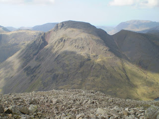
Pen and Scafell Pike to Great End


Putting off this walk till the Saturday (18th April) seems to have been a lucky decision (or an ace piece of judgement, perhaps….)

The day dawned windless, clear and blue-skied and we opted to park the car at Brotherilkeld which is a bit nearer to the hills than Wha House.

The walk up Eskdale to Great Moss in warming sunshine was just fab, with increasingly cracking views of the cirque of hills.

There were wild campers beneath Scafell Pike. I was jealous....

Our first objective was the little (not so little!) pointy top of Pen, which sticks out from the side of Scafell Pike, a bit like something sticking out from the side of Scafell Pike, in fact.

There’s around a thousand feet of steepish grass to get up on to this nobble, which is a slog, but a slog with better and better views all the time. So we didn’t rush. (I can’t rush anyway…). Its a fine, craggy, mountain spot for the eating of the banana and the ritual sacrifice of a just-passed-sell-by-date cheese salad butty....

After this we went straight for Scafell Pike’s summit starting with a short scramble and then a lot of boulders and stones to the top – which was heavy with people. In view of the crowds, we decided that Broad Crag would be a better place for a stop, so after a bit of mingling with the masses, we trundled off over the boulders and scree for the little scramble that took us to Broad Crag.

Coming up the hill were a stag party on suits and top hats, a lot of people expressing the view that they’d never make it (although they were nearly there!) and quite a bunch of old scouse chaps heaving and puffing…. A few runners ran off in to the distance…

Broad Crag was almost quiet – just a few people there, and Ill Crag had half a dozen or so – and an indication of an interesting way down.

Finally, we ended up on Great End with its fine views to the North and of Great gable.

To get back to the start, we went to Esk hause and followed the stream all the way back to Brotherilkeld.

Some lads were camping at one point and throwing a Frisbee around. They looked very sheepish at our approach and I think they were expecting us to try to turf them off. But we didn’t, obviously. They had Chuck Berry for music. I mean, be fair… Chuck Berry.....

They’d picked a fine spot for camping too. I’ve made a mental note of the spot.

At Lincove Bridge, we met a bat. It fluttered around a bit and then landed on the bridge parapet, hanging upside down. I’ve never seen a bat flying in bright daylight like that. There didn’t seem to be much in the way of insects….

Fine walk, though. This one will turn out to be a memorable one.

14 miles and 3400 feet of climbing.

Harter Fell and an abandoned Scafell Pike


Friday 17th April saw us setting off for Upper Eskdale from the Wha House car park in a fierce headwind.

After a couple of miles, as the headwind started to get its act together a bit more, I began to form the opinion that if it was like this at 250 metres, what would it be like at 900 metres, and I decided it might not be such good fun.

So, using our skill and judgement, we bailed out of a Scafell Pike thingy and drove around to Dunnerdale for a jaunt up the substantially lower Harter Fell.

Once out of the car for the second time, and well on the way to the foot of the hill, a lady backpacker saw me looking at the map and decided I was lost. She interrogated me as to my intentions and gave me directions of two or three possible routes up Harter Fell. I thanked her politely. Very helpful, I must say. Whatever would we have done without that. We might have been wandering around Coniston Old Man asking directions for the Pennine Way…..


Anyway, it’s a short, sharp, steep thrutch up to the top of Harter Fell from Dunnerdale. The wind was…er….windy in an extremely breezy sort of way – just enough to unbalance a person every now and then , and just enough to make the little scramble to the summit rock a bit exciting. A few other visitors visited, but the place could be described as "quiet"

We traversed the hill Northwards, bagging all the little rocky knolls in the way, and ending up at the top of Hard Knott Pass. A scruffy bridleway through cleared forest brought us back.

Just the two pints of shandy later that evening (that’s more than enough shandy) and a disappointing pint of bitter in the boozah.

Total walking for todays two walks: about 9 miles and 1700 feet (very approximately) of uphill.

Fab views of the roman fort by the way…

Whin Rigg and Burnmoor Tarn


Me and Mike from Go4awalk camped at Hollins Farm in Eskdale for three sunny day walks in the South Lakes.

Walk Number One on Thursday 16th April started in Miterdale. Not many people seem to know Miterdale – bit of a backwater, I think.

We climbed up through the woods on to Irton Fell and walked along the ridge to Whin Rigg, which has spectacular views down to Wastwater and spectacularly misses to reach the magic 610 metre/2000 foot mark by a mere metres.

Today, it was inhabited by various behooded DofE groups, some of whom didn’t appear to be enjoying themselves very much., and others who weren't enjoying it at all, and yet more who clearly thought the whole idea was crap. There were heavy-looking rucksacks and sore shoulders. I have the tee-shirt for this sort of thing, as it happens.

And so, having bagged our top, we descended to Burnmoor Tarn for a snooze out of the frisky wind in the paddock of Burnmoor Tarn House - at which point it started to rain – so we made for Miterdale’s car park, bagging Boat Howe on the way where it stopped raining.

Two parties of DofE participants were struggling with their tent poles back at the campsite.

A sober night for me in the pub as I’m in the process of rebalancing my blood pressure, following the installation of new batteries in the family blood pressure machine.

Babies squawked all night on the campsite and somewhere a tentful of holidaymakers clinked and laughed. And the wind roared in the trees, but unable to get at me cos I was sheltered behind a wall. I’d forgotten how noisy campsites were.


A short walk of about 8 miles and 2400 feet of upness in sunny, hazy, windy weather.

Wednesday, 15 April 2009

Crosby Ravensworth to Orton and back


Me and superdawg met the brother in Crosby Ravensworth city centre for a wander on bridleways over Crosby Ravensworth Fell towards Orton. Due to not really paying the appropriate amount of attention to the navigation, in favour of chatting about something or other probably quite important, we ended up having an unplanned visit to the cairn and trig point on Coalpit Hill which overlooks the very beautiful M6 motorway.

After a bit of locational adjustment, involving some deep heather and a Larsen trap with a crow in it (I hate these things…) we managed to get back on track and traversed the fairly vague scarpline on to Howenook Pike/Bousfield Howe.

I was sort of hoping that the weather forecast would be correct today and that we’d get some sunshine. It was a bit better than over in Crook, which was misty and a bit drizzly, but cool and cloudy and dull would best describe the Cumbrian weather. It was grand ensconced in deep heather with the cheese butty, but not exactly comfortable sitting in the wind.

A path through lambing pastures brought us to Orton with its whitewashed church and it’s pub. Unfortunately, we only managed the one pint as the landlord and landlady drove off, presumably on a shopping mission before we could get the second.

And so, only half full of beer, we slouched off back up another bridleway to recross the limestone karst back to Rosby Cravenhearth, or whatever its called.

We called at the memorial on Beacon Hill ( a memorial to the lighting of a beacon, apparently); met a lass with six dogs on leads saying “leave” in a threatening sort of manner, and back to Raven Athroscopy on exceedingly uninteresting bridleways wot bored the arse off the dog that he had to eat sticks. I have to say, that on a dull day, these bridleways do go on a bit. They’re grand for a bit of a hurtle, but they’re not specially exciting. There’s larks and pipits and sheep, and trapped crows for the keepers to kill (keepers have to like killing lots of things, cos that’s their job. Never turn your back on a keeper.) But they’re not really thrilling. They need a good blizzard, to be honest. Or you can watch the traffic on the M6 and hope for a crash.

Went home very very quickly. The A66 is such fun on an evening.

Shopping tomorrow for stuff for a three day trip to the Lakes (nothing to do with Mr Sloman’s expedition) – and this means that there will be a short blogging hiatus after this post. Weather forecast is good.

Sunday, 12 April 2009

Weardale Weeds and Slit Wood


Me and becky (adminfairy) and superdawg had a little Easter Sunday walk in Weardale up the rather lovely Slit Wood at Westgate.
I’m not entirely sure whether or not Slit Wood is named after Slit Vein or Slit Vein is named after Slit Wood. Slit Vein, I should explain is a 22km long mineral vein which runs along Weardale and has been dug and mined and generally messed around and, if you know how and where to look, it is easily identified. (It just needs somebody to point it out)
Any road up, as you’d expect (possibly), Slit Wood is intersected by Slit Vein which runs crossways to it. This means, of course, that Slit Wood holds lots of industrial archaeology…..

So we set off at a sign pointing g to “Weeds”. Is this the other end of the Weeds Wivverpool Canal I hear you ask. Don’t be daft say I, its nothing of the sort.
We enter Slit Wood at the ex-mill at the bottom (still has a wheel pit) and we ramble up the little gill beside a tumbling and occasionally gurgling beck till we reach Slit Vein, where there are the bargain stores, where each mining team stored it’s gains or ore before payment, and some interesting culverts in the beck, which I am honour-bound to explore. So – discarding boots and socks, I enter the frigid waters and splash upstream. But it gets too deep, so instead, I escape and we have a little brew-up in the hot sun. (yes – hot sun….)
In terms of weeds – so far Ive identified some Wood Anemone, Wild strawberry, Cowslip, Daisy. Coltsfoot, Pansy (not sure which type), Ramsoms and Bluebells not yet flowering, though. Oh, and dandelions, a much maligned but rather sophisticated and beautiful plant in my opinion. And lots of little white things, probably some kind of bedstraw… But its nice to see flowers flowering and lambs in the fields, and even an ex-hedgehog squashed on the road. Just like the mentalist bikers roaring up Weardale, and the now green hawthorn hedges they’re all good signs that spring has finally sprung. And willow-warblers in the woods too.
And so, post-brew we continue.
A bit further up, we exit the woods on to the moors and cross the beck where we find four 4wds stuck in the lane, which they have virtually destroyed. The crews of these four cars seem to be families of what my son-in-law would call “Pikeys”. I take pics of their registration numbers for forwarding to the County Council, but I’m not sure of their legal position in this lane. They’d have had to have driven on bridleways to get there, though.
An hour later, as we return on the “down” lane, they’re still where they were before – still revving up, still stuck. The shepherd who appears to be doing something vaguely obscene to a ewe, says that they’ve been there since this morning. He says that they don’t usually get stuck at that point.
I’m not unhappy that they are well stuck.
A bit later, we pass a little quarry which has an enormous boss of rock in it. The boss is the Slit Vein itself. The very man. The ironstone has been dug out from around the sides and the galena has been mined from the middle and what’s left is an enormous lump of quartz. For anybody who doesn’t quite understand the concept of a mineral vein – this is the place to visit.
We end the walk and go home via Boozebusters in Crook (all good walks should have beer at the end)
We’ve done just 6 miles and 800 or so feet of uphill and forty feet of paddling in two-foot deep water at not much above freezing (it felt) . Is that enough statistics?

Saturday, 11 April 2009

Loadsa work for charriddee


....don;t like to talk about it.
I have acquired a rail travel Voucher worth £21 which is valid for payment/part payment of the cost of rail travel on the principal train companies.
I will sell it to the highest bidder and forward the amount paid to Sue Ryder homes as a donation. (seeing as I got it for nothing)
It has to be used before 28 May 2009, and, as I'll be on the TGO Challenge in May, I'm setting the closing date for bids at 20 April 2009. This should allow time for cheques to clear before despatch to the most generous bidder. I'm not expecting a fortune, but I won't have time to use it and otherwise it'll just be thrown away.

Wednesday, 8 April 2009

Spango! and a scrap with the elements


Today's bag was the very lovely "Spango" - a cracking little grassy hummock in the middle of nowhere. In fact, its the middle of nowhere feel about these hills which is so enjoyable. I approached this one "from the back", so my impression that nobody ever climbs it was all the more thingy...
Anyway, its got Hares. Loads of Hares - running about being daft. In fact, I swear that one hare ran up behind another and touched it whilst announcing "Spango!" - at which point the chaser became the chased.
Spango could also be a Japanese TV game show involving people being made to eat worms whilst being dressed in diminutive underwear with little silver stars on them . Spango pants, in fact...
Anyway, after this conquest, I determined to walk to Wanlockhead for a pint of beer.
Head down into the fierce headwind for five miles and go for the Southern Upland Way. This was important.
The pub doesnt open on Mondays and Tuesdays does it? Story of my life, that is. And me fragged from the wind. The museum tea room sold me an egg butty and a scone and lots of tea. But no beer. grrrrrr....

And so, I climbed hill number seven - Green Hill just above Wanlockhead. The descent is just fab. A romp. A dance. A skip and a hop.

I'd chosen a camping spot deep in the little valley of Glendyne Burn. The valley is crossways to the headwind, so it should be sheltered. This was my thinking.

I descended and put up the tent. Not much soil. Tent pegs difficult to get in to any depth. It was calm, though. I had my tea and finished the final double scotch in my cycling bottle. The wind was getting a bit frisky. I dozed off. It went dark. the frisky wind waited for me to get into a proper sleep before unleashing and proper madness. About sunset(ish) it started raining, heavily and enthusiastically. The tent walls started dancing around. I chided it...
Half ten, pitch black, something had collapsed. I went out into the gale and replaced the pegs. I searched for big rocks to weigh them down. Everything was tight again. Midnight. Something else had collapsed. The tent heaved and flattened. Out again. More rocks. More poking the bloody pegs into stone. I got soaked.
At 3:00 an after more collapses and even the odd rock and peg pinging off into the night, the water was in the tent and I decided to pack whatever I could and sit in my full waterproofs till daylight. I couldn't get away from this spot in the dark. The beck was roaring nearby.
I seem to have got all the pegging points sorted but there was some danger of the pole breaking.
I could hear each big gust thundering and roaring up the valley before the tent pole lurched and flattened, and all the time the rain was like a hose.
A long night.
At six, I shoved the tent into a bag and abandoned the spot in a blizzard of huge snowflakes.
The route involved climbing back up the hill and contouring for a mile or so of steep hillside, then another couple of miles of flooded moor to the lanes into Sanquhar.
"No day fer walkin'" Said an old chap outside Nisa. "Are ye goin' East tae west or West tae East"
"I'm going home".
I must try to learn not to camp in wind tunnels
Another 28 km by the way....

TGO training - bagging day


And so, following a cosy snoozy comfy night at the restaurant for local foxes by the Poldive Burn (The place is heaving with little field meeces and the local foxes are having a field (meece) day, judging by the amount of fox poo laying around) - I blundered up through the forest and out on to Stony Hill - passing quite a bit of well distributed aircraft wreckage on the way. Whatever it was must have hit the hill very hard indeed -I would have thought... and some really nice lichens which were busily flowering.
Stony Hill is fairly nondescript, almost Pennine-ish, but it's neighbour - Cairn Table has more about it. The more about it being firstly a large and ancient cairn and an even bigger war memorial cairn and a view indicator and a path to Muirkirk. The big memorial cairn remember 87 people from Muirkirk who lost their lives in WW1. This is an enormous loss for such a place. But what a fine tribute.
I followed a path shown on the map, but non-existent in reality back down into the forest and through much tussling in the tussocks to the fine Cairn Kinney. Cairn Kinney's trig is rather strangely placed in a hole in the ancient summit cairn.

Due to it being perishing cold and freezing bits of me not meant to be frozen, I left the summit post-haste and put me tent up by Sherrifcleuch Burn (Northumbrian place name?!)
A fine spot too, with two streams of good, clean water.
It chucked it down during the night and the sleeping bag got a bit warm!
Another 16 and a bit kms...... but its not about kms, is it. (Its about ten miles)

TGO chally training in Galloway


One of the skills that all TGO challengers need to learn if they intend to travel to and from the event by public transport is the diplomatic return of all the spectacles, sandwhiches, small babies and pet dogs which stick to the outer eruptions or "straps" of the fully packed rucksack as you blunder up the central aisle of the Virgin voyager whilst it's accelerating and you're trying to concentrate on finding your reserved seat C17A (which will have somebody sitting in it who will growl as you approach)
And so, with unreserved seats on a train over half an hour late due to a goods train in the way , I arrived at Sanquhar and sought out the campsite. It appeared to be somebody's back garden and they were out and so, instead, in the tipping rain, I set out for the hills to find a nice somewhere to camp.
It stopped raining and, roughly five miles outa town, I spied a bit of untussocky grass with a big view and a water supply only slightly affected by a dead fox, set up camp, had me tea and just chilled for a bit.
A starry, moonlit night, it was, with only the distant lights of a remote council estate called Kirconnel glinting romantically in the distance.
In the morning there was ice on the tent.
The sleeping bag worked well
I was chuffed.
I went and bagged Cocker Hill, defended as it was by a rather fine array of tussock grass and bog.
I followed up this success by the bagging of the very fine, but grassy Kirkland Hill, a Marilyn of almost no note at all, but all the better for that.

And so, down into the depths of a deep, dark forest to find my bedding place for the night - which I found in an enorous clearing by the Poldive Burn.

The first 20km of my TGO challenge training walk was done. No rush, no route-marching; a saunter, in fact.
But what about the "Danger to Life" sign? Bit mad , that - somebody didn't want a communication mast up one of their hills, I suspect. I think the danger may have been exaggerated a bit.