statcounter

Wednesday, 20 January 2016

Canine Caterpillar Claims Caterpallot


Lucky( note: not shivering)  lusts after my pasty


All these pictures of snowy walks in the Lakes and Dales and Scotland and So-On made me think I was missing something, and I really hate Missing Something.  So, in cahoots with LTD, we decided to go up the North Pennines to bag an unbagged Tump going by the name of Caterpallot Hill.

Now Caterpallot Hill is a mere pimple on the chin of Melmerby Fell and a walk could be devised to include Fiend's Fell as well and also include the more abcess-or-boil-like Cuns Fell as well.

All good plans must have some weak spot, though and, in this case, the weak spot was a Very Cold Morning and a warm bed including a small dog who wasn't interested that next door's cat was rampaging around his backyard and much preferred to insinuate himself from his cosy bed into mine.

So we set off late and didn't arrive at Melmerby till noon.
Lucky's impression of a green caterpillar on Caterpallot


We achieved the summit of Caterpallot about an hour later after a bit of a slog along the intake wall. Caterpallot is one of those outliers that line the edge of the Cross Fell ridge and include such fine and ever-so-slightly pointy hills like Dufton Pike. The little gap between the outliers and the Pennine scarp is, in fact the boundary between the Carboniferous Pennine rocks and the older Lake District stuff. So, it's interesting, see?
Caterpallot Hill from the slopes of Cuns Fell


Having bagged the bag, we progressed to lunch. For me, this was a Cornish pasty and a curd tart and for the dog, it was a small piece of Cornish pasty and some curd tart crumbs. Its not good to spoil a dog.

We launched ourselves into the steep tussocks and soft snow of Cuns Fell and made ponderous progress. Legs were heavy. The snow was deep in places (Lucky enjoyed these places) and "soon" (not the inverted commas) we were standing, dripping with sweat and trembling with emotion (actually, not the last bit...) on the summit of Cuns Fell - another fine summit with a little rocky tor on top and a steep drop down one side. It was now getting quite murky and the sun was winding up it's alarm clock, had put the cat out and was sipping some cocoa ready for an early night.
Climbing Cuns Fell


So we forgoed...   forewented.... gave up the idea of going up Melmerby Fell and headed off on a Northwards contouring course for the path coming off Fields Fell back to Melmerby. This was done in short order.


Cuns Fell has a little rocky tor on top
At one point, I did notice a line of footsteps indicating that somebody had descended the fell wearing the same kind of MOD snowshoes that me and Matt had used on Cross Fell last winter. I found this fact pathetically interesting, a bit like finding a shovel in a slightly lighter shade of black than the one in our coalshed.
And  a big drop
 

We did 7 miles. There's no map. I'm not proud of the route, so you're not allowed to see it.

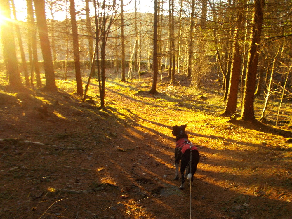
More walkies tomorrow. Hopefully, I will do better. Lucky enjoyed his new jacket by the way and didn't shiver once. Mind you, I did find it quite warm for some reason, although the knipemobile temperature gauge said it was 0.5 C. The snow was wet and thawing a bit, though.

Thursday, 14 January 2016

Middlehope Moor Weardale - Eventually, Winter

On the lane up to the border

Each January, for the last three or four years I've lead a Durham County Council Guided walk from Cowshill in Upper Weardale to the County Boundary with Northumberland, then across some lovely moors with fabby-whiz views of Weardale and alongside the RiverWear back to the start. My motivation for doing this was an occasion, about six years ago when me and Bruno walked the same route in hard winter conditions when the snow was deep and solid, the walking easy, and the sky was blue and, I hoped that at some point, a bunch of Durham CC guided walks punters might experience the same conditions. It's always been cold and often snowy, but never quite the same, as yet.
Driech conditions last Monday (brrr)


I titled the walk "A Shivery Walk to the Border". A bit naff, I suppose, but the walk title has stuck and a few die-hards brave the Neville's Cross traffic lights and the long drive up to Cowshill every year.

Lucky in his new coat on the reccy

LTD and summit cairnette Middlehope Moor 2009 feet amsl

Me and Lucky did the reccy for this last Monday. Lucky was wearing his new toasty dog-jacket, and just as well too, since the weather that day was on the turn from the soaking warm-but-outrageously-wet November and December to a something a bit more snowy and wintery.  Monday's precipitation was still mainly wet, but there was an edge to the cold and occasionally, sometimes, there was stinging bits of snow in the rain. There was snow on the moors too, and I took Lucky to the 2009 foot summit of the moor so he could bag the Nutall. He wasn't specially impressed, though. I could tell.


Weardale/Teesdale ridge from Middlehope Moor
In fact, I used the group shelter for me and LTD for lunch in the folds at Race Head.
Crossing Middlehope Moor


On the Wednesday, fourteen people and Bailey the doglet turned up and the day was a notch colder with less snow but blue skies and a nithering wind. Shivery, in fact.

Wednesday's views of the snow-clad Teesdale/Weardale ridge in particular were stunning and, apart from a few incidents involving deep boggy bits, the walk went well, I think.

Lunch in the sun
It seems that the winter may now have arrived. There was snow on the roof of one of the main drumtowers at Knipetowers this morning and the chains of the drawbridge scattered ice particles all over the postman.
On the Race Head road
 
And its perishing cold outside.

The walk is 8 miles and there's a map below. Some people with GPS devices thought it was 8.5 miles. I though it was 8.6 if you go to the summit.

And there's some nice samples of fluorspar along the Race Head track - particularly under the roots of a fallen tree in the little wood at the end of the track. I've got a huge lump. And I'm not really bragging....


Friday, 8 January 2016

No More Shivery-Dog

Lucky's slightly big jacket

Me and LTD were just about to set off to Trimdon to bag two of my remaining unbagged County Durham Tumps when the postman arrived bearing gifts.

The delivery today was Lucky’s new toasty warm jacket – a Hurtta Outdoor Ultimate Warmer jacket (which cost me many, many spondoolies by the way) – so we determined to give it a test.

The knipemobile thermometer was reading 3C during our journey across County Durham, and this was , it has to be said, a bit on the warm side for this jacket. But the test was passed:

Can the dog walk normally and leap dogfully over stiles etc whilst wearing the jacket?   (Yes)

Can the dog cock his leg every five bloody minutes? (Yes)

Can the dog do a lovely poo without anything horrible happe3ning to the back of the jacket? (Yes)

Does the dog like putting it on? (Not really)

It covers a lot of dog, is reputed to be waterproof and has a thermal lining, so, I expect that it will be fabby-whizz in the cold and windy snows of the North Pennines, Lake District and Northumberland. Lucky ought to remain toasty as I sit behind some drystone wall scoffing my egg and tomato butty. No more shivering for LTD.

Did we bag the two Tumps? (Catley Hill and Raisby Hill) (Yes)

The coat and the dog might well get a snowy test tomorrow becasue I have a reccy to do Right Up Weardale. I mean Right Up. Right, right up….

Only the one picture today as Aunty May’s camera has stopped working. (I now have three dead cameras)


Tuesday, 5 January 2016

Clarty Welly Walks


I didn't go out today - if I had I would have been alone in me wellies. Once again, LTD took one look out of the back door prior to his normal morning quest to chase next door's cat, and decided that his bed would be much more comfortable. I've ordered him a fabby-whiz toasty new jacket which I'm hoping will ameliorate his despising of anything cold and wet, specially when cold is accompanied by wet.

So, I stayed in till LTD's bladder became distended to bursting, at which point we went out into the slashing rain and, indeed, the clart or slutch for a brief exploration


And I decided, at some point, probably late last year now I think about it properly, to see if in 2016 I could encourage or even inspire just one person; just the one, to take up walking as a hobby or pastime and, in doing so, maybe save their mind, or even their life, or maybe just make their death more interesting than croaking away in a pool of bodily fluids, and expensively too, in a nursing home or hospice.

So, I came up with "Clarty Walks" suitable for wellies and bring your dog if you have one. This is a series of four easy walks starting at St Catherine's Community Centre in Crook in which explorations of Crooks Most Muddy and Partially Flooded Footpaths will be made. The idea is that the walks will expose some Crook peeps to the local footpath network so that they'll start doing their own long walks, and, who knows, maybe go on to longer and better stuff up the Dale, or even, dare I hope, in Cumbria or Northumberland....  eventually...


The walks are 2-hour, easy 3 mile jaunts or rambles, the main challenge of which will be to avoid falling over in the mud. We've put up posters in antici......pation

I'm not expecting a rush of enthusiastic and unfit  would-be hikers. In fact, it seems unlikely that anybody will turn up at all, in which case me and LTD will just have a nice plodge through the Co Durham clarts.

Its worth a shot, though, and the first one is on 15 January starting at 10:30 am.  There'll be one per fortnight after that for at least the next three walks. What happens after that depends if there's any enthusiasm for the project.

Apart from that, Me and Dawn have plots hatching and I have a List of Things To Do in 2016, so, unless something disastrous happens, the hillwalking and blogging will continue in much the same vein as before.

They're all free and I am qualified to do this kind of thing, y'know.

Sunday, 3 January 2016

Nenthead to Garrigill and back

Ash Gill Force

Well, that about wraps it up for 2015 - A good year for a Welsh backpack with JJ, lots of walkies with Dawn including Corbett-bagging in the heelans and also with JJ in the Cheviots, Wainwright's Coast to Coast with LTD and, of course, the North-East skinny-dip...   phew.. And much more stuff, adding up to 1459 miles, 250k feet of ascent and 141 tops bagged (Lucky did more than this!)
Sunny Nenthead


And it was off to a damp start to 2016 with a Wednesday-Walkers-Wot-Walk-On-Saturdays guided walk from the frankly soaked Nenthead car park to the ever-so-waterlogged Garrigill and back via the almost-in-spate South Tyne and Ash Gill Force a waterfall of some..er...force that can be walked behind for an impressive view of a roaring curtain of cream-coloured water.

Me and Lucky did a reccy a week or so before in roasting in weak winter sunshine. And it was good, if a bit sloppy underfoot.  This jaunt is, of course, mentioned in the previous post, so there's no need to drag up the fact that I kept getting lost eh?
Trying to switch on an ordnance survey map


Wandering behind Ash Gill Force
On the day, just four people turned up, plus Bailey The Dog. This was mainly due to a darkly sinister weather forecast, two attacks of coryza , or, maybe common colds,  and a social engagement involving anything not connected with driving over the Pennines to get really wet.  My Plan B, in the event of nobody turning up, was to attend a Knipe-based family gathering with some of the Scottish branches of Clan Knipe at the border fortress town of Alnwick. As for LTD, he refused to go out the back of knipetowers to chase Thomas, next door's ginger cat, which he does every morning unless it's chucking it down. His victorious ejection of Tommy from the back yard is usually celebrated with a dentastick and his breakfast. In view of the forecast and the fact that he shivers miserably when really wet, I left him at home snuggling smugly on a beanbag. My mission this coming week is to get him a better winter coat.

On the subject of getting lost, we did take the opportunity of the hill-foggy conditions to practise a little map-and-compass navigation. This went much better than I'd managed a few days before, it has to be said. It's a lot easier when you've given the map to somebody else... (just a  tip, there...)
Bentyfield and Whitesyke Mines by Garrigill Burn


Rob Cunningham has supplied most of the pics on this blog post, mainly due to the fact that my camera failed to recognise that any of the batteries I put in had any actual electricity in them. Thanks Rob.

I hope everybody enjoyed the jaunt. It didn't actually rain all day, preferring to drizzle, but there was some proper precipitation at for the final few miles.

Its a good walk, though and there's a map below for anybody else intent on trying to follow it. I made it 9 miles, everybody else said it was 10.
Ash Gill Force in sunshine