skip to main |
skip to sidebar
 We parked a car in a pal’s farmyard, mainly to gain a little bit of height, and wandered up through old pastures, seeking out hidden mineshafts. We found one, with a mat of grass covering five or six concrete sleepers with little in the way of cracks to allow depth to be gauged.
 We entered a bit of forest. The landowner came up on his ATV and we chatted for a while. Various Alston Moor issues were chewed over. It rained heavily for a short time.
Upwards through the thick forest. This is a public footpath and you’d only know by feel. The actual routs has had the lower branches snipped off to provide a comfy way through – but its not obvious. This wood is doomed, though. Within the next few weeks the trees will have gone and all that’s left will be piles of brash. This will probably block the path.
We entered a bit of forest. The landowner came up on his ATV and we chatted for a while. Various Alston Moor issues were chewed over. It rained heavily for a short time.
Upwards through the thick forest. This is a public footpath and you’d only know by feel. The actual routs has had the lower branches snipped off to provide a comfy way through – but its not obvious. This wood is doomed, though. Within the next few weeks the trees will have gone and all that’s left will be piles of brash. This will probably block the path.
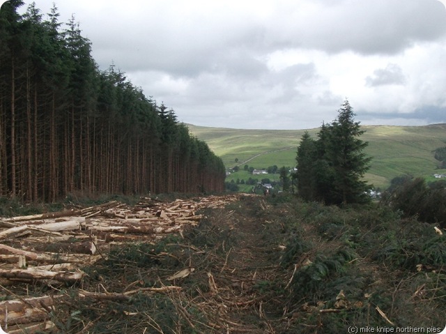 We exited the wood on the far side and walked around the top end where the harvesters were working. Brian started a conversation with the chap working the lopping machine whilst I went off to investigate a line of spoil heaps – discovering each had a concrete-covered shaft. There were lots of other bits of diggings and old pits and so on. You can trace the vein reasonably well…..
Meanwhile – Brian had discovered that the harvesters were a family concern from the Borders, that the machine was about as complex to operate as flying a helicopter, that the wood here was heavier than in other places due to the short growing seasons which leads to narrow tree rings, that the price of timber is £40 a ton and that 26 tons had just been transported away, and that the wood had 40000 tons of wood in it. That’s a million and a half quid. And its not a very big wood – you can walk around it in twenty minutes….
We exited the wood on the far side and walked around the top end where the harvesters were working. Brian started a conversation with the chap working the lopping machine whilst I went off to investigate a line of spoil heaps – discovering each had a concrete-covered shaft. There were lots of other bits of diggings and old pits and so on. You can trace the vein reasonably well…..
Meanwhile – Brian had discovered that the harvesters were a family concern from the Borders, that the machine was about as complex to operate as flying a helicopter, that the wood here was heavier than in other places due to the short growing seasons which leads to narrow tree rings, that the price of timber is £40 a ton and that 26 tons had just been transported away, and that the wood had 40000 tons of wood in it. That’s a million and a half quid. And its not a very big wood – you can walk around it in twenty minutes….
 The machine cuts a tree, strips off bark and small branches, cuts it to size and piles up the timber for extraction by another machine.
We gave them the phone number of the campsite at Westgate for their caravan and Brian offered various bits of local help, including a photo a day of the wood slowly disappearing for their website. You can see the wood clearly from his front room window.
The wood is occupied by a few deer and some small birds, all of which will find alternative accommodation close by.
The machine cuts a tree, strips off bark and small branches, cuts it to size and piles up the timber for extraction by another machine.
We gave them the phone number of the campsite at Westgate for their caravan and Brian offered various bits of local help, including a photo a day of the wood slowly disappearing for their website. You can see the wood clearly from his front room window.
The wood is occupied by a few deer and some small birds, all of which will find alternative accommodation close by.
 For anybody about to bemoan the loss of a bit of woodland – this is commercial forest, planted about forty years ago for the purpose of providing timber. It has to be harvested like any other crop, otherwise there’s no point. Inside the wood is not a specially nice place to be anyway – its dark and progress off the cut path is difficult and, in some places, impossible. It’ll get replanted in due course.
This little corner of Nenthead will be a bit colder this coming winter, though….
For anybody about to bemoan the loss of a bit of woodland – this is commercial forest, planted about forty years ago for the purpose of providing timber. It has to be harvested like any other crop, otherwise there’s no point. Inside the wood is not a specially nice place to be anyway – its dark and progress off the cut path is difficult and, in some places, impossible. It’ll get replanted in due course.
This little corner of Nenthead will be a bit colder this coming winter, though….
 Yes folks, its another Yorkshire Dales 2000 foot top, and this time there’s a loyalty bonus - a 600 metre top just because I’m that sort of bloke.
Having successfully put the knipemobile through the MOT without too much fuss, I decided to strike while the iron was hot, as it were, or at least drive whilst the car is working – and went to Kettlewell for the bagging (yet again) of this damn great lump of a Pennine.
Yes folks, its another Yorkshire Dales 2000 foot top, and this time there’s a loyalty bonus - a 600 metre top just because I’m that sort of bloke.
Having successfully put the knipemobile through the MOT without too much fuss, I decided to strike while the iron was hot, as it were, or at least drive whilst the car is working – and went to Kettlewell for the bagging (yet again) of this damn great lump of a Pennine.
 We went up via Dowber Gill – probably the most interesting way, I think. Near the top of the gill, there’s an iron cover on a lump of concrete. Sliding this to one side reveals the shored-up entrance to Providence Pot. It looks scary. It is scary. its a very complicated vertical maze which ends up in Dow Cave, about a mile away. I looked down it and went “Oooer…..!”
 A steep path takes the intrepid Whernsider up to Hag Dyke Farm. Hag Dyke farm is a scout hut. Today it was occupied by some of the better quality of yoof, crawling about in the juncus dressed in British Army battledress and covered in green Oil of Ulay face rub. The idea, apparently, was to creep up on Hag Dyke where some older military types were trying to spot them and occasionally sending out spoiler patrols. From the little crag above the house, it was apparent that one group of five were getting very close and the patrol had just walked past them without noticing them. Bless ‘em. What fun.
 We progressed to the summit for a turkey and tomato butty, a mars bar and some dribbling (Bruno did the dribbling).
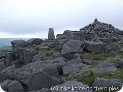
 I have to say that it was a bit parky on the top of Great Whernside today. I had to put some layers on. Cloud was touching some nearby fells and the wind was a bit searching.
It was, in fact, a bit autumnish….
Bugger
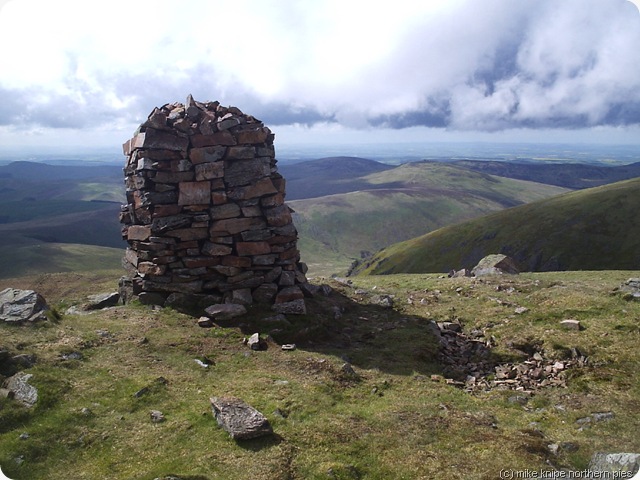
An easy walk and some bog trotting brought us along the ridge and up on to Little Whernside where the summit cairn appears not to be on the highest bit. But never mind.
I have to say that it was a bit parky on the top of Great Whernside today. I had to put some layers on. Cloud was touching some nearby fells and the wind was a bit searching.
It was, in fact, a bit autumnish….
Bugger
An easy walk and some bog trotting brought us along the ridge and up on to Little Whernside where the summit cairn appears not to be on the highest bit. But never mind.
 We retreated back to the GW/LW col or bealach and followed the bridleway to Park Rash. The last time I was here, maybe eighteen months ago, this path was a mess, churned up by off-road motor bikes. But it seems to have recovered. Remarkably quick, that…… You could barely tell….
Anyway, at Park Rash there’s added interest from the First Century British (Brigantian) defences – deep ditches and ramparts and so on , and a field full of suckler cows including Beano the Bull. We took a slight detour. Discretion is the better part of being trampled to death by dog-hating moo cows. Bruno agreed. They can get a bit mad, these beasties.
We retreated back to the GW/LW col or bealach and followed the bridleway to Park Rash. The last time I was here, maybe eighteen months ago, this path was a mess, churned up by off-road motor bikes. But it seems to have recovered. Remarkably quick, that…… You could barely tell….
Anyway, at Park Rash there’s added interest from the First Century British (Brigantian) defences – deep ditches and ramparts and so on , and a field full of suckler cows including Beano the Bull. We took a slight detour. Discretion is the better part of being trampled to death by dog-hating moo cows. Bruno agreed. They can get a bit mad, these beasties.
 A green lane brought us back to Kettlewell where TGO Challenger Heather Thomas-Smith leapt out from a gang of ice-cream eating girl guides and gave Bruno the bottom of her cone. TGO Challengers have a habit of popping up…..
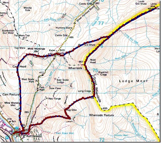
We did 13 miles and 2200 feet of uphill.
It were grand. I’d do it again.
A green lane brought us back to Kettlewell where TGO Challenger Heather Thomas-Smith leapt out from a gang of ice-cream eating girl guides and gave Bruno the bottom of her cone. TGO Challengers have a habit of popping up…..
We did 13 miles and 2200 feet of uphill.
It were grand. I’d do it again.
 November always seems like the end of the walking year to me. So, each November, I try to plan out whatever it is I might do the next year. In the past, this has inevitably had a four (ish) day backpacking trip in April as a pre-TGO shakedown; May is for the TGO and October is a fortnight in Wales. June, July and August each will have a week Hewitt bagging or whatever…. Last year I walked a high level route across Cumbria , for instance.
So this year, I decided that in August I will walk the English/Scottish Border and this has now crept up on me and slapped my head asking if I’m ever going to start planning for it.
And the answer is “No”. I’ve decided not to. I’m just going to buy a train ticket to Carlisle and walk till I get to Berwick.
November always seems like the end of the walking year to me. So, each November, I try to plan out whatever it is I might do the next year. In the past, this has inevitably had a four (ish) day backpacking trip in April as a pre-TGO shakedown; May is for the TGO and October is a fortnight in Wales. June, July and August each will have a week Hewitt bagging or whatever…. Last year I walked a high level route across Cumbria , for instance.
So this year, I decided that in August I will walk the English/Scottish Border and this has now crept up on me and slapped my head asking if I’m ever going to start planning for it.
And the answer is “No”. I’ve decided not to. I’m just going to buy a train ticket to Carlisle and walk till I get to Berwick.
 I start on 9 August (according to my diary) and, roughly speaking, the walk goes like this:
9/8/10 Carlisle to Longtown
10/8/10 Longtown to Newcastleton
11/8/10 Newcastleton to Kielder
12/8/10 Kielder to Byrness
13/8/10 Byreness to somewhere else
14/8/10 Wherever I was the night before to Kirk Yetholm
15/8/10 Kirk Yetholm to Coldstream (ish)
16/8/10 Coldstream(ish) to Berwick on Tweed.
And that’s it. Planned.
Lets see what happens if you just set off….
Will I make it?
I start on 9 August (according to my diary) and, roughly speaking, the walk goes like this:
9/8/10 Carlisle to Longtown
10/8/10 Longtown to Newcastleton
11/8/10 Newcastleton to Kielder
12/8/10 Kielder to Byrness
13/8/10 Byreness to somewhere else
14/8/10 Wherever I was the night before to Kirk Yetholm
15/8/10 Kirk Yetholm to Coldstream (ish)
16/8/10 Coldstream(ish) to Berwick on Tweed.
And that’s it. Planned.
Lets see what happens if you just set off….
Will I make it?
 This is yet another of one of those Yorkshire dales 2000 foot tops walks, the tops in this case being Great Coum, Green Hill and Gregareth. These three grassy lumps are arranged neatly in a little horseshoe around the little dale of Easegill. Easegill, of course is much more famous for its 75km of caving system than for a soggy round of three grassy lumps but not for us today.
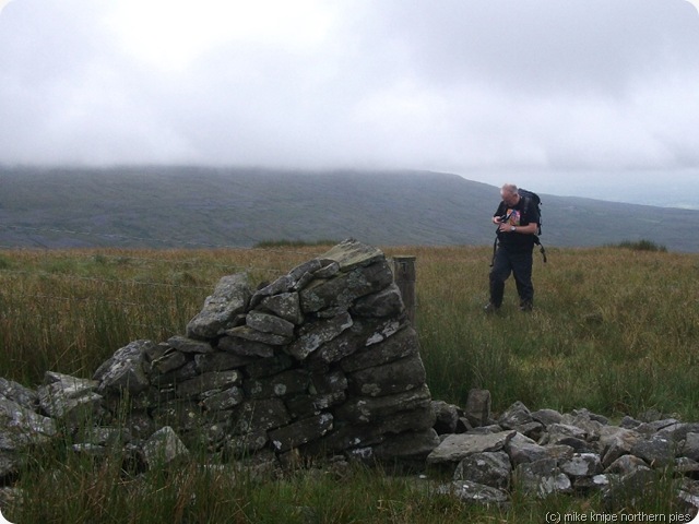 I picked up the brother from Kendal and whisked him off to some lane parking at a high road-end just next to Bullpot Farm. Bullpot Farm is the Red Rose Caving Club’s “hut”. Bullpot of the Witches being a pothole very close by….
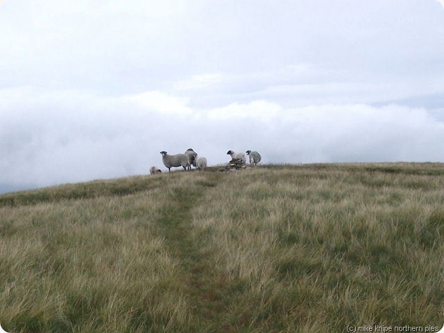
But none of this for us. Instead, we had a damp trek through soggy sedges for just a bit more than a thousand fairly gentle feet to the top of Crag Hill, which was occupied by a party of sheep, and then on to Great Coum for lunch. I’d been here before, of course, and I repeated the egg butty lunch. I’m not obsessed by Great Coum or anything, but its on the round y’see.
I picked up the brother from Kendal and whisked him off to some lane parking at a high road-end just next to Bullpot Farm. Bullpot Farm is the Red Rose Caving Club’s “hut”. Bullpot of the Witches being a pothole very close by….
But none of this for us. Instead, we had a damp trek through soggy sedges for just a bit more than a thousand fairly gentle feet to the top of Crag Hill, which was occupied by a party of sheep, and then on to Great Coum for lunch. I’d been here before, of course, and I repeated the egg butty lunch. I’m not obsessed by Great Coum or anything, but its on the round y’see.
 Hill fog had cleared on our climb up Crag Hill but here it rolled in again. We descended to the County Stone, not loking at the extensive view that we couldn’t see due to the hillfog. The County Stone marks the old county boundary of Lancashire, the West riding of Yorkshire and Westmorland. It sports some graffiti which is clearly older than the boundary walls that meet there….
 We plodded on to Green Hill and then to Gregareth, meeting with a very stroppy Swaledale (Swardle) ewe who stamped her feet at us and wouldn’t get out of the way.
 I must say that if you decide to do this ridge, wait for clear weather. Its not that its difficult to navigate the place, its just that in hill fog and without the lovely view of Ingleborough, the ridge is, well, not to put too fine a point on it, a bit dull. Its just too easy. You just walk alongside the wall…. and thats it.
We descended to the Three Men of Gregareth – three stone “men” or tall cairns..actually there’s now four of them. Bruno dozed off here whilst we had a snack and a shelter out of the wind and drifting mist. I’m not sure how he achieved this as the stones here aren’t exactly comfy cushions…..
I must say that if you decide to do this ridge, wait for clear weather. Its not that its difficult to navigate the place, its just that in hill fog and without the lovely view of Ingleborough, the ridge is, well, not to put too fine a point on it, a bit dull. Its just too easy. You just walk alongside the wall…. and thats it.
We descended to the Three Men of Gregareth – three stone “men” or tall cairns..actually there’s now four of them. Bruno dozed off here whilst we had a snack and a shelter out of the wind and drifting mist. I’m not sure how he achieved this as the stones here aren’t exactly comfy cushions…..

 We descended further to Leck Fell House and then across the moor to Easegill Kirk. Unfortunately, due to the extreme slipperiness of the carb limestone (its always like this when its wet), we couldn’t explore the Kirk properly. I’ll be back, though – its a fine and interesting gorge…
 An easy path took us back to Bullpot Farm…..
I think Gregareth could well mean Heather(y) Height. by the way. There’s a fair amount of Welsh in the place names around here. Its just a guess…
An easy path took us back to Bullpot Farm…..
I think Gregareth could well mean Heather(y) Height. by the way. There’s a fair amount of Welsh in the place names around here. Its just a guess…
 We did 9 and a bit miles and 2000 feet of climbing.
There’s only seven Yorkshire Dales 2000 foot tops left to do. Can you guess what they are?
We did 9 and a bit miles and 2000 feet of climbing.
There’s only seven Yorkshire Dales 2000 foot tops left to do. Can you guess what they are?

 The heat of the sun got me out of bed and I was away by 9:00 ish (ok, I know its not early, but if you’d been to Darts practise at the Hare and Hounds….) I called at Charlie’s and had coffee….
A bit later I slugged up the hill out of Westgate. various people stopped to chat. It took a while.
Eventually, at a strategic bend in the road, I headed off along a contour with a lane on it and this took me towards Heights Quarry. it was all very lovely so far.
The heat of the sun got me out of bed and I was away by 9:00 ish (ok, I know its not early, but if you’d been to Darts practise at the Hare and Hounds….) I called at Charlie’s and had coffee….
A bit later I slugged up the hill out of Westgate. various people stopped to chat. It took a while.
Eventually, at a strategic bend in the road, I headed off along a contour with a lane on it and this took me towards Heights Quarry. it was all very lovely so far.
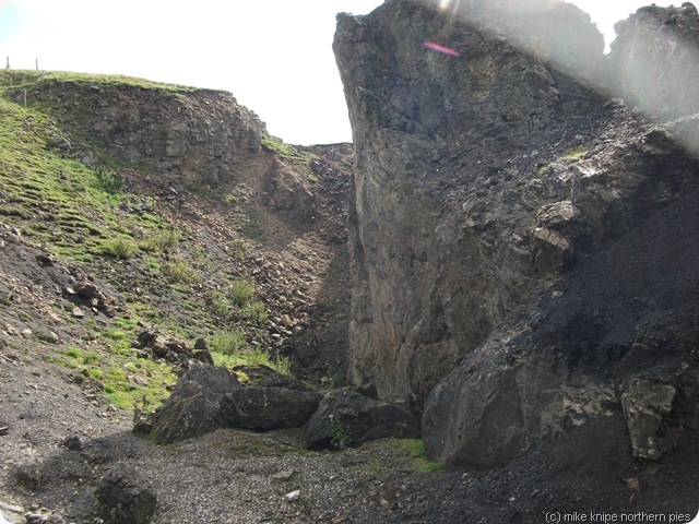 The route follows the old railway line to Rookhope and its all very lovely with some smashing Weardale views until a deep gorge suddenly appears at the feet. There is a moment of doubt (cos its a big drop) – but by poking around, a path on the left is found which drops down gently to the beck and then appears on the other side of the gorge without much at all in the way of drama. For geologists, there’s a very nice mined-out mineral vein here.
For about a kilometre after this point, its best to keep your left eye closed. The path goes alongside heights Quarry, which is still working and is very busy. Its well waymarked and fenced off from any danger and eventually industry is passed and the intrepid Pennine Journier pops out on the other side into old railway cuttings with bits of woodland, lots of flowers and many buzzing insects. Its green and damp and beautiful.
The route follows the old railway line to Rookhope and its all very lovely with some smashing Weardale views until a deep gorge suddenly appears at the feet. There is a moment of doubt (cos its a big drop) – but by poking around, a path on the left is found which drops down gently to the beck and then appears on the other side of the gorge without much at all in the way of drama. For geologists, there’s a very nice mined-out mineral vein here.
For about a kilometre after this point, its best to keep your left eye closed. The path goes alongside heights Quarry, which is still working and is very busy. Its well waymarked and fenced off from any danger and eventually industry is passed and the intrepid Pennine Journier pops out on the other side into old railway cuttings with bits of woodland, lots of flowers and many buzzing insects. Its green and damp and beautiful.
 After that, the Weardale Way goes easily along the railway line to Rookhope where it meets the cyclists’ Coast to Coast route and, of course, the Rookhope Inn where a short period of celebration is allowed.
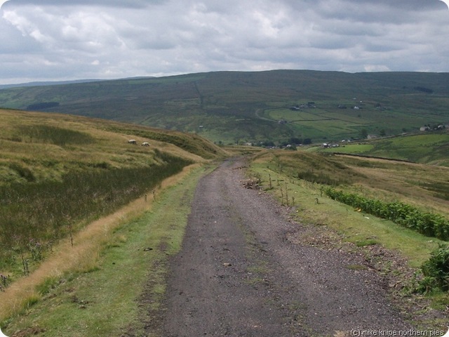 After “lunch”, I climbed the Bolts law incline, a bit wearily and followed PJ instructions to go and bag Bolts Law, scene of recent solstice partying. There’s a lot of grouse living in the Bolts Law heather, and its very heavily managed, so if I had a worry about the PJ route, it would be here. I’m not sure the shooting estate will be too chuffed about this route going through here. There could well be conflict. True, its open access, but its not open all the time, and Journiers with doggies will have to find another route.
 There is, in fact, a perfectly good footpath system from Rookhope running up by Stogel Clough and then over the North East slope of Bolts Law, crossing the summit and then down to Ramshaw. The path down to Ramshaw, though, is a mess. its difficult to follow, has what appears top be an old leat which is crossed on a rotten footbridge, and there’s electric fences. And lots of thistles. But its a right of way and can’t be closed. It just needs a bit of TLC, really. I followed this path down to Ramshaw, as best I could. I might report this to Durham County Council. I’m not sure its bad enough, though.
 After Ramshaw, there’s some quiet lanes and some woodland footpaths to Baybridge, then a pleasant riverside path to Blanchland.
There’s no phone signal in Blanchland, so I used the phonebox to ring home. I got a minute for 60p. 60 PENCE for a minute. Absolute robbery. I allowed myself to be exploited to the sum of three pints of Black Sheep in the Lord Crewe Arms whilst waiting for Maggie to arrive.
After Ramshaw, there’s some quiet lanes and some woodland footpaths to Baybridge, then a pleasant riverside path to Blanchland.
There’s no phone signal in Blanchland, so I used the phonebox to ring home. I got a minute for 60p. 60 PENCE for a minute. Absolute robbery. I allowed myself to be exploited to the sum of three pints of Black Sheep in the Lord Crewe Arms whilst waiting for Maggie to arrive.
 And that, folks, is the sum of my Pennine Journey sampler.
It might not be exactly the route in the book. It won’t be far out though. Its not an official route anyway…
Today’s was 11 miles and 1300 feet.
And that, folks, is the sum of my Pennine Journey sampler.
It might not be exactly the route in the book. It won’t be far out though. Its not an official route anyway…
Today’s was 11 miles and 1300 feet.


.jpg)


.jpg)


