skip to main |
skip to sidebar
 Quite a nice end to the walk.
I set off from the Twizel camp and wandered down the easiest of footpaths towards the sea. The river had herons, swans, ducks and fishermen, mostly up to their naughty parts in Tweed (thats the river, not the trousers).
Quite a nice end to the walk.
I set off from the Twizel camp and wandered down the easiest of footpaths towards the sea. The river had herons, swans, ducks and fishermen, mostly up to their naughty parts in Tweed (thats the river, not the trousers).

 I coasted towards Norham where I had a brief conversation with a bloke and his little black dog. He told me that the path at Horncliffe was closed due to some work going on there. I failed to ask him what the work was about. I was suspicious of another Northumberland CC footpath fiasco. I went to Norham’s village shop and bought a pork and apple butty, some orange juice, an orange and some choccy bars. Robert the Bruce had been here previously, apparently and had not yet paid for his fags.
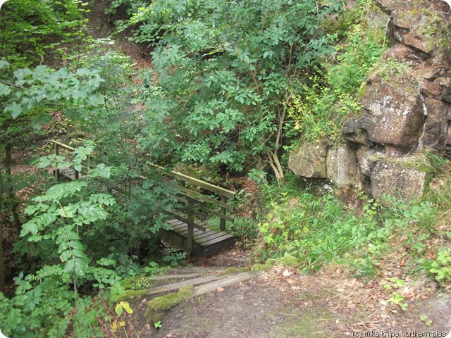 After Norham the path is narrow and runs alongside an unstable sandstone crag. There are no difficulties, though, and soon signs started appearing telling me that the path was closed at Horncliffe Burn. And it was.
But not to worry, another footpath headed South through the woods adn across a cornfield to Norham east Mains farm and thence to a minor road which could be used to outflank whatever it was they were doing in Horncliffe Burn.
After Norham the path is narrow and runs alongside an unstable sandstone crag. There are no difficulties, though, and soon signs started appearing telling me that the path was closed at Horncliffe Burn. And it was.
But not to worry, another footpath headed South through the woods adn across a cornfield to Norham east Mains farm and thence to a minor road which could be used to outflank whatever it was they were doing in Horncliffe Burn.

 The woodland grew ever thicker as I hacked my way South and son,yes, you’ve guessed it, no further progress was possible. There was thick vegetation including hawthorn, fence wire and monster nettles. I struggled out of the cul-de-sac and determined to go around. The subsequent obstacle course included a large embankment of the very same kind that they used to build motte and bailey castles on, and complete with even bigger and stingier stinging nettles. I found the stile into the woods at the far end of the jungle. It was derelict and surrounded by deep, lush green stuff. Yes folks, my third Northumberland County Council Comedy Footpath. Does nobody walk around here? Does the Council have a rights of way department and are they overworked, underfunded, underpaid and has their dog died recently?
The demesne farm was, apparently deserted and I finally made it to the road.
Which was closed!
They were resurfacing it. But the natives were friendly and I had a short chat with the man on the road roller. He offerred me a lift on it, in fact and told me that I could wark doon thah middel of thah rooooad as it were cloooazd fer sarfassin.
The woodland grew ever thicker as I hacked my way South and son,yes, you’ve guessed it, no further progress was possible. There was thick vegetation including hawthorn, fence wire and monster nettles. I struggled out of the cul-de-sac and determined to go around. The subsequent obstacle course included a large embankment of the very same kind that they used to build motte and bailey castles on, and complete with even bigger and stingier stinging nettles. I found the stile into the woods at the far end of the jungle. It was derelict and surrounded by deep, lush green stuff. Yes folks, my third Northumberland County Council Comedy Footpath. Does nobody walk around here? Does the Council have a rights of way department and are they overworked, underfunded, underpaid and has their dog died recently?
The demesne farm was, apparently deserted and I finally made it to the road.
Which was closed!
They were resurfacing it. But the natives were friendly and I had a short chat with the man on the road roller. He offerred me a lift on it, in fact and told me that I could wark doon thah middel of thah rooooad as it were cloooazd fer sarfassin.
 Eventually, I arrived in Horncliffe where I took up a short residence of the public bar in the Fishers Inn. The nice lass behind the bar told me that a) she knew the bloke at Norham and his little black dog and b) the path to Berwick was closed due to a landslip.
 I progressed towards BOT. There was no landslip. The path was nice and easy with just the two or three contours near the end. I passed by the Union Bridge where, I noticed as I chomped the pork and apple butty, that most drivers arrive and turned around again due to the narrow bollards. I wandered briefly into Scotland before continuing along the riverbank.
 Soon after this, the river began to smell of seaweed. I had reached the tidal part. And, ahead, I could now see a large, modern road bridge. this carried the A1 road to Edinburgh. It was busy and difficult to cross.
A bit further on a man in a boiler suit who seemed to be setting fire to piles of “stuff” pointed out the path to Berwick and gave me accurate directions to the nearest and finest fish and chip shop – I thought he said “Fowlers”, but actually he said “Foulis”.
Soon after this, the river began to smell of seaweed. I had reached the tidal part. And, ahead, I could now see a large, modern road bridge. this carried the A1 road to Edinburgh. It was busy and difficult to cross.
A bit further on a man in a boiler suit who seemed to be setting fire to piles of “stuff” pointed out the path to Berwick and gave me accurate directions to the nearest and finest fish and chip shop – I thought he said “Fowlers”, but actually he said “Foulis”.
 I crossed beneath the Royal Border Bridge – a railway bridge of many arches – then found the Fish and Chip Emporium which provided me with a big red box full of hot and delicious chips and fish, which I scoffed just by the oldest bridge into town.
 I found the station, waited for the train in the bar of the Castle Hotel and…. that was that. Job done. Walk Over. Anti –Climax.
Today I walked 17 miles with 600 feet of upness.
Altogether the walk was 123 miles. I haven’t added up the ascent.
I’ll do a summary with a few tips and ideas in a short while.
The End.
I found the station, waited for the train in the bar of the Castle Hotel and…. that was that. Job done. Walk Over. Anti –Climax.
Today I walked 17 miles with 600 feet of upness.
Altogether the walk was 123 miles. I haven’t added up the ascent.
I’ll do a summary with a few tips and ideas in a short while.
The End.


 The day started warm and still and misty. I visited the little shop again and wandered off roughly North-eastwards to find a signposted path to Hoselaw Loch. This was a good path – well waymarked and signposted at crucial points.
On the way, I bagged the diminutive HuMP Venchen Hill, which has what appears to be an ancient cairn on the top. Not much of a view, though, on account of the mist.
I forged fearlessly ever forwards to the cottages at Wideopen where I got a cheery wave from a bloke mending his car, a bark from his dog, and threatened with dismemberment like a little rag doll by a damn great German Shepherd, probably called fluffy or something by the old lady who was failing to impress on it to stop going a bit mad.
The day started warm and still and misty. I visited the little shop again and wandered off roughly North-eastwards to find a signposted path to Hoselaw Loch. This was a good path – well waymarked and signposted at crucial points.
On the way, I bagged the diminutive HuMP Venchen Hill, which has what appears to be an ancient cairn on the top. Not much of a view, though, on account of the mist.
I forged fearlessly ever forwards to the cottages at Wideopen where I got a cheery wave from a bloke mending his car, a bark from his dog, and threatened with dismemberment like a little rag doll by a damn great German Shepherd, probably called fluffy or something by the old lady who was failing to impress on it to stop going a bit mad.
 Hoselaw Loch was pretty and the day was cheering up. A couple in a cottage who had just had a conversation about what a hard day’s work they had coming in the garden, shouted a Southern English Retired From The Rat Race And Now We’re Actually In A Novel About How We Left The Rat Race And Moved Into A Cottage Right On The Fckn Border, I Mean You Can;t get Further North Than That I Mean Ter Say - cheery “hello” – a bit scarily cheery, actually. I think they’d maybe started to get lonely.
 And another old chap who was up to his neck in undergrowth waved a hello as I grazed on his blackberries. Actually, when you read that back, it sounds a bit..er… well ANYWAY, the route I followed along the lanes popped in and out of both Scotland and England, occasionally managing to achieve both at the same time. there was little evidence of warfare despite the proximity of Flodden Field, about which nothing at all should be mentioned when on the Scottish side.
Finally, I lurched back into England and made the mistake of taking yet another Northumberland County Council Comedy footpaths. This one lead the innocent rambler (me) to a long strip of thickly planted conifers. there was no way to tell which side of the conifers to walk on as they weren’t on my map. I chose the right hand side. Wrong. This lead to eight foot deep (I kid you not) nettles and not one deep ditch with a stream, but two.
And another old chap who was up to his neck in undergrowth waved a hello as I grazed on his blackberries. Actually, when you read that back, it sounds a bit..er… well ANYWAY, the route I followed along the lanes popped in and out of both Scotland and England, occasionally managing to achieve both at the same time. there was little evidence of warfare despite the proximity of Flodden Field, about which nothing at all should be mentioned when on the Scottish side.
Finally, I lurched back into England and made the mistake of taking yet another Northumberland County Council Comedy footpaths. This one lead the innocent rambler (me) to a long strip of thickly planted conifers. there was no way to tell which side of the conifers to walk on as they weren’t on my map. I chose the right hand side. Wrong. This lead to eight foot deep (I kid you not) nettles and not one deep ditch with a stream, but two.

 I retraced and found, hiding in the long grass, a waymark, pointing to the conifers. Must be the Left hand Side.
Wrong.
The left hand path skirted the conifers and tried and failed to squeeze between those and a deep ditch full of nettles and thistles and hawthorn bushes and all kinds of vegetable and mineral obstacles to any kind of progress.
I retraced to the entrance stile and plodded off grumpily towards Cornhill on Tweed by road.
I retraced and found, hiding in the long grass, a waymark, pointing to the conifers. Must be the Left hand Side.
Wrong.
The left hand path skirted the conifers and tried and failed to squeeze between those and a deep ditch full of nettles and thistles and hawthorn bushes and all kinds of vegetable and mineral obstacles to any kind of progress.
I retraced to the entrance stile and plodded off grumpily towards Cornhill on Tweed by road.
 At the exit to the path (and I use that word very very loosely indeed) was a sign saying that the field had been sprayed with sulphuric acid, so you’d better keep out or your feet will melt. I got the impression that walkers were not welcome. I got the impression that the pheasant feeders by the copse were a bit of a clue as to why not.
Cornhill is closed in any month with more than 23 days in it, so I wandered across the Border into Coldstream. Coldstream has two campsites marked on the map, neither of which exist, but it does have a Co-Op supermarket and a number of pubs. So all was good.
I bought water and butties and beer for a discreet camp somewhere by the Tweed and wandered off in search.
I found the River Tweed exactly where it was supposed to be and followed a good path through stubble fields to the road.
At the exit to the path (and I use that word very very loosely indeed) was a sign saying that the field had been sprayed with sulphuric acid, so you’d better keep out or your feet will melt. I got the impression that walkers were not welcome. I got the impression that the pheasant feeders by the copse were a bit of a clue as to why not.
Cornhill is closed in any month with more than 23 days in it, so I wandered across the Border into Coldstream. Coldstream has two campsites marked on the map, neither of which exist, but it does have a Co-Op supermarket and a number of pubs. So all was good.
I bought water and butties and beer for a discreet camp somewhere by the Tweed and wandered off in search.
I found the River Tweed exactly where it was supposed to be and followed a good path through stubble fields to the road.
 There’s a path from nearby which goes back to the Tweed, but it fails to cross the River Till, despite the existence of a disused railway bridge. having had previous experience of Northumberland CC’s paths, I wasn’t going to get suckered into a two mile cul-de-sac, so I plodded along the main road to the road bridge over the Till at Twizell Bridge – an ancient structure by-passed by a modern bridge. From here a narrow path through nettles and Himalayan balm leads to the River Tweed where I found an excellent seat on a bench on which to sup a few tins of beer.
The evening was now hot and sunny and the sound of a combine in the nearby field, together with the small birds and the burbling of the River persuaded me to put up the tent for a lisle nap.
The lisle nap lasted approximately 12 hours.
It was a noisy night , though.
There was a combine working over in Scotland throughout the wee small hours, an owl too-witted (male tawny, I think), a quiet conversation was overheard from somewhere nearby, some farm dogs occasionally had a frenzy and there was some strange barking very close by – maybe deer, I suspect.
I spent the night with a spider who built a small web in the top of the tent which caught several flies and beetles, all of which were quickly despatched.
Today was 19 miles and 1400 feet.
There’s a path from nearby which goes back to the Tweed, but it fails to cross the River Till, despite the existence of a disused railway bridge. having had previous experience of Northumberland CC’s paths, I wasn’t going to get suckered into a two mile cul-de-sac, so I plodded along the main road to the road bridge over the Till at Twizell Bridge – an ancient structure by-passed by a modern bridge. From here a narrow path through nettles and Himalayan balm leads to the River Tweed where I found an excellent seat on a bench on which to sup a few tins of beer.
The evening was now hot and sunny and the sound of a combine in the nearby field, together with the small birds and the burbling of the River persuaded me to put up the tent for a lisle nap.
The lisle nap lasted approximately 12 hours.
It was a noisy night , though.
There was a combine working over in Scotland throughout the wee small hours, an owl too-witted (male tawny, I think), a quiet conversation was overheard from somewhere nearby, some farm dogs occasionally had a frenzy and there was some strange barking very close by – maybe deer, I suspect.
I spent the night with a spider who built a small web in the top of the tent which caught several flies and beetles, all of which were quickly despatched.
Today was 19 miles and 1400 feet.


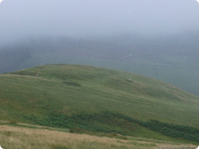 Today’s word is “Mizzly”
At about six in the morning, I awoke to the unmistakeable sizzle of drizzle on the flysheet. A brief peek out revealed a grey world of drifting fine rain. I snuggled down.
By half seven the mist had lifted up the hillside a bit, but the rain was still driving across the fells, and across the flysheet. I really didn't fancy the Border ridge in this clag, and I was wet enough already in the sock supply department. The solution was clear. I was at the head of the Beaumont Valley – which, if followed northwards, would deliver me in a reasonably dry state to Town Yetholm, which has a campsite and a pub, and, possibly a shop where Toblerones can be bought. And – and this is important – I could have a lie in because it wasn't too far and it was, basically, downhill.
So thats what I did.
A lazy breakfast of tea, porridge and prunes later and I packed up the soaking akto and pushed my way up through the Juncus to the col which holds Clennel Street.
Today’s word is “Mizzly”
At about six in the morning, I awoke to the unmistakeable sizzle of drizzle on the flysheet. A brief peek out revealed a grey world of drifting fine rain. I snuggled down.
By half seven the mist had lifted up the hillside a bit, but the rain was still driving across the fells, and across the flysheet. I really didn't fancy the Border ridge in this clag, and I was wet enough already in the sock supply department. The solution was clear. I was at the head of the Beaumont Valley – which, if followed northwards, would deliver me in a reasonably dry state to Town Yetholm, which has a campsite and a pub, and, possibly a shop where Toblerones can be bought. And – and this is important – I could have a lie in because it wasn't too far and it was, basically, downhill.
So thats what I did.
A lazy breakfast of tea, porridge and prunes later and I packed up the soaking akto and pushed my way up through the Juncus to the col which holds Clennel Street.
 The downhill bit to Cocklaw Head is a delight to walk on. And – for those interested in such things, it passes a fortified settlement or two on the way. The Cheviots are full of these things – almost one on every hilltop. They are, in the main, just a ring of earthworks circling a hilltop, big enough to hold a family or two and their cattle and horses. They’re also very close together, so they must have been some kind of tactical support arrangements. Anyway, they’re nothing to do with the Treaty of York borderline – they’re iron age and were generally occupied by the Votadini, a British tribe with a positive attitude to the Romans, who, despite the Wall being far to the South, had a significant presence around here.
This is Goddodin – Hen Ogledd. These peeps founded Edinburgh as a place for shopping and slightly surreal street plays. Read all about the Votadini here: http://en.wikipedia.org/wiki/Votadini
The downhill bit to Cocklaw Head is a delight to walk on. And – for those interested in such things, it passes a fortified settlement or two on the way. The Cheviots are full of these things – almost one on every hilltop. They are, in the main, just a ring of earthworks circling a hilltop, big enough to hold a family or two and their cattle and horses. They’re also very close together, so they must have been some kind of tactical support arrangements. Anyway, they’re nothing to do with the Treaty of York borderline – they’re iron age and were generally occupied by the Votadini, a British tribe with a positive attitude to the Romans, who, despite the Wall being far to the South, had a significant presence around here.
This is Goddodin – Hen Ogledd. These peeps founded Edinburgh as a place for shopping and slightly surreal street plays. Read all about the Votadini here: http://en.wikipedia.org/wiki/Votadini
 Anyway, there’s not much to say about the Beaumont Valley. I expect its quite pretty, but the hillfog was well down and the drizzle drizzled continuously, so nothing much cpuld be seen.
Town Yetholm was much better. The campsite is good and cost just a fiver, the shop has pies and bread rolls and merlot and chocolate…. and the pub, where it was going to be Caribbean Night, come in a loud shirt, was friendly and I chatted to a couple of camper-van campers from the campsite (where else?) over several pints of Guinness
I had a night in with the merlot, corned beef and rolls and the last of the shop’s supply of Sly Cake (Fruit slice to you) and The Scotsman newspaper. It drizzled continuously most of the night.
Today was just ten miles and 400 feet of uphill. A purist and idiot would have done the Pennine Way, which would have been much further and wetter and there would have been a fine view of exactly bugger all.
Anyway, there’s not much to say about the Beaumont Valley. I expect its quite pretty, but the hillfog was well down and the drizzle drizzled continuously, so nothing much cpuld be seen.
Town Yetholm was much better. The campsite is good and cost just a fiver, the shop has pies and bread rolls and merlot and chocolate…. and the pub, where it was going to be Caribbean Night, come in a loud shirt, was friendly and I chatted to a couple of camper-van campers from the campsite (where else?) over several pints of Guinness
I had a night in with the merlot, corned beef and rolls and the last of the shop’s supply of Sly Cake (Fruit slice to you) and The Scotsman newspaper. It drizzled continuously most of the night.
Today was just ten miles and 400 feet of uphill. A purist and idiot would have done the Pennine Way, which would have been much further and wetter and there would have been a fine view of exactly bugger all.

 Early in the morning, as I sat and scoffed my egg butty, the rain was bouncing down outside Forest View in a specially vicious and thundery kind of way. As I left though, it stopped. Then it started again. I sheltered whilst it passed. This was the pattern for the morning – nasty but brief showers.
 But the walking was much easier. This was The Pennine Way. It has a few boggy bits to start with then its a highway of duckboards and sandstone slabs which make for fast and easy progress. No navigation is done. Well, not much anyway.
 I got to the ten mile hut, so called because its eight miles from Byrness. there’s a twenty mile hut, similarly not twenty miles from Byrness. I lunched inside the hut and read the hut log. Somebody had recently donated maps of the Howgill fells and some boxer shorts, diahorrhea medicine and various other weight-saving accoutrements and potions.
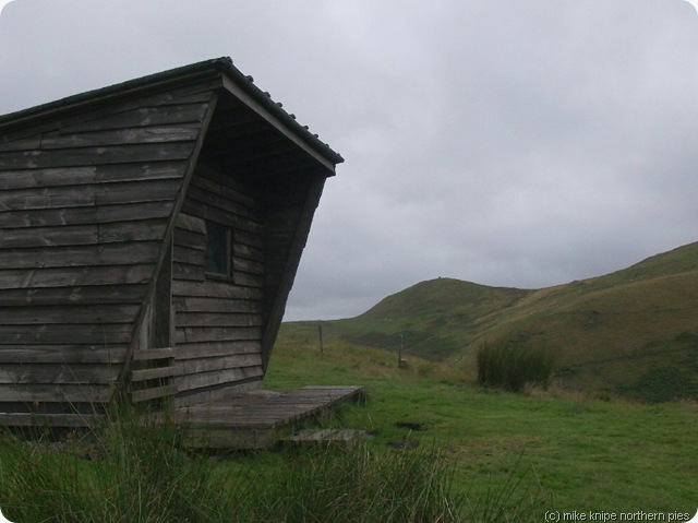 Somewhere around lamb Hill the mist descended and another walker passed the other way – the only other soul I would see till tomorrow. It began to drizzle and the wind picked up to form that lovely Northern driving drizzle that makes sitting beside a roaring fire with a warm barmaid on your knee and a copy of a Charles Dickens novel so desirable.
It was the best of times.
Somewhere around lamb Hill the mist descended and another walker passed the other way – the only other soul I would see till tomorrow. It began to drizzle and the wind picked up to form that lovely Northern driving drizzle that makes sitting beside a roaring fire with a warm barmaid on your knee and a copy of a Charles Dickens novel so desirable.
It was the best of times.
 At Windy Gyle, I decided I’d done enough. I would seek out a camping spot out of the wind and with some nice water and I would resume the Pennine Way bit in the morning. I was wet enough again. The feet were suffering again and they needed a rest. they were no worse, though. Maybe they were finally getting used to the idea. The left foot had brought a note from it’s mum, but I could tell it had written it itself. It had misspelled “diphtheria”.
The Scottish side of the Border fence provides the best camping spots, in my experience, so I followed Clennel Street northwards. Clennel Street, I should explain is an ancient cross-border route which is now just a track, green in places and rough surfaced in others. I understand that there were meetings of the “authorities” of both countries at the Russell’s cairn where the road crosses the border. there were hangings and shootings and fatal incidents there on occasions. You’d think twice about camping there on a wild and drizzly night like wot this was turning out to be.
At Windy Gyle, I decided I’d done enough. I would seek out a camping spot out of the wind and with some nice water and I would resume the Pennine Way bit in the morning. I was wet enough again. The feet were suffering again and they needed a rest. they were no worse, though. Maybe they were finally getting used to the idea. The left foot had brought a note from it’s mum, but I could tell it had written it itself. It had misspelled “diphtheria”.
The Scottish side of the Border fence provides the best camping spots, in my experience, so I followed Clennel Street northwards. Clennel Street, I should explain is an ancient cross-border route which is now just a track, green in places and rough surfaced in others. I understand that there were meetings of the “authorities” of both countries at the Russell’s cairn where the road crosses the border. there were hangings and shootings and fatal incidents there on occasions. You’d think twice about camping there on a wild and drizzly night like wot this was turning out to be.
 The strong wind from the East determined a camp down the hill on the west side. I found a spot. Put up the akto and retired inside for my dehydrated spag bol and the 25cls of cheapo scotch I’d saved for just such an occasion.
The drizzle drizzled on the tent all night. At some point the mist enveloped everything.
I quite like nights like that.
Today’s was 14 Miles and 2700 feet.
The strong wind from the East determined a camp down the hill on the west side. I found a spot. Put up the akto and retired inside for my dehydrated spag bol and the 25cls of cheapo scotch I’d saved for just such an occasion.
The drizzle drizzled on the tent all night. At some point the mist enveloped everything.
I quite like nights like that.
Today’s was 14 Miles and 2700 feet.
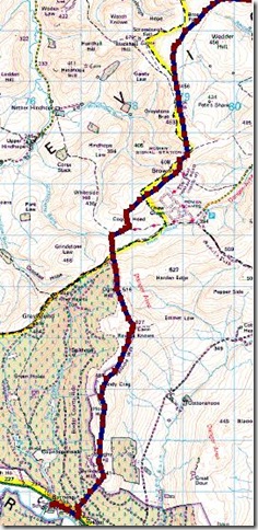
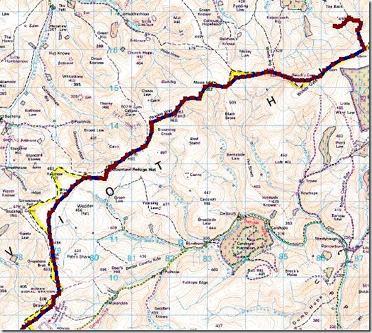
 There’s phrase for today is “A walk on Northumberland County Council’s Comedy Bridleway”
I started well again – in the correct direction (albeit after some urgent replanning) and with happier feet than last night.
I’d originally intended to follow the Border ridge over Peel Fell and Carlin Tooth to Carter Bar and then on to Hungry Law. Reality stepped in somewhere and I realised that, for me, this would be a two day walk, or at least one and a half…
There’s phrase for today is “A walk on Northumberland County Council’s Comedy Bridleway”
I started well again – in the correct direction (albeit after some urgent replanning) and with happier feet than last night.
I’d originally intended to follow the Border ridge over Peel Fell and Carlin Tooth to Carter Bar and then on to Hungry Law. Reality stepped in somewhere and I realised that, for me, this would be a two day walk, or at least one and a half…
 Anybody else determined to walk the Border should really go this way and allow the appropriate amount of time. As it was, I wasn’t up to it, I had a bed booked at Byrness and a ticket at Berwick, so I could only take an extra day by forfeiting these things. Look, I’m a Yorkshireman, don’t be so daft.
So a direct bridleway going almost all the way the Byrness in fairly short order looked to be an easy option. How wrong could I be?
The Toll road at the A68 from Kielder leads the innocent innocuously into the inhospitable interior (thats enough of that now…) At East Kielder the bridleway starts over rough pastures with cows and sheep and a vague air of neglect.
Anybody else determined to walk the Border should really go this way and allow the appropriate amount of time. As it was, I wasn’t up to it, I had a bed booked at Byrness and a ticket at Berwick, so I could only take an extra day by forfeiting these things. Look, I’m a Yorkshireman, don’t be so daft.
So a direct bridleway going almost all the way the Byrness in fairly short order looked to be an easy option. How wrong could I be?
The Toll road at the A68 from Kielder leads the innocent innocuously into the inhospitable interior (thats enough of that now…) At East Kielder the bridleway starts over rough pastures with cows and sheep and a vague air of neglect.
 At Kielderhead bothy, there’s a beck to be paddled, some deep nettles and a barricaded gate all of which would effectively prevent a person on horseback progressing any further. The bothy is locked and bolted and closed due to Neds and their boozy parties and random vandalism and general arseholiness. It adds to the atmosphere but shows that the Forestry Commission can spend money on blocking up this building but bugger-all on the right of way.
 I entered tussock land. The tussocks here are deep and green and lush and big. The line of the path is less than obvious.
As it progresses eastwards, it gets no better. Sometimes there’s a thin trod which appears to be more of a sheep trod. Sometimes there is deep and ravenous bracken, well over head height. Within the bracken there are holes for the ankles.
I entered tussock land. The tussocks here are deep and green and lush and big. The line of the path is less than obvious.
As it progresses eastwards, it gets no better. Sometimes there’s a thin trod which appears to be more of a sheep trod. Sometimes there is deep and ravenous bracken, well over head height. Within the bracken there are holes for the ankles.
 Eventually, after many an hour of struggle, it gets worse. It started raining very heavily at this point, just to add to the delight, and having just put my foot into a two foot deep hole full of cold, black methane-water, I was rejoicing at being out, I can tell you.
I heaved my way up throught he dep heather and ever deeper bracken to Girdle Fell, using GPS to hit the boundary at just over 520 metres. Here, there was a bit of a path and a noticeboard describing the walk to the waterfall and picnic place. Its a good job I didn;t try to go there. Both the path and the pickernick area are pure figment of Tilshill Forestry’s fevered imagination. maybe they get a grant or something.
Eventually, after many an hour of struggle, it gets worse. It started raining very heavily at this point, just to add to the delight, and having just put my foot into a two foot deep hole full of cold, black methane-water, I was rejoicing at being out, I can tell you.
I heaved my way up throught he dep heather and ever deeper bracken to Girdle Fell, using GPS to hit the boundary at just over 520 metres. Here, there was a bit of a path and a noticeboard describing the walk to the waterfall and picnic place. Its a good job I didn;t try to go there. Both the path and the pickernick area are pure figment of Tilshill Forestry’s fevered imagination. maybe they get a grant or something.
 Just as things were getting better (it stopped raining) – it got a lot worse. The bridleway plunges very steeply through seven foot deep bracken down a forest ride. Lower down the ride is competely blocked by large fallen trees. The local black flies add to the sheer fckn enjoyment of this place.
Eventually, I was on the verge of giving up altogether when I noticed, on the opposite side of the beck, a forest road. The bridleway itself was nowhere to be seen More bracken and trees seemed to be in the way. I plunged through the last of the jungle and crossed the beck. The forest ride, which incidentally was supposed to have the picnic area lead easily through a locked gate (how are you supposed to get to the non-existent picnic area?) – through a beef field, of which I was in no mood to have any nonsense from – so they allran away – down to Catcleugh reservoir where it started chucking it down again.
Just as things were getting better (it stopped raining) – it got a lot worse. The bridleway plunges very steeply through seven foot deep bracken down a forest ride. Lower down the ride is competely blocked by large fallen trees. The local black flies add to the sheer fckn enjoyment of this place.
Eventually, I was on the verge of giving up altogether when I noticed, on the opposite side of the beck, a forest road. The bridleway itself was nowhere to be seen More bracken and trees seemed to be in the way. I plunged through the last of the jungle and crossed the beck. The forest ride, which incidentally was supposed to have the picnic area lead easily through a locked gate (how are you supposed to get to the non-existent picnic area?) – through a beef field, of which I was in no mood to have any nonsense from – so they allran away – down to Catcleugh reservoir where it started chucking it down again.
 I eventually arrived, somewhat bedraggled, or at least , more bedraggled than usual at the Forest view Hostel at Byrness where I was gently deprived of my soaking waterproof, boots and nasty socks and had hot tea and cold beer and a bit of sympathy from Colin and Joyce. Joyce and Colin must be well rehearsed in tending to the needs of the fragged off the Pennine Way and, despite the return of the pain in the foot, it was a good end to a duff day.
About the bridleway – Something Must Be Done. This is an important route. Its not Government Cuts, Northumberland County Council, its years and years of neglect. A few strong words with those foresters would be a start, and maybe a few wooden stakes will yellow paint on the top would help to establish a path that can be followed. You know , the sort of thing they have everywhere else…….
In theory at least, I covered 13 Miles with 1500 feet of ascent. It felt like a week in the Burmese jungle.
On the plus side, I got the socks washed and the the tent dried and I got fed, showered, watered, beered and cheered up. I will be in contact with Northumberland CC about this.
More of which later…
I eventually arrived, somewhat bedraggled, or at least , more bedraggled than usual at the Forest view Hostel at Byrness where I was gently deprived of my soaking waterproof, boots and nasty socks and had hot tea and cold beer and a bit of sympathy from Colin and Joyce. Joyce and Colin must be well rehearsed in tending to the needs of the fragged off the Pennine Way and, despite the return of the pain in the foot, it was a good end to a duff day.
About the bridleway – Something Must Be Done. This is an important route. Its not Government Cuts, Northumberland County Council, its years and years of neglect. A few strong words with those foresters would be a start, and maybe a few wooden stakes will yellow paint on the top would help to establish a path that can be followed. You know , the sort of thing they have everywhere else…….
In theory at least, I covered 13 Miles with 1500 feet of ascent. It felt like a week in the Burmese jungle.
On the plus side, I got the socks washed and the the tent dried and I got fed, showered, watered, beered and cheered up. I will be in contact with Northumberland CC about this.
More of which later…


.jpg)


.jpg)


