 |
| Ringo Scans the Horizon For Errant Porridge |
It's been a while. Must do better. In this post I am continuing my obsession with the TGO Challenge. (A google search will reveal all) I will promise to write stuff about other...er...stuff in later posts and if I fail, you can send the lads round.But, see , if I manage to complete the 2025 TGO Challenge, it will be the 20th time I've done it. So this is special. And, maybe, this could be the last time, maybe the last time I don't know (Apols to Jagger/Richards) (Just goes to show how old I am) (I should try to stop keeping writing sentences in brackets) (Oh I dunno, though...)
So what I normally do before a TGO challenge (look it up!) (sorry!) is do a bit of training - hence me and Ringo turned up in Tebay City Centre, just off junction 38 of the M6 on Tuesday lunchtime and we marched manfully and dogfully in a roughly Westerly direction towards New York, but not really intending to go this far, yet without an actual fixed plan.
 |
| Footbridge Over the River Lune |
 |
| Bridleway to Freedom |
 |
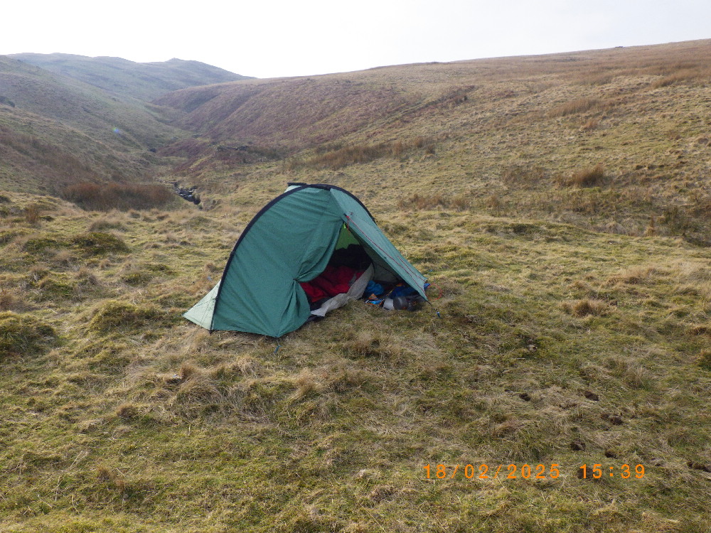
| First Camp After Not Very Far At All |
 |
| The Little Black Dots in the Distance Are Fell Ponies. Ringo Hates Horses of Any Kind. |
 |
| Ringo Snuggles in Early |
We didn't go very far into the hinterland before we found a lovely spot for the camping, and, there being no evidence of any Hinters, dropping hints or anything, we put up the tent, had our tea and settled in for the night. Nights in February are very long and dark and settling in with a book, a radio, cheesy nibbles and a hint of single malt is Just The Thing. Ringo passes the night by having running about and barking dreams and farting. He is quite good and sleeping as long as it's dark. Tuesday night had something like ten hours of dark.And before settling in until the first visit by Mr Bladder (about half past ten), I put stuff out for the morning's repast - that is to say, two sachets of Winalot, some kibble in a plastic bag, some coffee bags and a pack of dehydrated porridge with some kind of fruit in it by Food On The Move, proudly made in Lancashire, as was I. I was particularly looking forward to this and even had a couple of oat-based dreams.
 |
| Ringo Announces That He Will NOT be Dragging My Pack Along Today |
 |
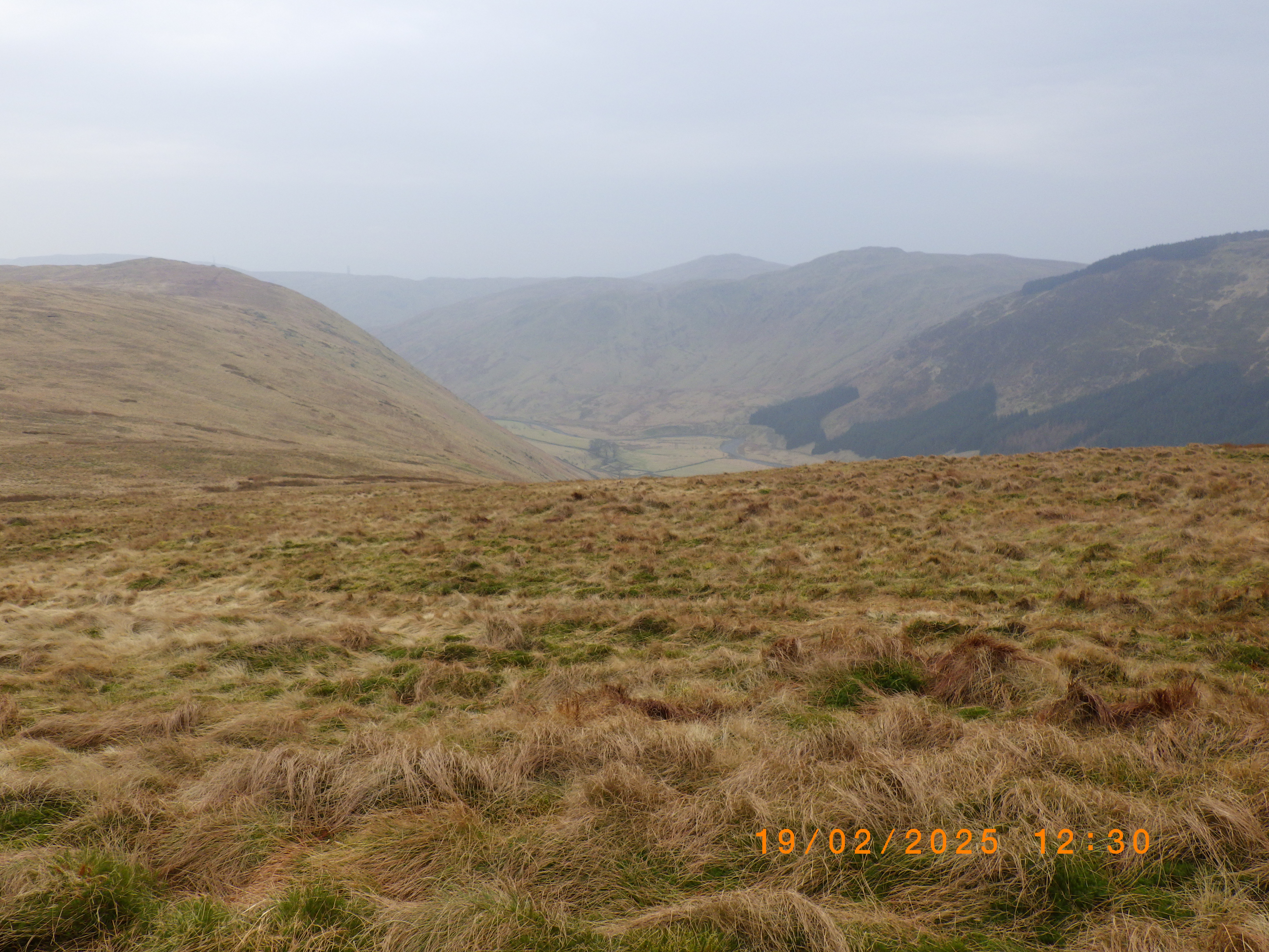
| The Other Borrowdale |
 |
| Ringo Spots Nothing At All, Just Over There |
 |
| For the Life of Me I can't Remember This, Except to Say That Its Starting To Rain |
 |
| Lucky Discovery of a Sheltered Spot |
So, in the grey dawn of the very next day I was dischuffed to find that the lovely porridge, proudly made in Lancashire had been nicked. Gone. Space where porridge should be. I scanned the horizon. Ringo sniffed the horizon. He does have history where pinching well packaged foodstuffs are concerned, but in this case he was under his woofbag with a thermal blanket over him (cold night and I'm much too soft), so I'm pretty sure it wasn't him. And the kibble and winalot was intact. I do remember hearing a strange noise in the porch sometime during the darkest and coldest part of the night but by the time I'd located a headlight, whatever it was, had gone. As had my porridge. Luckily I had a spare pack of porridge. The following morning's breakfast was ill-starred, though.So we packed up and wandered off into the hills, a bit late, mainly due to oversleeping for an hour or so, despite the ten hours we'd just had in our stink pits.
Around lunchtime, it started raining. By early afternoon it was chucking it down, so we left the ridge and sought a bit of flat grass near a stream, out of the wind, with no animals running off with my victuals.
 |
| Ringo Un The Wet Porridgeless Morning |
 |
| Some Bridge Or Other Over Some Kind of Beck |
 |
| Doesn't Explain How You Can Slow Down a Squirrel. Maybe Engage it in Conversation (?) |
 |
| Ringo Doing an Excellent Impression of a Wet Dog |
We followed a deer fence for a bit and came across a ruined farmhouse with a small and very sheltered enclosure, so I put up the tent there and we settled in to a wet night with the wind roaring through the trees, but not really bothering us at all. It was, in fact, very much a replay of the night before. Apart from the wind, which on the previous night had mainly come from the dog.In the morning it was still precipitating in a persistent manner, so we packed up wetly and splodged off along the bridleway and along lanes back to Tebay.
I refuse to disclose how far this semi-planned stravaig was, or even less how much ascent there was, mainly due to the embarrassment this would cause Ringo who is very proud of the distances he can pull me. Low scores would be revealed, and, if repeated on a TGO challenge, I probably wouldn't make it to the Great Glen within the two weeks available.
Must do better. I have another trip sort of planned, but not really. I am determined, though, to order some more proudly Lancashire porridge and look after it a bit more carefully.


.jpg)


.jpg)


