In the meantime, here's the bright side of nuclear armageddon - the fact that if we all go at once, there'll be no tears afterwards because everybody will have fried together. This also applies to every other doom scenario. So cheer up and be happy. It's not the end of the world.... oh well, actually..... it is....
Friday, 5 October 2012
It's An Ill Wind (Interval)
In the meantime, here's the bright side of nuclear armageddon - the fact that if we all go at once, there'll be no tears afterwards because everybody will have fried together. This also applies to every other doom scenario. So cheer up and be happy. It's not the end of the world.... oh well, actually..... it is....
Thursday, 4 October 2012
Burbling in Baldersdale –The Noah’s Ark Alternative
All I can say is that it seemed like a good idea at the time. When it came time to put in bids for the Durham County Council winter guided walks programme, I was studying the 1:25k North Pennines map and my wandering digit lighted on Burble Well and it occurred to me that it would be a jolly jape to take a guided walk there. My first reccy of the place was ages and ages ago and there was a blog post all about it. The place is on the soggy side of damp, and quite difficult to find at first, so I redesigned the route completely so as to come at it from a direction where there was a handy handrail, spookily named “Burble beck”. Burble beck has a right of way running next to it and on the ground there’s a bit of a path.
The pre-walk reccy discovered several new features. these were:
1) The stiles on the right of way between Pitcher House and Friar House are in a shaky condition. this wouldn’t be good for a group of any size and somebody could end up with half a tonne of stone wall on them.
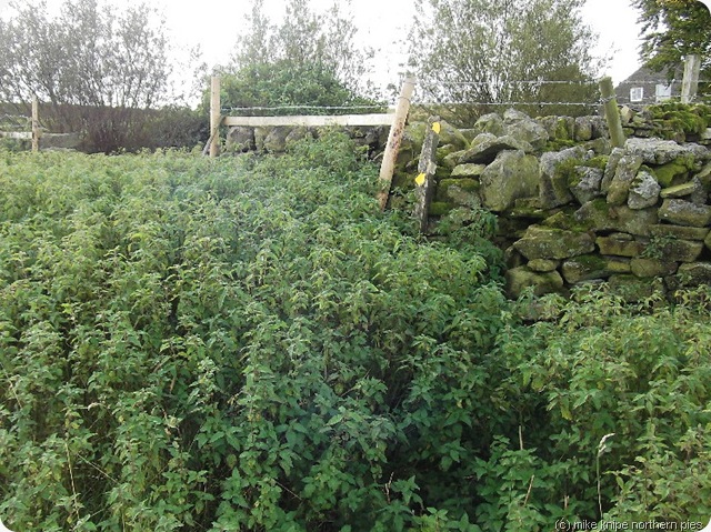
2) The right of way at Mere beck House has been diverted, the stile is deep in nettles and is falling down and the diverted footpath is blocked with barbed wire AND the waymarks are either pointing the wrong way, are absent or are just blank discs. I have reported this to the rights of way peeps. A short diversion was taken on the day.
3) The six inches of rain which fell in two days last week has submerged great chunks of the path East of Race Yate and the invisible paths over Fairy Head are rough and wet up to the knees in places, but the Pennine Way by Goldsborough was reasonably dry. A wide boggy bit on Currack Rigg was just passable at the cost of one wet sock.
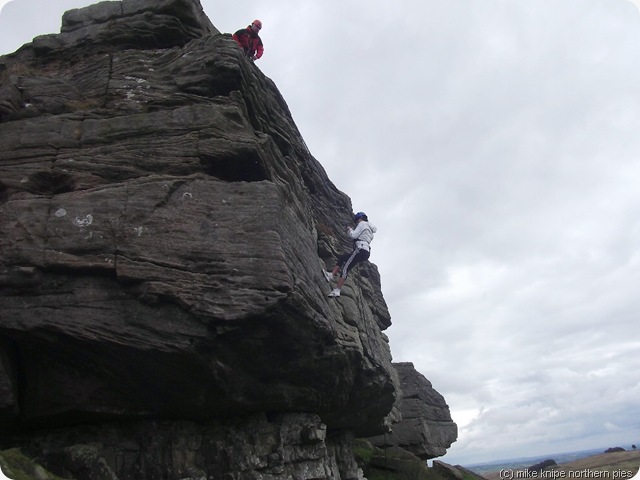
4) A Polish lass abseiling off Goldsborough was braver than her English companion.
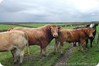
5) There are lots of cattle on the route – none of whom are specially dangerous. Two suckers with new calves are, perhaps, the riskiest.
When it came to doing the walk, as well as the two compulsory Davids and an Eric, sixteen people and a small dog turned up and we set off over pastures that were even soggier than when I did the reccy, and which were to be yet soggier by the end of the day.
I had chopped huge great chunks off the route in an attempt to keep our party’s socks dry. This was to prove a hopeless cause which was badly lost in the now knee-deep ditch on Currack Rigg.
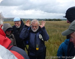
We found the Burble Well easily. I could tell that the group were impressed by the way they asked incredulously if this was “it” and also by the dark mutterings concerning how to test the depth of a well by the insertion of a walk leader as we poked the oily slick on the surface of the orange water with a walking pole to make sure that it was something ferrous and not the contents of a tractor’s sump. As the North Atlantic began to unload yet another fierce and refreshing shower, I detected the first rumblings of rebellion. We returned to the cars the quick way, getting even wetter in the process.
The reccy was miles and miles and miles and involved much retracing and, indeed, splodging through cold, black, smelly water. The walk was advertised as eleven miles, but we managed about nine and a half. This walk would be better in a drought, perhaps when the skylarks are singing high in a blue and cloudless June sky. If you tried it when the bogs were frozen, you’d never get up the road to the start.
The map represents the route as it should be and not the Noah’s Ark Option.
Note that the “danger area” is an active army firing range and, despite the existence of rights of way, should not be entered when the red flags or bullets are flying.
Monday, 1 October 2012
Mobbing by Moo Cows
Today was the day for doing my adopt-a-path stuff at Blanchland and Edmundbyers. I considered, however, that since I walked the Edmundbyers path twice for the DCC guided walk only a week or two back, that I didn’t need to do it again and instead, I would investigate some of the shoreline paths at Derwent Reservoir, particularly as Bruno had been nagging to go there for a while as he’s never been. And neither had I.
But first, we had the little matter of the six or so miles from Blanchland , up to Townfield through Deborah Wood and back to Blanchland over the bridleways on the moor top.
This went well. The Deborah Woods paths are getting a bit muddier, probably since this last September that’s just drained away provided some 150% of the usual September rainfall and the summer , generally has been the wettest since Noah got his first dinghy. So no surprises there.
The shored-up path to Townfield continues to fall apart very very slowly. I can;t detect much of a change since last May, in fact – but I’ll report it anyway.
And then we were ambushed. We entered a field full of suckler cattle and it became apparent, quite quickly , that they weren’t too keen on Superdawg’s presence. I let him off the lead and he decided that walking close at heel would be a good idea in view of the aggression starting to develop amongst our udderred friends.
They began to run at us and I had to wave my arms about and shout a bit to fend them off. Bruno retreated up the hill in short order. This was the wrong direction. I called him back. The cows got a bit madder and Bruno weaved amongst them, tail between his legs, causing even more havoc. A riot was developing. I did some more shouting as they came too close and chased them off. Bruno buggerred off in the downhill direction. This was a good decision as the now completely mental herd followed him at speed and forgot about me.
I didn’t take any pics as I was busy.
He waited for me by the gate. We escaped. there was a lot of noise behind us as we beat a retreat…
To Derwent Reservoir. I’d intended to see if I could circumnavigate it. The answer was “no”.
A path goes up one side for a couple of miles and a path goes up the other side for a couple of miles, but a complete circuit would involve road walking. So we didn’t. Its very nice, though, and the path is well made and easy to walk on. I introduced Bruno to some belted galloways who were much more civilised than the sucklers and were only interested to see what we were and whether or not we’d brought any hay. Or silage. Or anything.
We did eleven miles altogether.
Bruno’s attitude to cattle has hardened.
Saturday, 29 September 2012
Tunstall Haute Route
OK, it’s a bit of a pretentious title for an eight mile walk on the edge of the Pennines. but it’s just a joke, see? And it’s a higher route than the other Tunstall walks wot I do for the council – hence the “haute” bit.. (Apols for being cheeky to the camera by the way, but this kind of behaviour is starting to be expected by some customers….)
Anyway, me and the Dawg reccied this walk the other day – the day, in fact, that it finally stopped raining after dumping all of six inches of the wet stuff on the North of England, causing all kinds of damp chaos including the closure of the A1(M) motorway for several days and inundating York yet again, and washing away some of Wolsingham’s ducks. (They seem to have returned a couple of days later)
Dave and Anna stewarded the walk on Friday, and seventeen people turned up for a potentially sloppy round.
Bruno discovered that parts of the walk were found to be underwater on the reccy, so a few adjustments were made. It had dried out a bit by Friday, but the ground was still pretty much waterlogged and generally a bit sloppy in places.
And the path along the moor top, which is the main point of the walk in that it’s a high-level poddle with extensive views into the Tunstall dale below – has been trashed somewhat by those people in four wheel drive vehicles. But they like a quagmire. Its no fun without a quagmire. Durham County Council punters, on the other hand are not so keen on deep mud.
It’s a nice little walk, though, with nothing threatening, apart, perhaps than the occasional suckler herd; although me and the dawg weren’t bothered by the kie who just watched us pass by with just a hint of interest.
Me and the dawg lunched in the shelter of the walls of the disused Crook to Sunderland railway line, but with the guided walk, we sought instead the shelter of the picnic area near the head of Tunstall reservoir, there being a bit of a chilly autumn drift from completely the wrong direction for the comfortable scoffing of a beef and onion butty and some ginger cake.
The old railway line went over the hills from Crook to Tow Law and joined the Stanhope/Weardale line at Waskerley and it was this junction in World War Two that was chosen for a large ammunition dump – the remains of which are still extant and used for storing old fire engines and buses and also for the exploits of the County Durham doggers – a cold and draughty spot for that sort of thing, I would have thought.
A brief shower produced a rainbow and the Biggest Stile In the World produced some mild excitement before we followed the easy path beside the old park wall back to Wolsingham.
It’s eight and a bit miles. Here’s a map. Bring your own banana.
Note that due to flooding the route alongside Tunstall reservoir was not followed. Instead, we went along the road on the West side of the pond.
There was also a minor diversion in Wolsingham due to a white van driver with a load of “stuff” who blocked a path. He was till talking to himself as we left him to it.
Tuesday, 25 September 2012
A Bit of Mallerstang Edge
I met the nephew at Thrang, just at the foot of Lady Anne’s Highway over the side of Mallerstang and he, me and the dawg wandered up the bridleway as far as Hell Gill, passing the sculpture placed in tribute to the sacrifices of many a brave lobster in the never-ending pursuit of the perfect thermadore. This sculpture is in the form of a huge lobster claw, rearing up out of the thin limestone soils representing hope, failure and rebirth by recreating in mock stone the many attempts at cooking the perfect lobster that ended up being buried in the back garden.
Hell Gill is an enormously deep and narrow limestone gorge, almost a roofless cave, in fact, which is spanned by a bridge and which begs for exploration from the bottom to the top. Or from the top to the bottom. I must do this some time, before I get to old and senile to ..er…. are you our Graham? I didn’t take a pic as I was still overwhelmed by the sheer beauty of the lobster a mile or so back. These things are always an improvement on real nature dontcha think.
Incidentally, for those who considered that the cow in the picture in yesterday’s blogpost was beautiful, take a look at this sheep. Now worrabout that eh? Impressive, eh? Bit of a knowing wink, there….
Anyway – we progressed up an intermittent path alongside Hell Gill beck to the edge of Hangingstone Scar – noting several sheltered camping spots in the gill (note for all readers named “Dawn”). Hangingstone Scar is impressive and is the start of Mallerstang Edge. We left the Edge to bag the top at Archy Styrigg and followed the wide, grassy ridge easily to High Seat, lunching just out of the perishing draught in the hags at the head of Gale Sike.
Gale Sike gives an easy route back down through the crags – easier if you trend a bit to the North to avoid a steepening. More camping spots were noticed at the foot of the main slope – nice, flat places with a bit of shelter and a small stream of good, clear, water and, not to mention the cracking views West and North.
We did a sort of descending traverse from here back to the parking spot, which we managed to hit pretty accurately, mainly by aiming for a farm on the hillside opposite and not using any of your modern aids such as maps or compasses. I like to call this the “wet thumb” method. This is very accurate if it doesn’t get foggy or anything (!)
We put the world to rights and talked about music and stuff for eight miles and about 1700 feet of up. The dog didn’t really join in.
Longer walks along Mallerstang Edge are available, specially if you use the train to get from Kirkby Stephen to Garsdale where you can use the ridge to get back to the start. The walking is generally quite easy.