statcounter

Friday 30 March 2018

Messing About in Some Snow

DSCN2758
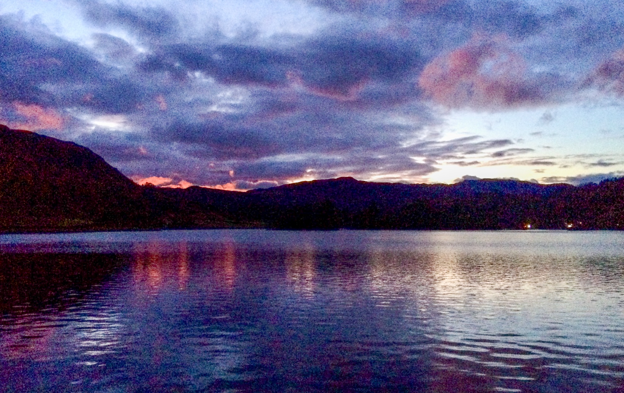
We have several grandchildren staying at Pietowers at the moment and it’s my role (apparently) to keep them entertained in between hours of Minecraft on the Netflix, whatever that means.
The other day, we visited Gibson’s Cave at Bowlees where it’s possible to get behind the waterfall. This was followed by paddling in the beck (I kid you not) and hot chocolate and scones at the cafe. This, though, WAS NOT ENOUGH. So, we went in search of snow and found some large patches and drifts just over the border of Cumbria beside the road to Alston. Sproglets had a play whilst I guarded the car [!]. It was drizzling, though and. already wet from the beck at Bowlees, and, not really equipped for life in the snow, drizzle and nithering North Atlantic breeze, the antics turned to shivering competitions and were soon abandoned and we returned to the relative warmth of the knipetowers buttery.
DSCN2749DSCN2751DSCN2753
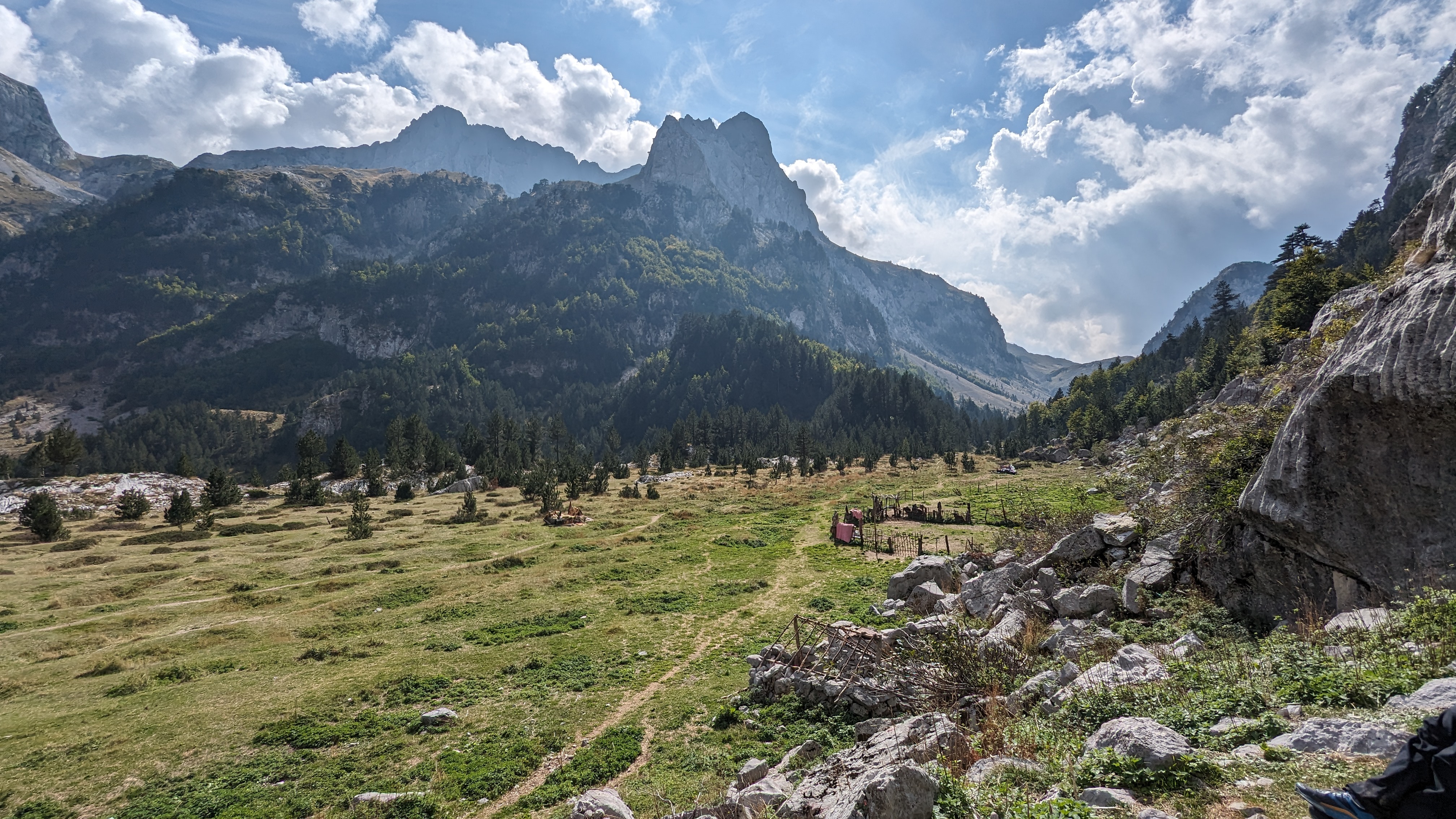
Two days later, and equipped with coats, boots, trenching tools, gloves/mitts and an ice-axe and hats, we returned and a happy day was spent digging snow-holes (mine was the best!), climbing up steep snow (I was best at this!), sliding down again (they couldn’t compete with my epic slides!), discovering crevasses (I found the biggest/deepest one!) and, generally getting wet and cold (not me, I’m too clever).
Half-time was home-made very hot lentil and sweet-potato soup wot I made and butties and crisps and stuff like that.
DSCN2757DSCN2759DSCN2761
No miles were done. There was no measurable ascent. Several tonnes of snow were shifted, much of it into boots and trousers for melting on the journey home and no significant injuries were sustained, apart from some borderline hypothermia which was treated back at Pietowers with a bathful of hot water, a small plastic boat and a small, yellow toy duck

.DSCN2760
I would expect the snow to be thawing now, but, apparently, this morning has added another three or four inches of white-stuff to the remaining patches. I say patches, but there’s elements of glacier in the stream-bottoms, the snow being covered up with layers of shale from floods and thaws and refrozen a few times into a hard, dirty ice and the drifts are twenty or thirty feet high and overhanging in places. It’s all good, clean fun and very safe, (well, fairly safe anyway ) though and run-outs were into soft cushions of snow/ice so, even short flights off overhangs were undertaken. And we even managed a couple of ice-axe braking practice runs. That was a short summer, though, innit?
This was my idea by the way. Just sayin’.

Wednesday 28 March 2018

Wolsingham Wayfarers (More) Teesdale Waterfalls

DSCN2735
A couple of weeks ago I posted a blogpost about reccying a route in Teesdale which connected up several waterfalls. After a short email exchange I decided that I’d actually lead a walk similar to that already planned by Wolsingham Wayfarers, but with an extra bit on for added value, thus providing a twelve mile walk substantially coincidental with an old Durham County Council guided walks route originally titled “Best of Teesdale”. That walk was a bit longer, though, so I chopped a bit off. I was leading this walk because the original leader, Neil, has an injury which prevents him lrading walks for the time being.
So, the original walk would have been 9 miles, I thought this one would be 11.5 and various GPS readings gave 11.8 to 12 miles in the end.
DSCN2731DSCN2732
Spring had decided to spring on the day and the clocks had gone forward, so in lovely, bright sunshine, but still with a seeking nithering edge to the breeze, just five of us plus LTD started off from Bowlees, followed the Pennine Way up past Low Force, High Force and Bleaberry Force to the lovely juniper woods at Bracken Rigg and then over the Green Trod to the Tees. We returned to Forest in Teesdale via the ruins of the pencil factory (some readers at least will know where this is) – and back to the start by lanes and paths which form the old routes up the Dale which existed before the current main road was built.
DSCN2737DSCN2740DSCN2741
The sun shone, the lapwings lapped, there were meadow pipits on the hill and lambs in the fields, and even a patch of Coltsfoot and the keepers were setting fire to the moors. Yes, it was (eventually) spring. There was still some snow, though – some very large patches and old drifts of old, hard snow.
DSCN2742DSCN2743
I really should have done another reccy before doing this walk, but I just couldn’t fit it all in. The route was fine, though, apart from a couple of missing suckboards and a minor navigational brain-freeze. The “other” walk which me and LTD did the other week and which links up seven (or eight, depending on the counting strategy) is a cracking walk as well, in my ‘umble, and can be saved for future reference, either for the Wolsingham Wayfarers group, or the Wednesday Walkers Walking on Saturdays group or, even, another group. Or even a combination….
The walk was 12 miles and 1700 feet of upness.
DSCN2744DSCN2745
Guided walks by Wolsingham Wayfarers are free to attend, dog friendly, human friendly and excellent and details of their programme can be seen here (click it!) No booking required, just turn up.

Saturday 24 March 2018

Mizzly Stuff in the Howgill Fells

DSCN2722

This was another TGO Challenge preparation walk – the idea being to do lots of contours. As a fairly gentle [koff] introduction to this, I chose the Howgill Fells – one of the Howgill classic walks from Sedbergh to The Calf, Cautley Crag and Spout returning via the clarty bridleway from Cautley to Sedbergh, but with some additional contours added by the inclusion of Yarlside. This would all add up to about 1000 metres, which is only exceeded by four of the thirteen days of my TGO challenge route at 1350 metres.

DSCN2719DSCN2720

So, me, LTD and The Bro marched out of Sedbergh on what is now the Dales High Way route (not sure when this happened) – and we heaved our way up the first contours into the mist and drizzle. Navigation to The Calf is very easy since the path is heavily engineered and surfaced for much of the way and reliably turns up at the trig on the top even though it seems, at times, in the murk, that it’s going too far downhill at one point. But it isn’t.

DSCN2721

DSCN2724

It was far too nithering to be sitting around lunching at the summit, so we did some proper navigation and turned up an short time later at the posh arty sheepfold in Force Gill (not in the beck, which is, of course, Force Gill Beck). This seems to be a nice place for a bivi or overnight if its a bit windy although sheepfolds always seem really attractive places to lunch out of the wind till you actually get there and then they’re usually draughty and often quite wet, having firtly interfered with the local drainage when they were first built, and, secondly, having played host to generations of sheep whenever it was they were actually used for gathering sheep. Still, it was out of the worst and as my chicken, tomato and mustard butty slowly disappeared, the clag, glaur and mizzle seemed to be lifting.

DSCN2725DSCN2726

We passed the top of Cautley Spout which was still wearing a bit of icing and followed the high-level path to Bowderdale Head, climbing the apparently huge and beetling grassy buttress of Yarlside by a thin trod which climbs next to the final re-entrant of Bowderdale Beck, a steep gully, speckled with mouse-holes, complete with entrance-piles of mouse poo. LTD is often interested in mice and has eaten one or two in his time. On this occasion, when I introduced him to one of the holes, he just ate some of the poo.  Dhuhh…. Should have let him have some of my chicken..

DSCN2727DSCN2728

We descended to Cautley by the long ridge to Ben End, found the bridleway footbridge, which is not quite where it says it is on the map, and plodded back to Sedbergh on the bridleway which was quite clarty and is now Wainwright’s Pennine Journey route. There were some very pregnant sheep on the bit. I must say, I do try to avoid going into pastures with lambing sheep with a dog at this time of year. This time the sheep seemed fairly relaxed about LTD, or maybe they were too heavy to move very far very quickly. I don’t think any harm was done, though – LTD was kept really really close and we did give the ewes time to waddle out of the way.

DSCN2729

It was 11 miles and 3600 feet of ascent, which was reasonable progress, I think.

There’s a map below in case anybody…..

As a footnote, I would confess to being a bit knackered after this walk, although the merlot I got at Kirkby Stephen Co-op later on helped with my recovery – thanks for asking.

the calf yarlside

Tuesday 20 March 2018

TGO Challenge Preparation–A Pilgrimage

DSCN2712

I had a different 17-mile walk planned which would have started at Hawes, but there having been a heavy snowfall over the last few days, and with pictures of huge snowdrifts appearing on-line, I opted for a low-level trundle between the 7th Century Saxon (Anglian, really…!) Church at Escomb and St Cuthbert’s Cathedral at Durham. The church at Escomb is one of the oldest stone builkdings in Britain and is built from stone robbed from the nearby roman fortress at Vinovium, just outside Bishop Auckland. One stone has the inscitption “LEG VI” upside down and there’s also an arch pinched complete from the fort.

DSCN2696

Most people doing such a walk would probably have entered both buildings, but having LTD with me, and covered in clarts (mud), I thought they probably wouldn’t have let me in. So I stayed outside.

The seed of an idea for this walk was sown by a member of Crook and Weardale Ramblers (he knows who he is). Apparently, there’s a chap going around doing pilgrimages between significant eccesiastical locations and, for County Durham, these two churches are pretty significant.

DSCN2699DSCN2700

The route is simple. The Weardale Way passes Escomb Church and follows the River Wear all the way to Durham. Its then a simple matter of walking uphill from the river to the cathedral. The distance is 15 miles, but by starting at Escomb School and having to walk to Durham bus station, I managed to increase the length of the walk to just under 17 miles, which was my training target for March.

DSCN2701DSCN2703

Apart from a few minor diversions which don’t appear on my OS map, and a couple of fallen trees, the main difficulty was mud. Mud at Brocken Banks, just outside Bishop Auckland was the worst and a lack of waymarks makes decision-making about how to progress with any digity at all quite difficult. Many walkers will have encountered rocksteps. At Brocken Banks there’s a mudstep, only overcome with some difficulty and a young ash sapling. Here, there is quite a strong possibility of falling backwards into a soft and splodgy landing.

DSCN2705DSCN2706

Other places had no waymarks at all and the mud of the Croxdale woods was specially clarty.

It might be better in summer, apart from the additional hazard of cattle, I should think.

But it’s a good walk and those of a religious bent might consider giving it a go. There’s enough to make a rambler sufficiently smug and a bit pious about overcoming any hardships which might be encountered.

Logic seems to be calling me to extend the route to Jarrow and then, maybe, to LIndisfarne. If I get the time I might do this at some point.

DSCN2709

Saturday 17 March 2018

Much Mooching in the Malvern Hills

DSCN2679
The Malvern Hills had been on my List of Things To Do for a couple of years. It’s a long way from Pietowers, so a couple of days at least was required.
Dawn appeared at Durham Train Station and we slipped off down the A1 to the Travelodge at Hartlebury, which is tolerably close to the Malvern Hills, but inconveniently on the wrong side of Worcester. On the upside, there was a kettle, it was warm and dry, and it wasn’t all than much more expensive than camping. And there was less of that mud stuff and trekking to the toilets…. 
We did two walks.
DSCN2676DSCN2677
Firstly, we parked prettily for four quid (four quid?) at the foot of the ridge leading to Worcester Beacon. This is the Malverns highest hill at 425 metres, but looks higher.  The sun came out and, if you sat in the sun, out of the wind, you could have been forgiven for thinking that it was mid March. Which it was. LTD in particular enjoyed the sunbathing whilst I scoffed a squishy banana.
We progressed Northwards over Sugar Loaf and North Hill, returning almost to the car park via paths which contoured around the hills we’d just climbed. The Malverns have lots of these and they’re outrageously enjoyable and easy to walk on.
DSCN2678DSCN2682
So, we passed the knipemobile, which was still there, lights off, wheels still on, and wandered Southwards, pretty much as far as we could go and stay on the ridge. And so, we bagged Perseverance Hill, Jubilee Hill, Pinnacle Hill and Black Hill and returned to the car on one of those lovely contouring paths that they have wot I’ve already mentioned.
DSCN2688
On the Wednesday, we went to the car park at the foot of British Camp. Here, we paid yet another four quid (four quid?) (again?), had a very nice bacon roll at the cafe there and set off over Herefordshire Beacon (which has the British Camp on it) ( One of the supposed scenes of Caractacus’s last stand before he escaped to County Durham/North Yorks to Cartamandua, Queen of the Brigantes dontcha know, who betrayed him to the Romans, leading to a revolt by her husband/brother Venutius and ultimately the conquest of Hen Ogledd aka Northern England and the Borders, so, a right old bugger-up in other words)  I did notice that several trees, including one senior hawthorn had a beautiful crown of mistletoe. The mystical relevance of this, specially so adjacent to several iron-age fortresses should not go unmentioned, which is why I mentioned it. I should also mention the oaks, ashes, hollies and so on…. AND I should mention that three of the four local hill-forts have evidence of a violent and burning end to their existence, but not, apparently, the British Camp, which seems to have just been abandoned, maybe because Caractacus had buggerred-off to Yorkshire, right up the A1(M). There is scant historical evidence that he and his peripatetic war-band purchased  bacon rolls at the services at the far end of the M18, although we did, and they were quite nice. And, historically, if any bacon rolls were purchased, this is the most likely spot. It’s also where the locals a start calling you “Luv”.
DSCN2683DSCN2689
So, we wandered down the ridge, bagging Swinyard Hill, Midsummer Hill and Ragged Stone Hill, returning via bridleways and contouring paths (Have I mentioned these before?) back to the knipemobile which was exactly where I left it save for a very small amount of continental drift and a huge but indistinguishable shift in position in the Universe and Everything.
DSCN2690DSCN2691
I liked the Malverns – lots of contours in a short distance, and extensive views both East and West. There’s clearly a lot of pedestrian pressure and the footpaths are hardened in many places, and there’s lots of them. And there’s lots and lots of people about. You need to have a wee before you set off. Just a tip there for you…. 
And we managed somehow to have two consecutive dry days in between some horrendous driving in heavy rain and spray for hours and hours of motorways.


Saturday 10 March 2018

Teesdale Waterfalls

DSCN2671

The lesson for today is to “READ THE INSTRUCTIONS BEFORE ASSEMBLY”

I had it on my List Of Things To Do to reccy a walk for Wolsingham Wayfarers up Teesdale. In my mind (what’s left of it) I had the words “Teesdale” and “Waterfalls”. So that’s what I did.

Me and LTD waited for a bit for the worst of the snowdrifts to clear and off we went armed with only an OS map and a cheese salad sandwich (and a banana, coffee, protein bomb things and some 85% Free-trade chocolate)

DSCN2651

DSCN2653

We did this walk and managed to link up seven lovely waterfalls in Teesdale AND, not only did we manage that, but we did it in the apportioned Nine of the Queen’s statute miles. We returned to Pietowers in smug mode and celebrated with some Californian merlot on Friday night. (Friday night is merlot night at Pietowers) (It doesn’t have to be merlot, actually, almost anything will do.)

DSCN2655

DSCN2658DSCN2659

Just now, I looked at the programme and it said there was a walk on Sunday 25 March 2018, 9 miles (so far so good) Teesdale Waterfalls (Yes, yes, still good) and Cronkley Fell. What? Cronkley Fell. We did not venture up Cronkley Fell.

Still, what could possibly go wrong? I’ve been up Cronkley Fell loads of times and I don’t think I’ve got the time to do another reccy.

On the upside, the walk we did was really very nice and I diswcovered a few places I’d not visited before and it was all rather lovely.

DSCN2663DSCN2664

There was still a fair amount of snow left – some of it very deep indeed, and there’d been a few small avalanches in some places.

There are indications that the Beast From The East might well return for a short spell in about a week, so, maybe, by the 25th of March, there’ll be new old thawing snowdrifts to cheer the place up and beef up the water levels in the falls.

To see Wolsingham Wayfarers programme visit wolsingham wayfarers guided walks (click the linkm innit) The walks are excellent and free and if your dog is well behaved (like wot LTD is), he/she can come too.

DSCN2666DSCN2667DSCN2669DSCN2673