statcounter

Thursday 25 January 2018

Langstrath Dipping Possibilities

DSCN2446

Y’see, I hadn’t forgotten about the pools of Langstrath. We now have a short hiatus or space in the Pieblog before we do more walkies this weekend (free guided walk from Westgate to Rookhope over the tops on Sunday starting at 10:00 c/o Weardale Wayfarers and lead by LTD, closely followed on the blunt end of the lead by Yours Truly – bring own egg and tomato butty)

Hennyway, below is a bunch of photographs of some pools which can be found in Langstrath. Langstrath is the rather beautiful side-dale of Borrowdale, accessed from Rosthwaite which has a car park and a pub, or there’s a bit of parking near the school.

There’s a moderately easy walk of around 8 miles which heads up the West side of Stonethwaite Beck as far as Tray Dub and returns to Rosthwaite after crossing the footbridge there by the Cumbria Way path on the East side of the beck. Route finding is pretty straightforward.

RSCN2462

There are pools suitable for dipping,  some hugely deep and some fairly shallow, at various points on the walk. The star pool is Blackmoss Pot which some people will jump into from the rocks above. This is much too dangerous a prospect for me, though, I can tell you, and I would probably die almost immediately on sudden contact with the cold water. This  would probably spoil my day out completely.

Two of these pools – Galleny Force and Blackmoss Pot are listed in Daniel Start’s excellent book “Wild Swimming” available at all good bookshops and one or two bad ones.

Ideally, you’d want to wander up there on a warm day, maybe with a picnic,  or you might be heading towards Rosthwaite after a day on the fells, in which case a nice dip might well be Just The Thing. I am aware that some people do like to dip at any time of year and that some people may well feel over-dressed in a cozzie or in their undies or shorts, or whatever. I’d just point out that the footpaths are often very well populated with walkers so you might want to use some discretion about this.

Whatever is your desire, the deep, green pools of lovely, clear water are inviting and very “refreshing”.

Should you not be sufficiently wet after this plodge, there’s more pools available a bit further up the beck from Tray Dub

DSCN2444DSCN2448DSCN2449DSCN2452DSCN2453DSCN2454

Sunday 21 January 2018

Snowdays

DSCN2503

Its like the middle of January out there, folks.  We seem to be having a winter this…  er….. winter. Me and LTD’s last three walks have been increasingly snowy.

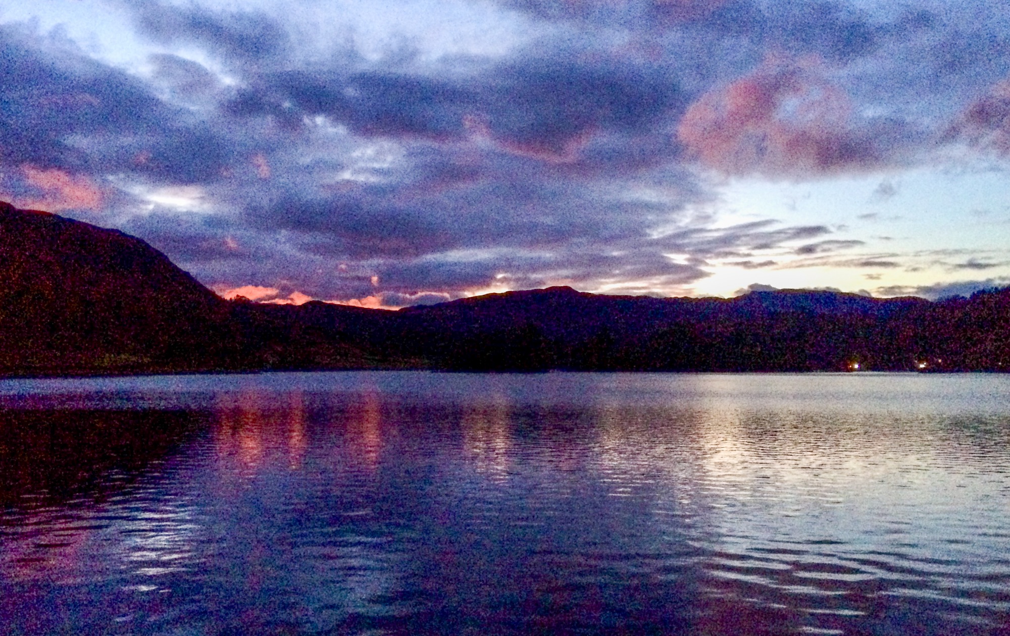
Midweek, we went to Bolam Lake in Northumberland, passing four cars off the road on the A68 and another just by Bolam Lake’s car park. There was a bit of drifting off the fields.

DSCN2482

This was the occasion of the Wednesday Walkers Walking on Saturdays Except To Say That It Was a Wednesday. I was at the back today, making sure nobody came adrift and that all the gates were as they were before we passed. My personal objective was Shaftoe Crags, a small hill that had defeated the gentle attentions of me and Dawn way back in 2017 when we’d been somehwee else and thought it looked interesting.

There was snow. Not all that much snow. And there was ice. A fair bit of ice. We went across the fields to Bolam church where there’s a repaired hole in the wall after a member of the Lufwaffe, somehow disoriented by the absence of Sunderland docks below, where it ought to have been,  and being harried by two RAF fighters, jettisoned his bombs, one of which bounced off a grave and entered the church making  a new hole in the wall. Apparently he came back to have a look fifty or sixty years later and received a cordial welcome from the locals, specially as he hadn’t killed anybody, I suppose.

DSCN2485DSCN2487

After a chilly trek around the flatter bits of Northumberland, our leader announced that he was shortening the walk and wouldn’t be visiting Shaftoe Crags. I mentioned that in this case, I’d be leaving the walk, and there was a general consensus that maybe we should head up there anyway. In any case, the walk avoided the summit, so I nicked off and bagged it anyway. It was only 150 metres away.

We did 11 miles altogether.

DSCN2499DSCN2502DSCN2504

And then there was a doggy walk – a routine one up the Deerness Valley Railway path to Stanley Beck and through the woods back over to Stanley Crook. Now the snow was deeper and, in the pristine fields where nobody had ventured before, LTD was able to charge about and bark and eat some snow. It was almost  6 miles of hard work. But the winter is quite beautiful in the sunshine.

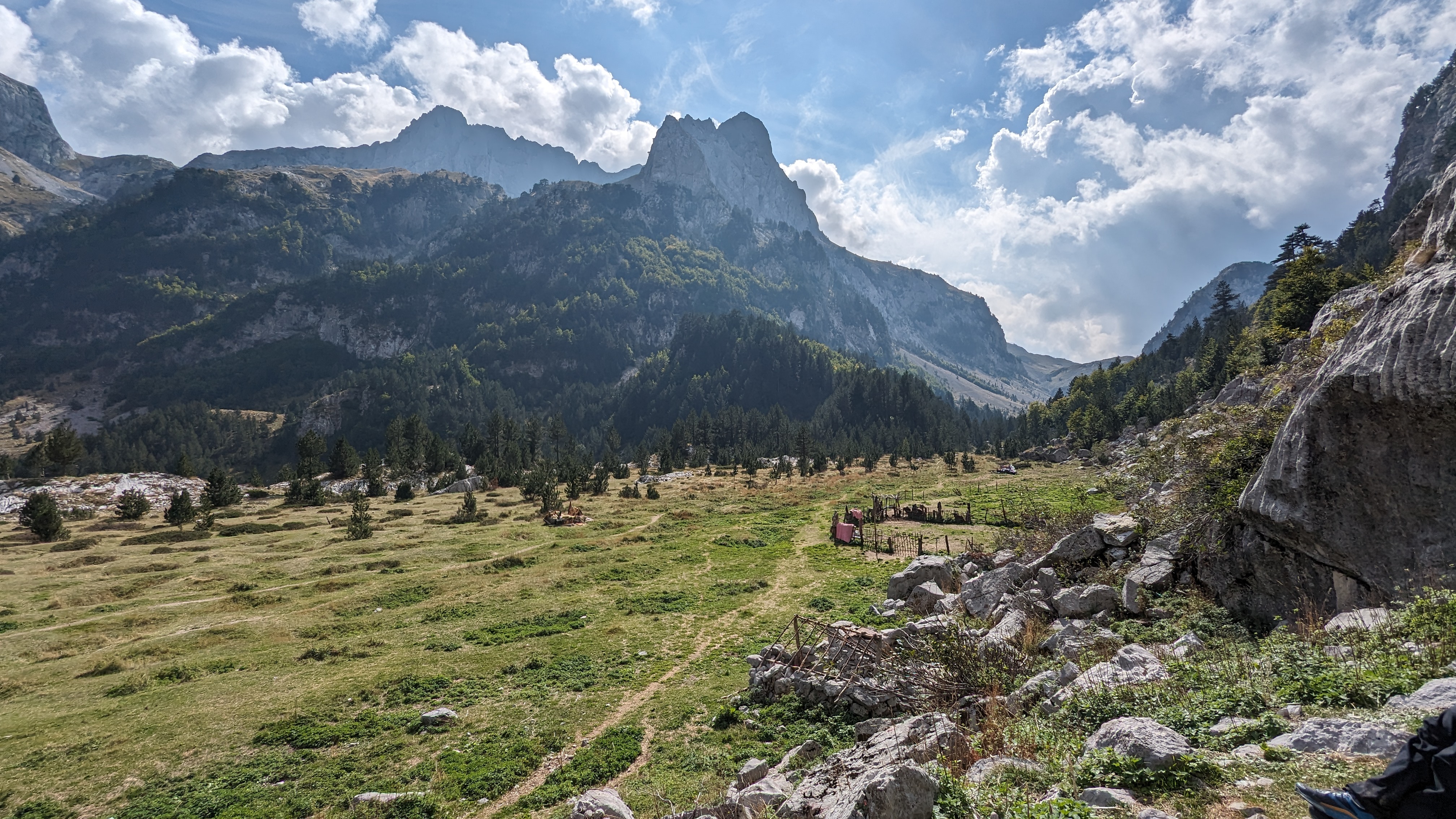
It gets no warmer. I have a Weardale Wanderers guided walk to lead next weekend, so LTD suggested that we’d better do a reccy. This route is an ex-Durham County Council walk which heads up from Westgate in Weardale, through Slit Wood and over the tops to Rookhope. We didn;t get as far as that.

DSCN2509

Slit Wood had just a moderate snow cover which got noticeably deeper with distance. By the time we headed out over the moor to Scarsike Head, it was generally knee deep and quite soft. Some parts were navel-deep and the whole event turned into a desperate struggle. Even LTD was struggling. We battled on up the hill, eventually achieving the stile onto the road at the top. Here, a chap with a landrover said he’d been stuck there overnight as the snow made deep drifts on his line of retreat. He expected to be there for at least another night. He had managed to nip home and return and refused some hot coffee.

DSCN2512DSCN2517DSCN2518DSCN2519DSCN2520

It was clear that I wouldn’t be able to complete the route and would probably run out of steam before having to do the return journey from Rookhope to Westgate. So we abandoned and walked (struggled) down the road back to Westgate. For the first mile there were deep drifts, hard to see in the available lighting. A 4x4 came up the hill and met me at the point where the tarmac became visible. I told him the road was blocked. He seemed quite grumpy in the way that some 4X4 drivers like to reinforce prejudices against 4X4 drivers, so he went on his way up the hill. Hopefully, the chap with the landy got away in a reasonable time. He did seem pretty relaxed about it and mentioned that it wasn’t the first time…

A few minutes later, he returned, at some speed. He obviously didn’t have time to chat about the snow drifts.

DSCN2523

We only managed 5 miles altogether. We were both knackered, frankly, and spent the rest of the day supping tea (or in LTD’s case, snoozing in his cosy bed next to the radiator)

I’ll have to go back sometime this week and finish the reccy. The lesson is that if you think you might need snowshoes, take some snow shoes, yer big daft twerp.

As a post-script, I would say that whoever repaired the footpath in Slit Wood, you’ve done a cracking job.

And I won’t be taking any loony comments from Westgate locals about what people choose to plant in their gardens or whether or not they like to put a notice on their gate reminding walkers to keep their dog on a lead and to pick up the dog’s poo. Just sayin’

Will the winter continue in the same fashion? Will I remember to take the correct kit next time? Will the ice on my whiskers melt before I get home?

Monday 15 January 2018

High Cup Nick and Backstone Edge by GPS

DSCN2475

Langstrath pools will have to wait a little bit longer for a blogpost because, in the meantime, me and LTD did this one:

DSCN2464

The idea was to bag two fairly diminutive Tumps at Dufton – Harthwaite and Keisley Bank. Harthwaite is not open access and bagging the summit is a trespass, but, as there was no stock on the hill, and nobody to witness my ascent, I considered it fairly harmless to visit the top. It’s a lovely, green hill with a small disused quarry on the top and a gate at the bottom gives access to a lane which, in turn gives access to the open access land on which stands the slightly higher Keisley Bank.

DSCN2465

Keisley Bank has a steep scarp facing the Pennines, at the foot of which is a small but bijoux tarn, – Studgill Tarn -  hidden away and, probably, not very well known.

DSCN2469

The plan was to bag these two and then head up to High Cup Nick via the Pennine Way and getting there involved negotiating a series of broken walls, gates, frozen bogs, unfrozen bogs and some sheep pens. When we arrived, the results were disappointing. The fog was down, the wind nithered through the nethers and the ground was frozen hard, so we retreated inside our big orange group shelter for a chicken salad butty, a Coopland’s curd tart (don’t mention this to the cardiac nurse or, indeed, the dietetic nurse). In the comparitively tropical climes of the big orange bag, we (that is to say, me) consulted the Howgills and Eden Valley OS map for a continuation of our adventures.

DSCN2470DSCN2471

A traverse of Backstone Edge was the decision. This involved switching on the Garmin, selecting the trig point on the summit as a target and heading off up the steep and rocky edge into the feeezing misty murk of Backstone Edge. Almost immediately, we put up a large male (? dog ?buck ?bull) hare who hared off into the glaur. Everything was well iced and it took us a good half an hour to get to the trig point. The trig point is about to fall over. A second target, just 200 metres away, was the high point, at 699 metres. We found a cairn quite close to this point, but not quite at the point marked on the map.

DSCN2474DSCN2478

Next, was a “mine”, about 700 metres away and down a steep slope. This marked the start of a bridleway whioch eventually leads back to Dufton via Great Rundale. Great Rundale is a huge gash in the hills with mines in the crags at either side and a very large area of industrial devastation at it’s head. This is not pretty, but lower down, the valley becomes deep and impressive and the track leads easily back to Dufton.

We did 10 miles and 2600 feet of ascent. I was quite glad I had the Garmin too. I don’t use it for seriously all that much although I do like to watch the distance to target numbers decreasing…  The back country behind Backstone Edge is quite rough going and a bit flat, so navigation can be tricky, although, in practise, the numerous ponds and tarns provide good targets, and the edge overlooking the Eden Valley is pretty distinctive.

backstone edge

Saturday 13 January 2018

Borrowdale 1 - Sour Milk Gill and Seatoller Fell

DSCN2439

Desultory arrangements resulted in me, LTD and Dawn nicking off to Borrowdale  on Monday last for a few days camping.

Two walks were done from the campsite at Chapel Farm – this one and an exploration of the lovely pools in Langstrath. Since some people might be  specially interested in the pools, in which much refreshing dipping can be done, in conjunction with a spot of sitting about scoffing chicken salad butties and bananas whilst soaking up the hot sun, I’m leaving that for a separate blogpost. So, you’ll just have to make do with the one walk on this one.

DSCN2433DSCN2434

It had been specially cold over the previous few days, and Monday night was a rippingly chilly night. although, at only –2C or –3C, quite a bit warmer than it had been.

The dawn (not Dawn (!) (dhuhh) ) was typically late for early January and despite the huge amount of sleep provided by the long and dark hours from 5pm the previous afternoon, it was specially hard to wake up, particularly in the light of various interesting, if irritating dreams.  LTD was snuggled on his own mat, with a woolly comforter and an ancient but serviceable four season sleeping bag and, apparently, hadn’t even noticed the onset of daylight to disturb his 14 hours in sleepy snoozy dreamyland during which his dreams seemed to consist of various bouts of running about and barking. But we did not care, because our target for today was Seatoller Fell, a small but contoury lump just above..er…Seatoller, so not too far away and easily acheived in a shortish timespan.  We were to get there via Sour Milk Gill, a steep and icy climb with a scrambly bit.

DSCN2432DSCN2435

There was no snow at this level – up to about 400 and a bit metres, but the paths were icy and the becks and waterfalls were heavily decorated, although not fully frozen.

And the sun beat down mercilessly. Actually, it was a bit chilly, but quite beautiful anyway, with spectacular cloud formations pouring over nearby higher fells and dispersing as they descended.

DSCN2436DSCN2437DSCN2438DSCN2440

We bashed and tiptoed and heaved our way up the path, cleverly designed to hold as much ice as possible, thereby making the whole expedition just that little but more of a thrill.

From the Seathwaite slabs, a wall lead us around the head of the corrie, under the ramparts of Raven Crag and, by contouring, on to the top of Seatoller Fell.

We returned, as the light began to fade, by the Honister Pass road, which was quiet and quick.

It was just about 6 miles and 1400 feet of up, most of it squashed into a small area above Seathwaite.

Just time for soup and a snooze to build up strength for  a stewed steak and spuds tea and our main sleep later on. This is what I like about winter camping, you can get sooo much rest.   ZZzzzzzzzzzzzz

Friday 12 January 2018

Shivery Walk (Upper (very Upper) Weardale)

DSCN2425

I’m doing a bit of blogpost catching-up here, being a couple of walking incidents behind.

This one is from 5 and 6 January and concerns “A Shivery Walk to the Border” The Border in question being the county boundary bgetween County Durham and Northumberland. This is a guided walk, initially done as part of Durham County Council’s guided walk programme (wot I’ve abandoned) and now done for the Wednesday Walkers Walking on Saturdays group, which is a kind of DCC splinter group, organised almost entirely by email by the redoubtable Eric Borley. Peeps can get on the list of email addresses by request. (Just ask)

DSCN2412

So, me and LTD did the reccy on 5 January. This was a bit late because the walk took place on 6 January, but the weather was , frankly ‘orrible during the week before and I had Christmas whisky to drink anyway, so it all had to wait.

DSCN2413

DSCN2414

So me and LTD did the reccy, from Cowshill , adding the summit of Middlehope Moor for an additional thrill and it was all very cold and snowy and a bit icy and windy and, a bit on the ‘orrible side to be fair. We began with  clear views and then the hill-fog came in and me beard froze, as did LTD’s tail and it was not specially very nice.

DSCN2417

Overnight on 5/6 January, it snowed again and, at 07:30 am on the 6th, it was dark and cold and there was heavy hail hitting the parapets of knipetowers and so LTD declared a rest-day – having briefly looked outside and then headed back to his cosy stink-pit next to the radiator in #3 Barrel-Vaulted Tower, refusing to consider putting a harness and lead on and threatening extreme violence to anybody who might try toi disturb his cosy time,  his favourite place. So I turned up with an empty lead, but , not unnacompanied, having collected Li Yang from her hilltop fortress on the way.

11 other people turned up.

The sky was blue and the cold was “noticeable” – partly from the fact that my beard froze and formed icicles where icicles are Not Required.

DSCN2422

We heaved ourselves up into ever-depening snow to the Northumberland boudary, crossed it and entered an arctic landscape of pure white and blue, eventually achieving the summit of Middlehope Moor with it’s immpressive 18 inch frozen cairn.  I suspect that most walkers were a bit underwhelmed after all that effort.

DSCN2423

The things got worse. We headed for a small square blob on the near horizon – rumoured to be an old sheepfold where the burning sun and the shelter from the arctic nither would produce conditions suitable for a coffee-stop and, if too much time were to be spent here, a lovely suntan which would make holiday-makers in the tropics or Australia jealous with rage, and those  wimpy doggies now abed curse themselves that they were not here..

This took some considerable effort, the drainage ditches and hags being hidden under deep and  soft snow, letting in whomsoever might go first up to their nips, and having to be lifted out by whoever was behind them. I spent several episodes up to my chin in snow.

In the end the sheepfold was a bit warmer and just about OK for brief stop.

DSCN2424

DSCN2427

DSCN2428

Then we had miles and miles of semi-frozen tussock and grass, whilst all the time being beaten by fierce and uncompromising blizzards of snow and bits of ice wot hurt on the face until we found shelter begind the complex walls of Race Yate where the blue and purple flourspar glints unnoticed in the weakened sun. [Thats enough of that sorta stuff by the way]

And so, we finshed more easily by roads and riverside paths back to Cowshill, 8 miles in total.

We might do this walk again next year. Please don’t try it in the summer, it’s much more fun when it’s a bit cold. and it’s much, much more beautiful.

shivery walk mark 2