
“Penhill” translates as “Hill Hill” You’d have thought a little more imagination could have been employed.
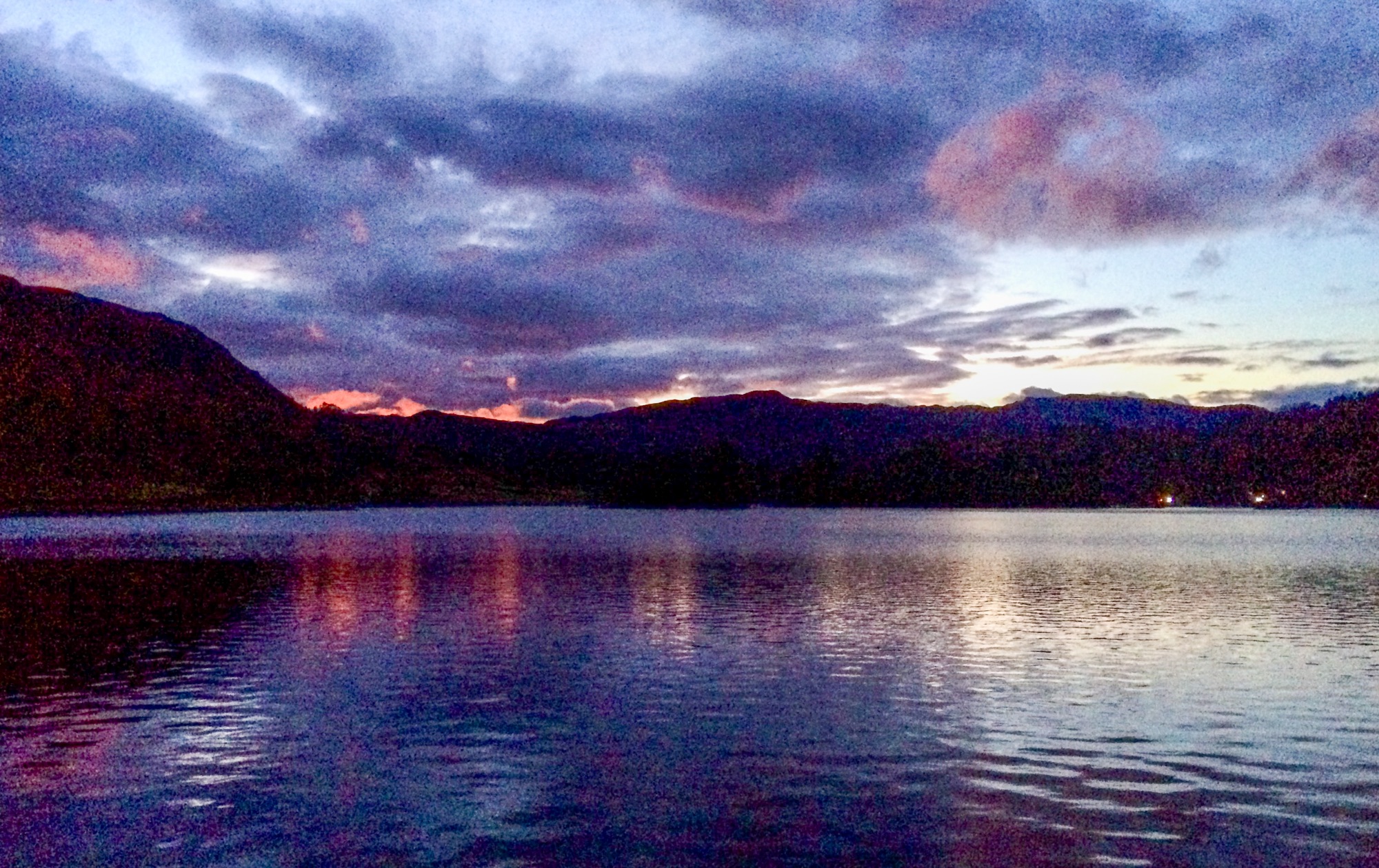
The detailed arrangements for this foray into the Yorkshire Dales was only arranged last evening when we eventually decided on a walk to the top of Pen Hill. “We” being me, superdawg and rellies Paul and Bev.
We met on the village green at West Burton where, unusually in these days when it’s traditional to squeeze very last drop of loose change from tourists and motorists alike, the parking is free. This fact seems to ensure that the village is full of parked cars on a summer Sunday and that the village shop and pub do a reasonable trade.

We set off for a look at the village’s waterfall,(Cauldron Force) which lies in a wooded bower and has a hugely deep plunge pool, ideal for plunging in on a hot day. We’re still waiting for global warming to produce a hot day, by the way…. Today, the place was aniseed scented with Sweet Cicely which seems to be abundant
This was followed by a foray along almost the full length of Morpeth gate, where it started raining. We’d expected this, though and the choice of hill was one about which we could be flexible and have a number of quick escape routes back to the cars if the weather turned specially nasty. But it wasn’t that bad, so we plodged on.

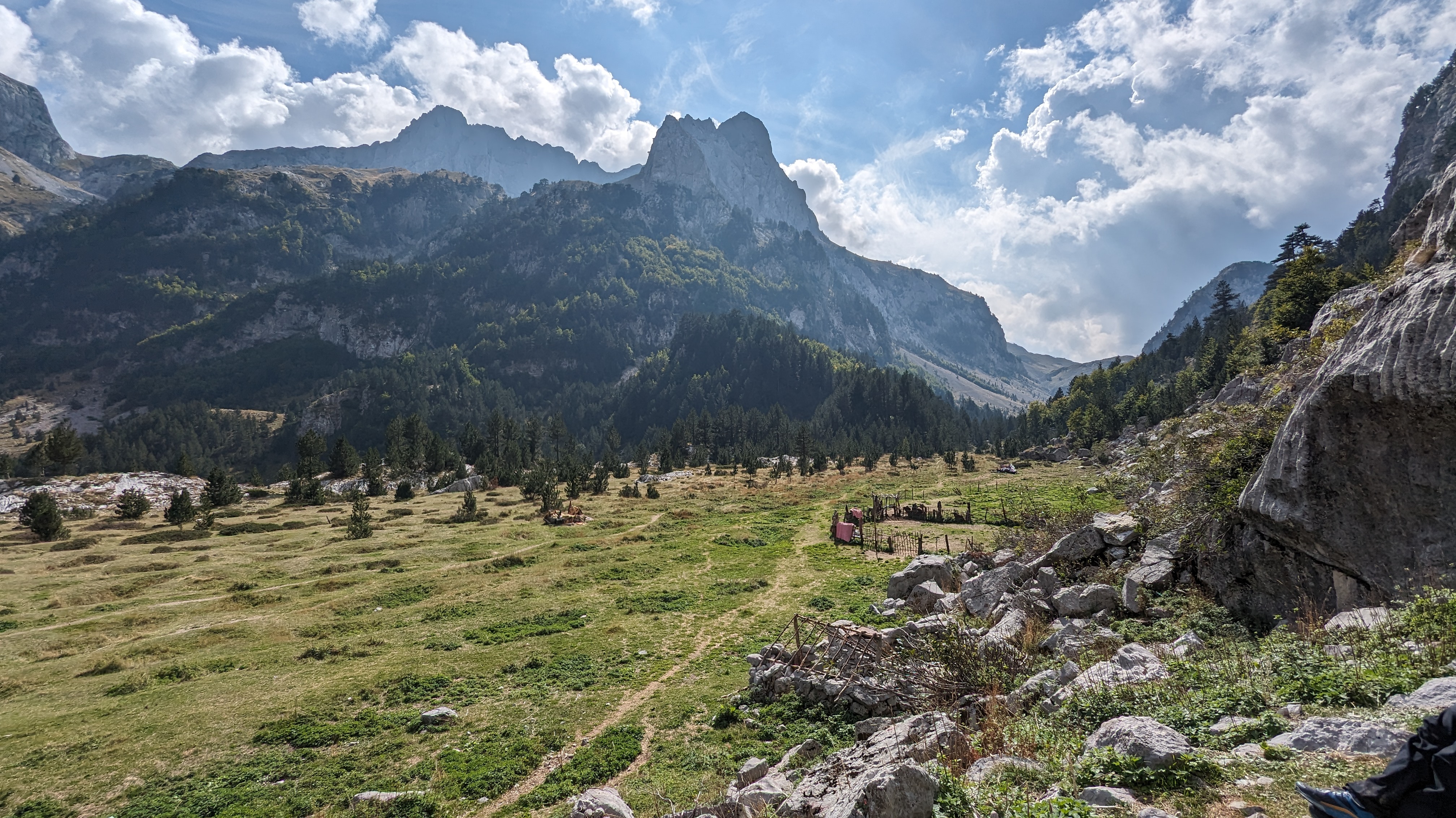
Morpeth gate is an ancient road, wide enough to be a drove road, which goes nowhere near Morpeth and, in fact, not even in Morpeth’s direction. Its more likely that its just the original road up the Dale, being on a dry limestone shelf, as opposed to the soggier, heavily wooded ground below in the dale where the modern road lies. Its good, easy walking, though and has good views over Wensleydale.
Morpeth Gate goes on for quite a way and leads to the Northern end of Penhill, the bit where the beacon is.
On the bit of road between the end of Morpeth gate and the start of the Penhill path, we met huge numbers of cyclists, none of whom had cycle bells, and some of whom were exhibiting sysmptoms of severe exhaustion and cardiac distress. This, and the Very Tight Trousers and Tops With Writing On, I took to be part of the Olympic Legacy. There’s a distinct Darwinian element creeping in here. I hope some of them survive to go on to lead fulfilling lives and the wearing of less obscene pants. darts, dominoes and beer-swilling really should be in the Olympics. Much safer.

After avoiding a field full of sucklers by an illegal (dog) rough and soggy detour over a bit of grouse moor and then, joining a bridleway we performed a steep, grassy heave up the end of the big hill to a stone plinth which holds the modern version of Penhill beacon. The ancient beacon is a few yards away across heather. This is one of the ancient network of beacons created for the defence of England against the privations of Suntanned Steel-Breasted Spaniards with Pointy Beards, Accordion-playing and Onion and Beret-Wearing Frenchmen and drunken naughty Scotsmen with no pants on when it would be lit to warn the Nation to gather together for a panic. A chain of such beacons leads all the way from Cornwall to Berwick and would be manned in times of danger by people with good eyesight and the ability to get a really good fire going quickly.

We followed an unmapped but nice path along the Western edge of the hill which would have cracking views on a less hazy day, and on to the summit which was a fairly unimpressive lump of heather, a bit higher than all the other bits of heather.

As the rain became heavier, we came back down to Waldendale using the bridleway from Coverdaale and Thus, West Burton. This was very very slippery in the wet and infested with a huge herd or flock of pheasants who would be better served as a defence against being shot at by the local Barbour jackets by being a bit quieter with their escape. They could just sneak off. There’d be a lot more survivors. Just a tip, there.
We’d done about 9 miles. We all thought we’d done ten.
Here’s a map. Its a good walk. Do it. Do it now. Gwan!


.jpg)


.jpg)


.jpg)


4 comments:
My hips are aching just from looking at the first picture!! Half your luck in having all those beautiful walks in your lovely country.
Really good walk Mike, lovely photos.
Hi Mike, just come across your great blog, now added to my list of blogs i'm following, looking forwrad to having a look back
regards Gary
http://walksnwildlife.blogspot.co.uk/
Beautiful place...........I would like to visit this place.
Post a Comment